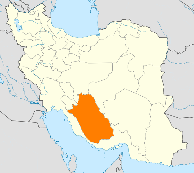
- Mohr County
-
Mohr County
شهرستان مهر— County — Coordinates: 27°47′N 52°35′E / 27.783°N 52.583°ECoordinates: 27°47′N 52°35′E / 27.783°N 52.583°E Country  Iran
IranProvince Fars Capital Mohr Bakhsh (Districts) Central District, Galleh Dar District, Varavi District, Asir District Population (2006) – Total 54,094 Time zone IRST (UTC+3:30) – Summer (DST) IRDT (UTC+4:30) Mohr County can be found at GEOnet Names Server, at this link, by opening the Advanced Search box, entering "9206575" in the "Unique Feature Id" form, and clicking on "Search Database". Mohr County (Persian: شهرستان مهر) is a county in Fars Province in Iran. The capital of the county is Mohr. Its main industries are based on its rich gas sources. Tabnak, Homa, Shanol, Varavi and Parsian refinary are important Gas Zones in this region. It has a dry hot climate. At the 2006 census, the county's population was 54,094, in 10,999 families.[1] The county is subdivided into four districts: the Central District, Galleh Dar District, Varavi District, and Asir District. The county has four cities: Mohr, Varavi, Asir, and Galleh Dar.
References
- ^ "Census of the Islamic Republic of Iran, 1385 (2006)" (Excel). Islamic Republic of Iran. http://www.amar.org.ir/DesktopModules/FTPManager/upload/upload2360/newjkh/newjkh/07.xls.
- اطلس گیتاشناسی استانهای ایران [Atlas Gitashenasi Ostanhai Iran] (Gitashenasi Province Atlas of Iran)
 Fars Province, Iran
Capital 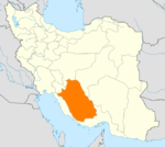
Counties (A-K)
and CitiesAbadeh • Bahman • Izadkhvast • Soghad • SurmaqArsanjanSurian • KorehiDarab • Jannat ShahrEqlid • SedehEstahban • Ij • RonizFasa • Now Bandegan • Sheshdeh • ZahedshahrFiruzabad • MeymandGerash CountyKavar CountyKharameh CountyKharamehKhonj CountySafashahr • QaderabadCounties (L-Z)
and CitiesLamerd • Ahel • Ala-e Marvdasht • EshkananNurabad • Khumeh ZarMarvdasht • Kamfiruz • Ramjerd • SeyyedanMohr CountyMohr • Asir • Galleh Dar • VaraviPasargad CountySaadat ShahrQir and Karzin CountyQir • Efzar • KarzinRostam CountySarvestan CountySarvestanArdakan • Beyza • HamashahrZarrin Dasht CountyHajjiabad • Dowbaran • Shahr-e PirLandmarks Afif-Abad Garden · Amir's dam · Arg of Karim Khan · Barmdelak lagoon · Bishapur · Delgosha Garden · Eram Garden · Estakhr · Ghal'eh Dokhtar · Ka'ba-ye Zartosht · Kazerun fire temple · Lake Parishan · Naqsh-e Rajab · Naqsh-e Rustam · Palace of Ardashir · Pars museum · Pasargadae · Persepolis · Qavam House · Qur'an Gate · Saadi's mausoleum · Sarvestan Sassanian palace · Shah Cheragh · Colossal Statue of Shapur I in Shapur cave · Tangeh Bolaghi · Hāfezieh · Tounbbot · Vakil Bath · Vakil Bazaar · Vakil Mosque
Categories:- Mohr County
- Counties of Iran
- Counties of Fars Province
- Fars Province geography stubs
Wikimedia Foundation. 2010.