- Mesudiye, Ordu
-
For other uses, see Mesudiye (disambiguation).
Mesudiye — District — Location of Mesudiye within Turkey. Location of Mesudiye
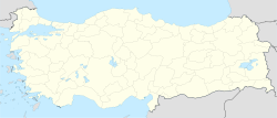
 Mesudiye
Coordinates: 40°28′N 37°46′E / 40.467°N 37.767°E Country  Turkey
Region Black Sea Province Ordu Government - Mayor İsa Gül (Independent) Area - District 1,100 km2 (424.7 sq mi) Elevation 1,308 m (4,291 ft) Population (2000)[1] - District 28,551 - Density 25.96/km2 (67.2/sq mi) - Urban 5,665 Time zone EET (UTC+2) - Summer (DST) EEST (UTC+3) Postal code 52xxx Area code(s) 0452 Licence plate 52 Website www.mesudiye.bel.tr Mesudiye, formerly Hamidiye, (Grk: Μεσουδιέ) is a town and district of Ordu Province in the Black Sea region of Turkey. According to the 2000 census, population of the district is 28,551 of which 5,665 live in the town of Mesudiye.[1][2] The district covers an area of 1,100 km2 (425 sq mi),[3] and the town lies at an elevation of 1,308 m (4,291 ft).
Mesudiye is a large area of hilly countryside, villages and pasture far inland from the Black Sea coast, south-west of the city of Ordu, in the direction of Sivas. This is a low-income district that since the 1950s has seen successive generations migrate away to jobs in Istanbul and elsewhere. Today Mesudiye itself is a small town of 5,600 people and the whole district is sparsely populated, although busier in summer with returning Mesudiye families on vacation. Efforts are being made by the state to boost the local economy including the opening of a college of a higher education college. The province is home of Turcophone Muslims of Greek ethnic origin.
Contents
History
Mesudiye has been inhabited since the Iron Age era and has numerous remains from the time of the Hittites and there are a number of rock tombs from early antiquity in the area. When it was brought into the Ottoman Empire by Mehmed II in 1455 the area was a collection of mountain villages centred on the slightly larger village and market place known then as Milas. This was renamed Hamidiye in 1876 and then Mesudiye in 1908. According to Bryer and Winfield, the later Greek name for Mesudiye (or Hamidiye) was Meletios, Melet, or Milas (Grk: Μελέτιος, Μελέτ, or Μήλας), probably derived from the Melanthios River(Melet Irmak) which runs through it and down to Ordu.[4]
Villages
The villages of Mesudiye district include Abdili, Alanköy, Arıcılar, Arıkmusa, Armutkolu, Arpaalan, Aşağıgökçe, Aşıklı, Balıklı, Bayırköy, Bayraklı, Beşbıyık, Beyağaç, Beyseki, Birebir, Celalköy, Çaltepe, Çardaklı, Çavdar, Çerçi, Çitliksarıca, Çukuralan, Darıcabaşı, Dayılı, Derebaşı, Doğançam, Dursunlu, Erikköy, Esatlı, Göçbeyi, Gülpınar, Güneyce, Güvenli, Güzelce, Güzle, Hamzalı, Herközü, Ilışar, Kaleköy, Karabayır, Karacaören, Kavaklıdere, Kışlacık, Konacık, Mahmudiye, Musalı, Pınarlı, Sarıca, Sarıyayla, Türkköyü, Yağmurlar, Yardere, Yavşan, Yeşilçit, Yeveli, Yukarıgökçe, and Yuvalı.
References
- ^ a b Turkish Statistical Institute. "Census 2000, Key statistics for urban areas of Turkey" (in Turkish) (XLS). http://www.die.gov.tr/nufus_sayimi/2000tablo5.xls. Retrieved 2009-05-19.
- ^ GeoHive. "Statistical information on Turkey's administrative units" (in English). http://www.xist.org/cntry/turkey.aspx?levels=Karadeniz. Retrieved 2009-05-19.
- ^ Statoids. "Statistical information on districts of Turkey" (in English). http://www.statoids.com/ytr.html. Retrieved 2009-05-19.
- ^ Anthony Bryer, David Winfield (1985). The Byzantine Monuments and Topography of the Pontios. Dumbarton Oaks. p. 116. ISBN 088402122X.
Notes
- Falling Rain Genomics, Inc. "Geographical information on Mesudiye, Turkey" (in English). http://www.fallingrain.com/world/TU/52/Mesudiye.html. Retrieved 2009-05-19.
External links
- (Turkish) District governor's official website
- (Turkish) District municipality's official website
- Road map of Mesudiye and environs
- Various images of Mesudiye, Ordu
 Mesudiye, Ordu in Ordu Province (in the Black Sea region) of Turkey
Urban districts 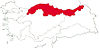
Rural districts RegionsAegean Black Sea Central Anatolia Eastern Anatolia Marmara Mediterranean Southeastern Anatolia Categories:- Districts of Ordu
- Black Sea Region
- Black Sea Region geography stubs
- Populated places in Ordu Province


Wikimedia Foundation. 2010.