- Eden Landing, California
-
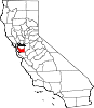
Coordinates: 37°38′40.76″N 122°9′21.87″W / 37.6446556°N 122.156075°W Eden Landing (also, Mount Eden Landing, Edendale, Barrons Landing, Barron's Landing, and Peterman's Landing) is a former settlement in Alameda County, California.[1] It was located west-southwest of Mount Eden.[1] Its site is now located within the corporate limits of Hayward.[1] Eden Landing was established in 1854 by farmers who were dissatisfied with the freight charges at Allen's Landing, which was a quarter of a mile (400 m) west.[1] The place was bought by Richard Barron in 1855, and renamed Barrons Landing.[1] Henry Louis Petermann and Mary F. Petermann operated their salt works here.[1] Stokes Landing was located east of Eden Landing on Alameda Creek.[1]
A post office operated at Edendale from 1873 to 1875.[1] Coordinates were obtained from USGS GNIS[2] for Barron's Landing.
References
See also
- Eden Landing Ecological Reserve, in the same region
Municipalities and communities of Alameda County, California Cities Alameda | Albany | Berkeley | Dublin | Emeryville | Fremont | Hayward | Livermore | Newark | Oakland | Piedmont | Pleasanton | San Leandro | Union City
CDPs Ashland | Castro Valley | Cherryland | Fairview | San Lorenzo | Sunol
Unincorporated
communitiesAlbrae | Altamont | Asco | Baumberg | Brightside | Brookshire | Carpenter | Dougherty | Dresser | East Pleasanton | Farwell | Hall Station | Halvern | Kilkare Woods | Komandorski Village | Lorenzo Station | Mattos | Mendenhall Springs | Midway | Mountain House | Mowry Landing | Radum | San Ramon Village | Scotts Corner | Sorenson | Verona
Former settlements Alden | Alvarado | Ann | Decoto | Drawbridge | Eden Landing | Elliot | Goecken | Greenville | Hacienda | Hayward Heath | Laddville | Larkin's Landing | Mallard | Melita | Merienda | Monte Vista | Remillard | Robert | Russell City | Stokes Landing | Tesla
Categories:- Neighborhoods in California
- Hayward, California
- Populated places established in 1854
- Former settlements in Alameda County, California
- Alameda County, California geography stubs

Wikimedia Foundation. 2010.