- National Register of Historic Places listings in Benton County, Indiana
-
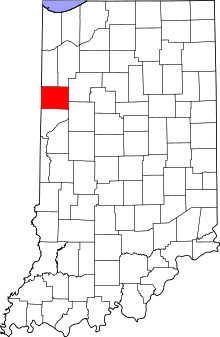 Location of Benton County in Indiana
This is a list of the National Register of Historic Places listings in Benton County, Indiana.
This is intended to be a complete list of the properties on the National Register of Historic Places in Benton County, Indiana, United States. Latitude and longitude coordinates are provided for many National Register properties; these locations may be seen together in a Google map.[1]
There are 5 properties listed on the National Register in the county.
-
- This National Park Service list is complete through NPS recent listings posted November 10, 2011.[2]
Current listings
[3] Landmark name [4] Image Date listed Location City or town Summary 1 Benton County Courthouse 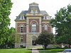
August 1, 2008 706 E. 5th St.
40°37′02″N 87°18′56″W / 40.617222°N 87.315556°WFowler 2 Fowler Theatre 
December 6, 2004 111 E. 5th St.
40°37′04″N 87°19′22″W / 40.617778°N 87.322778°WFowler 3 Fraser & Isham Law Office 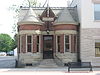
September 22, 2000 306 E. 5th St.
40°37′03″N 87°19′09″W / 40.6175°N 87.319167°WFowler 4 David S. Heath House 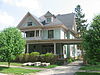
September 17, 1999 202 W. McConnell
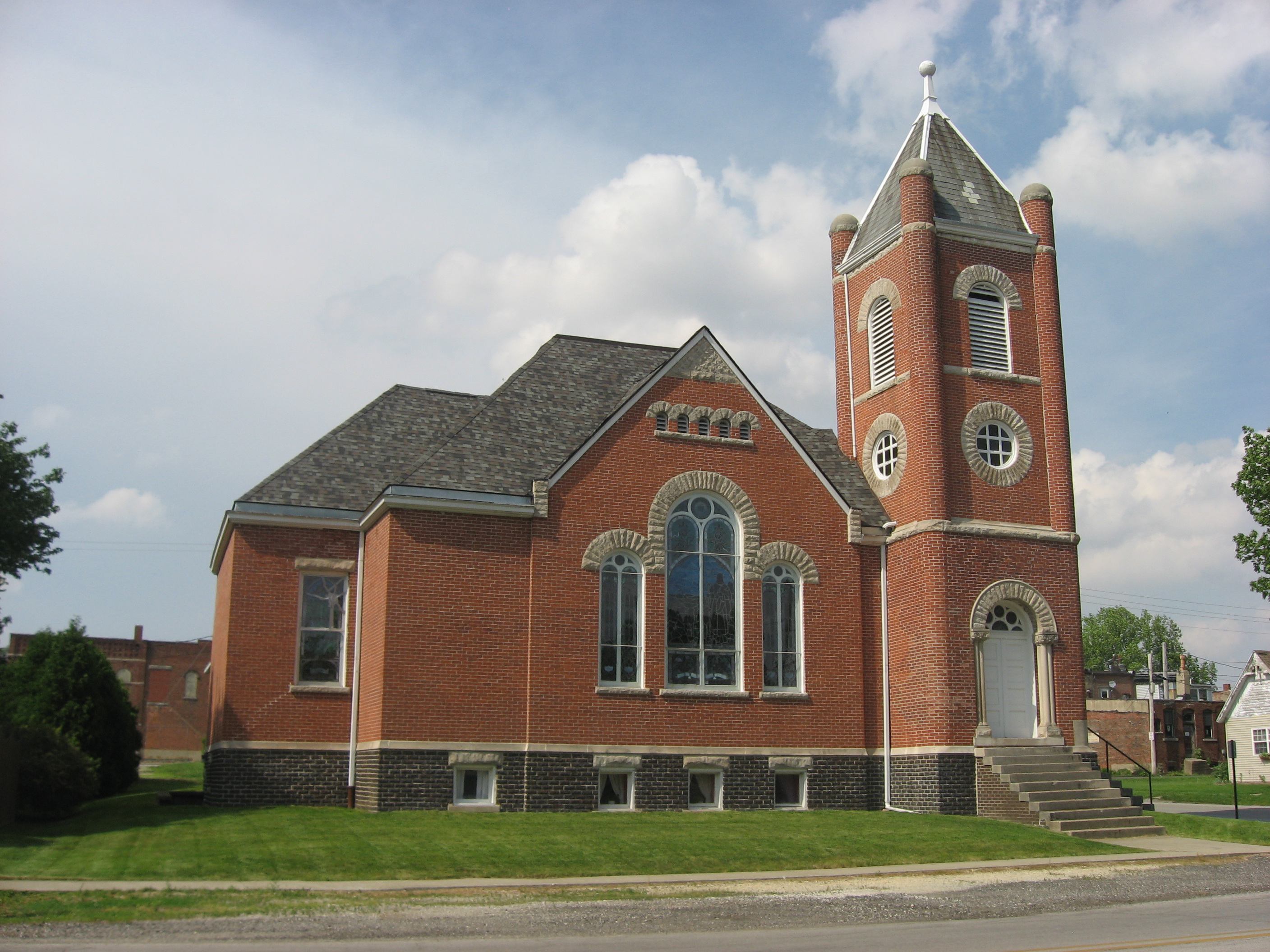
40°31′10″N 87°15′06″W / 40.519444°N 87.251667°WOxford 5 Presbyterian Church Building 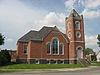
March 1, 1984 Northwestern corner of the junction of Benton and Justus Sts.
40°31′08″N 87°15′02″W / 40.518889°N 87.250556°WOxford See also
- List of National Historic Landmarks in Indiana
- National Register of Historic Places listings in Indiana
References
- ^ The latitude and longitude information provided in this table was derived originally from the National Register Information System, which has been found to be fairly accurate for about 99% of listings. For about 1% of NRIS original coordinates, experience has shown that one or both coordinates are typos or otherwise extremely far off; some corrections may have been made. A more subtle problem causes many locations to be off by up to 150 yards, depending on location in the country: most NRIS coordinates were derived from tracing out latitude and longitudes off of USGS topographical quadrant maps created under the North American Datum of 1927, which differs from the current, highly accurate WGS84 GPS system used by Google maps. Chicago is about right, but NRIS longitudes in Washington are higher by about 4.5 seconds, and are lower by about 2.0 seconds in Maine. Latitudes differ by about 1.0 second in Florida. Some locations in this table may have been corrected to current GPS standards.
- ^ "National Register of Historic Places: Weekly List Actions". National Park Service, United States Department of the Interior. Retrieved on November 10, 2011.
- ^ Numbers represent an ordering by significant words. Various colorings, defined here, differentiate National Historic Landmark sites and National Register of Historic Places Districts from other NRHP buildings, structures, sites or objects.
- ^ "National Register Information System". National Register of Historic Places. National Park Service. . http://nrhp.focus.nps.gov/natreg/docs/All_Data.html.
U.S. National Register of Historic Places Topics Lists by states Alabama • Alaska • Arizona • Arkansas • California • Colorado • Connecticut • Delaware • Florida • Georgia • Hawaii • Idaho • Illinois • Indiana • Iowa • Kansas • Kentucky • Louisiana • Maine • Maryland • Massachusetts • Michigan • Minnesota • Mississippi • Missouri • Montana • Nebraska • Nevada • New Hampshire • New Jersey • New Mexico • New York • North Carolina • North Dakota • Ohio • Oklahoma • Oregon • Pennsylvania • Rhode Island • South Carolina • South Dakota • Tennessee • Texas • Utah • Vermont • Virginia • Washington • West Virginia • Wisconsin • WyomingLists by territories Lists by associated states Other Municipalities and communities of Benton County, Indiana Towns 
Townships Unincorporated
communitiesAtkinson | Barce | Chase | Dunn | Dunnington | Free | Freeland Park | Handy | Lochiel | Raub | Swanington | Talbot | Templeton | Wadena
Footnotes ‡This populated place also has portions in an adjacent county or counties
Categories:- Benton County, Indiana
- National Register of Historic Places in Indiana by county
-


Wikimedia Foundation. 2010.