- National Register of Historic Places listings in Hawaii Volcanoes National Park
-
This is a list of the National Register of Historic Places listings in Hawaii Volcanoes National Park.
This is intended to be a complete list of the properties and districts on the National Register of Historic Places in Hawaii Volcanoes National Park, Hawaii, United States. The locations of National Register properties and districts for which the latitude and longitude coordinates are included below, may be seen in a Google map.[1]
There are eight properties and districts listed on the National Register in the park..
-
- This National Park Service list is complete through NPS recent listings posted November 10, 2011.[2]
Current listings
[3] Landmark name[4] Image Date listed Location City or Town Summary 1 1790 Footprints 
August 7, 1974 9.1 miles south of park headquarters on Hawaii Route 11, then along a foot trail to the southeast for 1 mile
19°23′0″N 155°20′7″W / 19.383333°N 155.33528°WHawaii Volcanoes National Park Footprints left in solidified ash from Kilauea eruption 2 Ainahou Ranch 
February 8, 1995 Off Chain of Craters Road in Hawaii Volcanoes National Park
19°20′37″N 155°13′44″W / 19.34361°N 155.22889°WHawaii Volcanoes National Park Built by Shipman family as refuge from World War II, used to raise endangered Hawaiian Goose 3 Ainapo Trail 
August 30, 1974 Hawaii Volcanoes National Park
19°27′39″N 155°34′39″W / 19.46083°N 155.5775°WMauna Loa Ancient trail to the Mokuaweoweo summit 4 Kilauea Crater 
July 24, 1974 Southwest of Hilo in Hawaii Volcanoes National Park
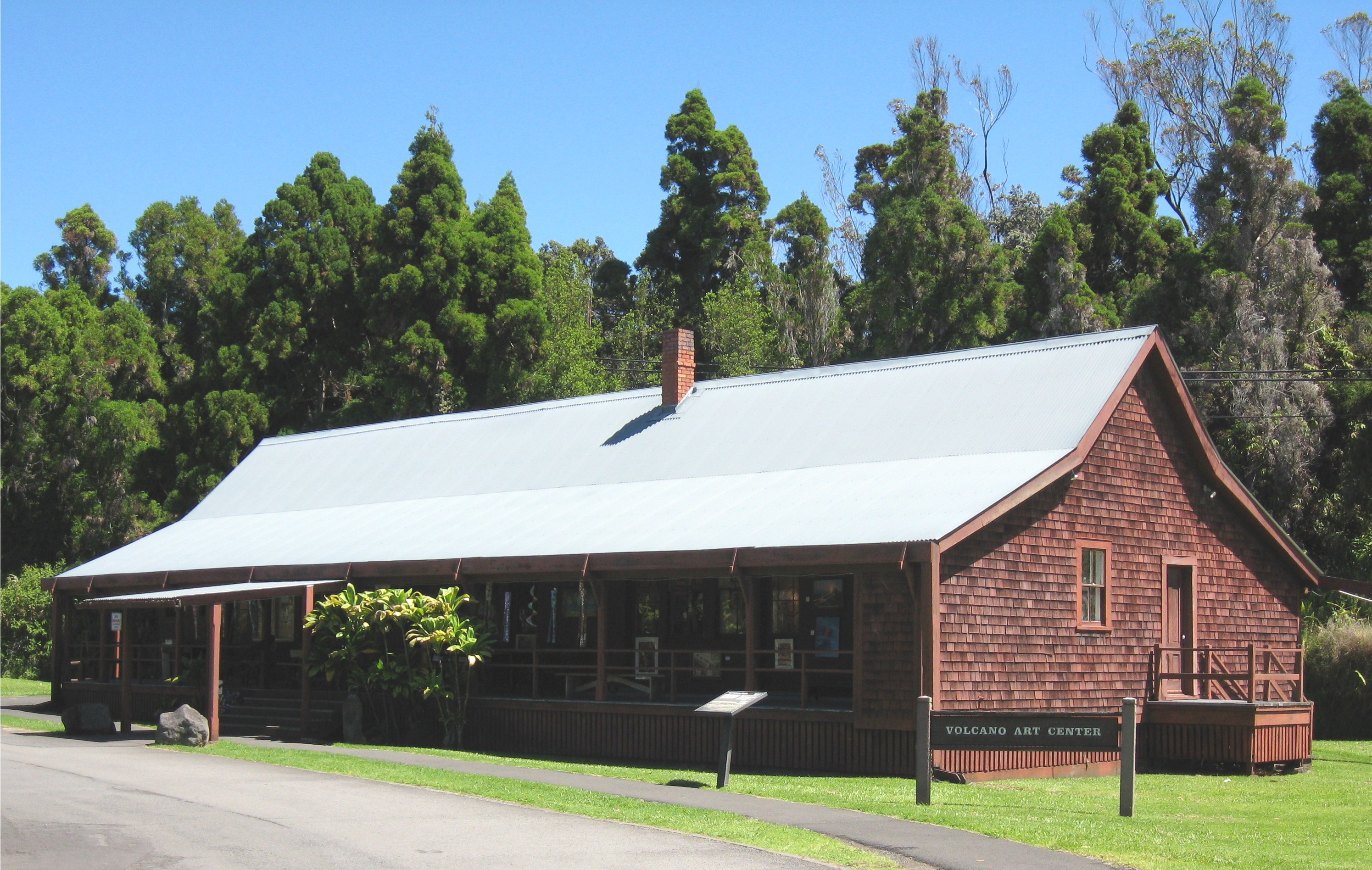
19°25′2″N 155°16′36″W / 19.41722°N 155.27667°WHilo Active volcano is a world heritage site 5 Old Volcano House No. 42 
July 24, 1974 Southwest of Hilo on Hawaii Route 11 in Hawaii Volcanoes National Park
19°26′2″N 155°15′39″W / 19.43389°N 155.26083°WHilo Built in 1877; now Volcano Art Center gallery 6 Puna-Ka'u Historic District July 1, 1974 Hawaii Volcanoes National Park
19°17′42″N 155°14′31″W / 19.295°N 155.24194°WPāhala 7 Whitney Seismograph Vault No. 29 
July 24, 1974 Southwest of Hilo on Hawaii Route 11 in Hawaii Volcanoes National Park
19°25′59″N 155°15′40″W / 19.43306°N 155.26111°WHilo Original home of Hawaiian Volcano Observatory founded by Thomas Jaggar in 1912 8 Wilkes Campsite 
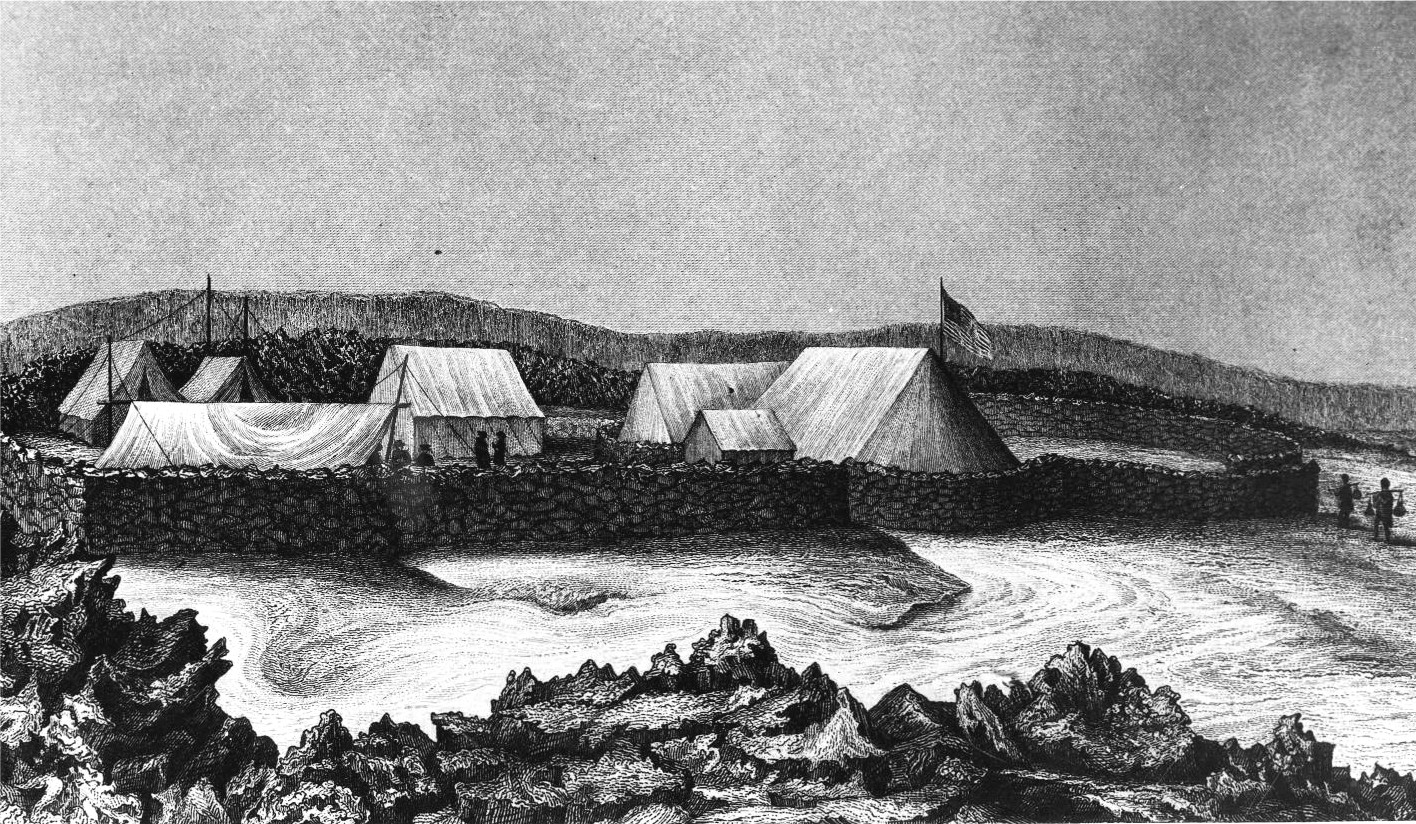
July 24, 1974 West of Hilo at Mauna Loa Volcano in Hawaii Volcanoes National Park
19°28′14″N 155°35′6″W / 19.47056°N 155.585°WHilo Ruins of 1840 Charles Wilkes camp site at Mokuaweoweo summit See also
- National Register of Historic Places listings on the island of Hawaii
- List of National Historic Landmarks in Hawaii
- National Register of Historic Places listings in Hawaii
References
- ^ The latitude and longitude information provided in this table was derived originally from the National Register Information System, which has been found to be fairly accurate for about 99% of listings. For about 1% of NRIS original coordinates, experience has shown that one or both coordinates are typos or otherwise extremely far off; some corrections may have been made. A more subtle problem causes many locations to be off by up to 150 yards, depending on location in the country: most NRIS coordinates were derived from tracing out latitude and longitudes off of USGS topographical quadrant maps created under the North American Datum of 1927, which differs from the current, highly accurate WGS84 GPS system used by Google maps. Chicago is about right, but NRIS longitudes in Washington are higher by about 4.5 seconds, and are lower by about 2.0 seconds in Maine. Latitudes differ by about 1.0 second in Florida. Some locations in this table may have been corrected to current GPS standards.
- ^ "National Register of Historic Places: Weekly List Actions". National Park Service, United States Department of the Interior. Retrieved on November 10, 2011.
- ^ Numbers represent an ordering by significant words. Various colorings, defined here, differentiate National Historic Landmark sites and National Register of Historic Places Districts from other NRHP buildings, structures, sites or objects.
- ^ "National Register Information System". National Register of Historic Places. National Park Service. 2008-04-24. http://nrhp.focus.nps.gov/natreg/docs/All_Data.html.
National Register of Historic Places in Hawaii Volcanoes National Park Historic districts Puna-Ka'u Historic District
NRHP properties 1790 Footprints | Ainahou Ranch | Ainapo Trail | Kilauea Crater | Old Volcano House No. 42 | Whitney Seismograph Vault No. 29 | Wilkes Campsite
See also: National Register of Historic Places listings in Hawaii Volcanoes National ParkU.S. National Register of Historic Places Topics Lists by states Alabama • Alaska • Arizona • Arkansas • California • Colorado • Connecticut • Delaware • Florida • Georgia • Hawaii • Idaho • Illinois • Indiana • Iowa • Kansas • Kentucky • Louisiana • Maine • Maryland • Massachusetts • Michigan • Minnesota • Mississippi • Missouri • Montana • Nebraska • Nevada • New Hampshire • New Jersey • New Mexico • New York • North Carolina • North Dakota • Ohio • Oklahoma • Oregon • Pennsylvania • Rhode Island • South Carolina • South Dakota • Tennessee • Texas • Utah • Vermont • Virginia • Washington • West Virginia • Wisconsin • WyomingLists by territories Lists by associated states Other Categories:- National Register of Historic Places lists in the National Park Service
- Hawaiʻi Volcanoes National Park
-


Wikimedia Foundation. 2010.