|
Landmark name |
Image |
Date listed |
Location |
City or Town |
Summary |
| 1 |
Central National Bank Building |
|
01978-12-18 December 18, 1978 |
103 SW Adams St.
40°41′27″N 89°35′20″W / 40.69083°N 89.58889°W / 40.69083; -89.58889 (Central National Park Building) |
Peoria |
|
| 2 |
Christ Church of Lower Kickapoo |
|
01983-02-10 February 10, 1983 |
W of Norwood on Christ Church Rd.
40°42′25″N 89°43′0″W / 40.70694°N 89.716667°W / 40.70694; -89.716667 (Christ Church of Lower Kickapoo) |
Norwood |
|
| 3 |
Cumberland Presbyterian Church |
|
01980-03-18 March 18, 1980 |
405 N. Monson St.[dated info]
40°41′33″N 89°35′46″W / 40.6925°N 89.59611°W / 40.6925; -89.59611 (Cumberland Presbyterian Church) |
Peoria |
|
| 4 |
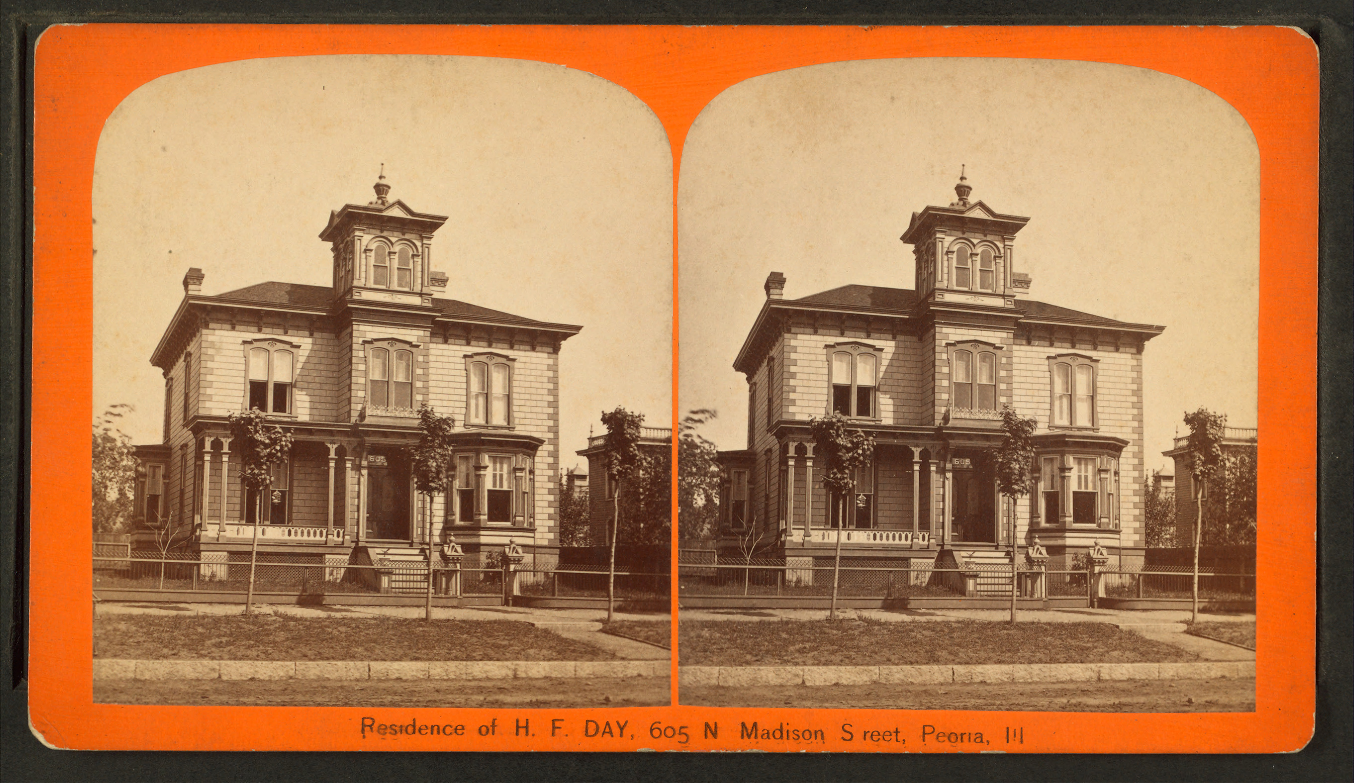
Judge Flanagan Residence |
|
01975-09-05 September 5, 1975 |
942 NE Glen Oak Ave.
40°42′14″N 89°35′7″W / 40.70389°N 89.58528°W / 40.70389; -89.58528 (Judge John C. Flanagan Residence) |
Peoria |
|
| 5 |
Judge Jacob Gale House |
|
01982-03-19 March 19, 1982 |
403 NE Jefferson St.
40°41′46″N 89°35′8″W / 40.69611°N 89.58556°W / 40.69611; -89.58556 (Judge Jacob Gale House) |
Peoria |
|
| 6 |
Grand Army of the Republic Memorial Hall |
|
01976-07-13 July 13, 1976 |
416 Hamilton Blvd.
40°41′40″N 89°35′21″W / 40.69444°N 89.58917°W / 40.69444; -89.58917 (Grand Army of the Republic Memorial Hall) |
Peoria |
|
| 7 |
Grand View Drive |
 |
01996-09-27 September 27, 1996 |
Roughly bounded by N. Prospect Rd., the Illinois River bluffs, Adams St., and the Grand View Dr. W. right of way
40°44′30″N 89°33′52″W / 40.74167°N 89.56444°W / 40.74167; -89.56444 (Grand View Drive) |
Peoria and Peoria Heights |
|
| 8 |
Illinois Waterway Project Office |
|
02004-03-10 March 10, 2004 |
257 Grant St. |
Peoria |
|
| 9 |
International Harvester Building |
|
02005-11-15 November 15, 2005 |
1301-1309 Southwest Washington St.
40°40′53″N 89°36′14″W / 40.68139°N 89.60389°W / 40.68139; -89.60389 (International Harvester Building) |
Peoria |
|
| 10 |
Jubilee College |
|
01972-01-04 January 4, 1972 |
NW of Kickapoo on U.S. 150 and I-74
40°49′38″N 89°46′40″W / 40.82722°N 89.77778°W / 40.82722; -89.77778 (Jubilee College) |
Kickapoo |
|
| 11 |
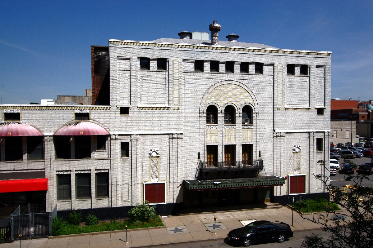
Madison Theatre |
 |
01980-11-21 November 21, 1980 |
502 Main St.
40°41′39″N 89°35′29″W / 40.69417°N 89.59139°W / 40.69417; -89.59139 (Madison Theatre) |
Peoria |
|
| 12 |
North Side Historic District |
 |
01983-11-21 November 21, 1983 |
Roughly bounded by Perry, Caroline, Madison and Fayette Sts.
40°41′57″N 89°35′2″W / 40.69917°N 89.58389°W / 40.69917; -89.58389 (North Side Historic District) |
Peoria |
|
| 13 |
Peace and Harvest |
|
01994-02-16 February 16, 1994 |
Jefferson and Hamilton Sts.
40°41′35″N 89°35′21″W / 40.69306°N 89.58917°W / 40.69306; -89.58917 (Peace and Harvest) |
Peoria |
|
| 14 |
Peoria Automobile Club |
|
01995-08-04 August 4, 1995 |
100 Park Blvd.
40°54′12″N 89°29′24″W / 40.90333°N 89.49°W / 40.90333; -89.49 (Peoria Automobile Club) |
Chillicothe |
|
| 15 |
Peoria City Hall |
 |
01973-02-06 February 6, 1973 |
419 Fulton St.
40°41′32″N 89°35′33″W / 40.69222°N 89.5925°W / 40.69222; -89.5925 (Peoria City Hall) |
Peoria |
|
| 16 |
Peoria Cordage Company |
|
01982-03-19 March 19, 1982 |
Address Restricted |
Peoria |
|
| 17 |
Peoria Mineral Springs |
|
01982-03-05 March 5, 1982 |
701 W. 7th Ave.[dated info]
40°41′45″N 89°36′18″W / 40.69583°N 89.605°W / 40.69583; -89.605 (Peoria Mineral Springs) |
Peoria |
|
| 18 |
Peoria State Hospital |
 |
01982-02-17 February 17, 1982 |
Ricketts Ave. near U.S. 24
40°38′4″N 89°39′32″W / 40.63444°N 89.65889°W / 40.63444; -89.65889 (Peoria State Hospital) |
Bartonville |
|
| 19 |
Peoria Waterworks |
|
01980-03-18 March 18, 1980 |
Lorentz Ave.
40°43′28″N 89°33′8″W / 40.72444°N 89.55222°W / 40.72444; -89.55222 (Peoria Waterworks) |
Peoria |
|
| 20 |
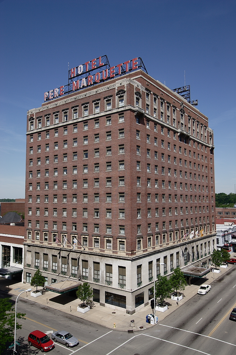
Pere Marquette Hotel |
 |
01982-08-12 August 12, 1982 |
501 Main St.
40°41′37″N 89°35′31″W / 40.69361°N 89.59194°W / 40.69361; -89.59194 (Pere Marquette Hotel) |
Peoria |
|
| 21 |
Pettingill-Morron House |
|
01976-04-02 April 2, 1976 |
1212 W. Moss Ave.
40°41′39″N 89°36′41″W / 40.69417°N 89.61139°W / 40.69417; -89.61139 (Pettingill-Morron House) |
Peoria |
|
| 22 |
The Pioneers |
|
02001-05-04 May 4, 2001 |
Central Park, N,. Magnolia St.
40°46′45″N 89°58′22″W / 40.77917°N 89.97278°W / 40.77917; -89.97278 (The Pioneers statue) |
Elmwood |
|
| 23 |
Pleasant Grove School |
|
01994-05-19 May 19, 1994 |
.6 mi. W of Eden Rd., on Pleasant Grove Rd.
40°40′41″N 89°50′43″W / 40.67806°N 89.84528°W / 40.67806; -89.84528 (Pleasant Grove School (Eden)) |
Eden |
|
| 24 |
John C. Proctor Recreation Center |
|
01979-09-06 September 6, 1979 |
300 S. Allen St.[clarification needed]
40°41′7″N 89°36′58″W / 40.68528°N 89.61611°W / 40.68528; -89.61611 (John C. Proctor Recreation Center) |
Peoria |
|
| 25 |
Rock Island Depot and Freight House (River Station) |
 |
01978-12-22 December 22, 1978 |
32 Liberty St.
40°41′17″N 89°35′20″W / 40.68806°N 89.58889°W / 40.68806; -89.58889 (Rock Island Depot and Freight House) |
Peoria |
|
| 26 |
Springdale Cemetery |
|
02004-12-10 December 10, 2004 |
3014 N. Prospect Rd.
40°43′51″N 89°13′16″W / 40.73083°N 89.22111°W / 40.73083; -89.22111 (Springdale Cemetery) |
Peoria |
|
| 27 |
Washington C. Wear House |
|
01993-08-19 August 19, 1993 |
1 mi. S and 0.4 mi. W of jct. of IL 90 and IL 91
40°54′55″N 89°45′53″W / 40.91528°N 89.76472°W / 40.91528; -89.76472 (Washington C. Wear House) |
Princeville |
|
| 28 |
West Bluff Historic District |
 |
01976-12-17 December 17, 1976 |
Randolph, High and Moss Sts., E of Western St.
40°41′49″N 89°36′31″W / 40.69694°N 89.60861°W / 40.69694; -89.60861 (West Bluff Historic District) |
Peoria |
|
| 29 |
YWCA Building |
|
02007-05-17 May 17, 2007 |
301 NE Jefferson
40°41′40″N 89°35′16″W / 40.69444°N 89.58778°W / 40.69444; -89.58778 (YWCA Building) |
Peoria |
|