- National Register of Historic Places listings in Roanoke, Virginia
-
This list includes properties and districts listed on the National Register of Historic Places in the independent city of Roanoke, Virginia. Click the "Map of all coordinates" link to the right to view a Google map of all properties and districts with latitude and longitude coordinates in the table below.[1]
-
- This National Park Service list is complete through NPS recent listings posted November 10, 2011.[2]
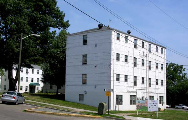
[3] Landmark name[4] Image Date listed Location City or Town Summary 1 Apartment Building on Windsor Avenue and Brunswick St. August 23, 2010 2049 Windsor Ave.
37°15′47″N 79°58′49″W / 37.26306°N 79.98028°WRoanoke 2 Belle Aire April 15, 1975 U.S. 11
37°15′49″N 80°1′3″W / 37.26361°N 80.0175°WRoanoke 3 Belmont Methodist-Episcopal Church August 18, 2011 806 Jamison Ave.
37°16′8″N 79°55′47″W / 37.26889°N 79.92972°WRoanoke 4 Boxley Building 
March 8, 1984 416 Jefferson Street SW
37°16′12″N 79°56′25″W / 37.27°N 79.94028°WRoanoke 5 Boxley-Sprinkle House 
November 27, 2004 2611 Crystal Spring Avenue
37°14′38.8″N 79°57′0.8″W / 37.244111°N 79.950222°WRoanoke 6 Buena Vista July 30, 1974 Penmar Avenue and 9th Street
37°15′50″N 79°55′28″W / 37.26389°N 79.92444°WRoanoke 7 Burrell Memorial Hospital 
September 22, 2003 611 McDowell Street
37°16′57.2″N 79°56′57.5″W / 37.282556°N 79.949306°WRoanoke 8 Campbell Avenue Complex January 24, 1991 118-128 Campbell Avenue SW
37°16′18″N 79°56′37″W / 37.27167°N 79.94361°WRoanoke 9 Colonial National Bank 
December 17, 1983 202-208 Jefferson Street
37°16′17.8″N 79°56′25″W / 37.271611°N 79.94028°WRoanoke 10 Crystal Spring Steam Pumping Station 
May 23, 1980 2016 Lake Street SE
37°14′58.8″N 79°56′37.4″W / 37.249667°N 79.943722°WRoanoke 11 Fire Station No. 1 
May 7, 1973 13 East Church Avenue
37°16′12″N 79°56′24″W / 37.27°N 79.94°WRoanoke 12 First National Bank 
June 14, 1982 101 South Jefferson Street
37°16′20.3″N 79°56′26.8″W / 37.272306°N 79.940778°WRoanoke 13 Gainsboro Branch of the Roanoke City Public Library 
December 2, 1996 15 Patton Avenue NW
37°16′38″N 79°56′29″W / 37.27722°N 79.94139°WRoanoke 14 Gainsboro Historic District November 16, 2005 Bounded by Wells, Centre, 1st St. Bridge and Gilmer, Commonwealth, N. Jefferson and 2nd., Patton, Harrison etc.
37°16′34.6″N 79°56′31.72″W / 37.276278°N 79.9421444°WRoanoke 15 Grandin Road Commercial Historic District 
November 27, 2002 Grandin Road SW, and Memorial Avenue
37°15′54″N 79°58′34″W / 37.265°N 79.97611°WRoanoke 16 Harrison School 
September 9, 1982 523 Harrison Avenue NW
37°16′45″N 79°56′54″W / 37.27917°N 79.94833°WRoanoke 17 Henry Street Historic District 
November 27, 2004 100 block of Henry Street NW
37°16′30″N 79°56′32″W / 37.275°N 79.94222°WRoanoke 18 Patrick Henry Hotel 
July 3, 1991 617 Jefferson Street South
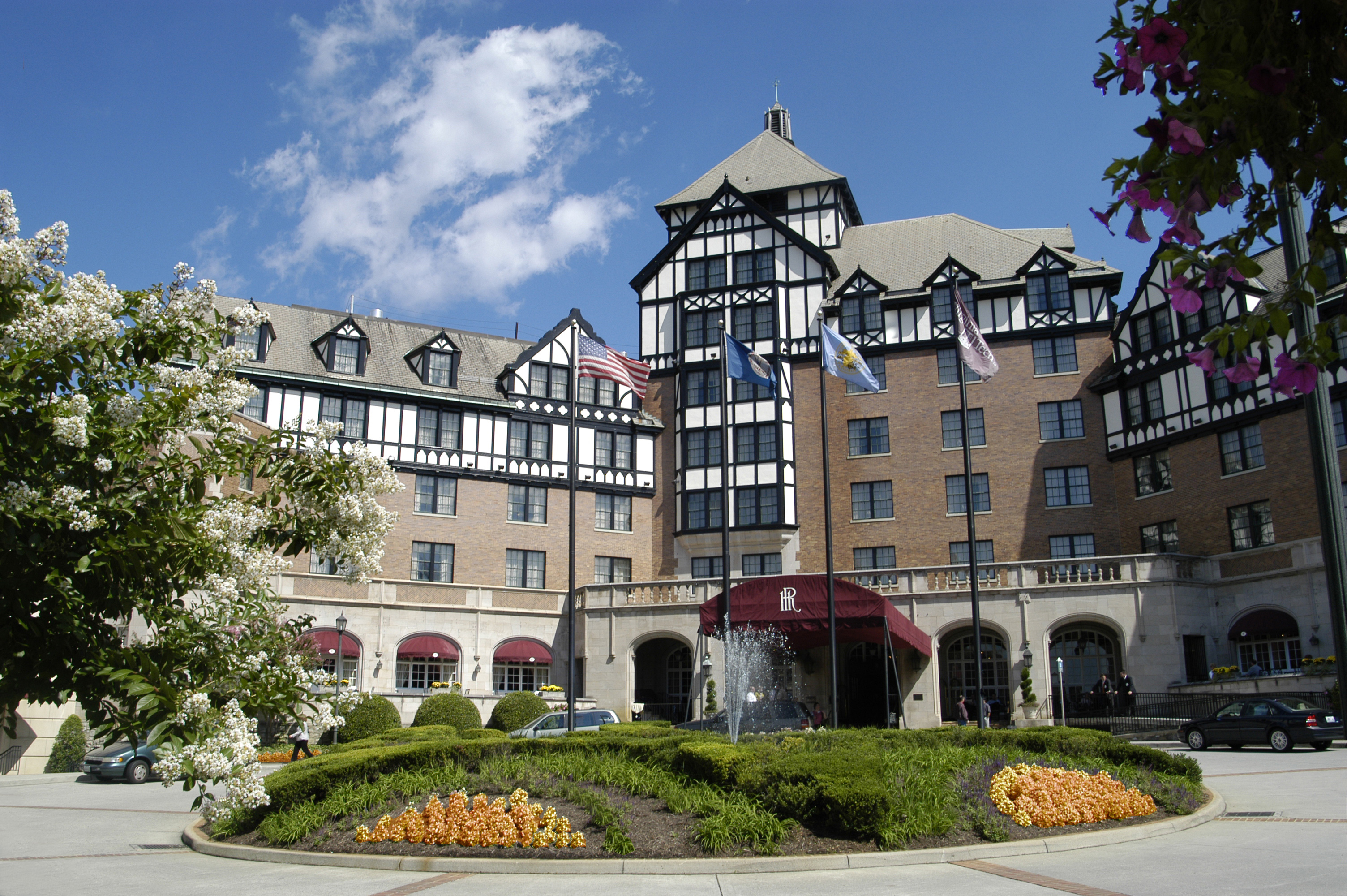
37°16′6.9″N 79°56′27.2″W / 37.268583°N 79.940889°WRoanoke 19 Hotel Roanoke 
February 16, 1996 110 Shenandoah Avenue
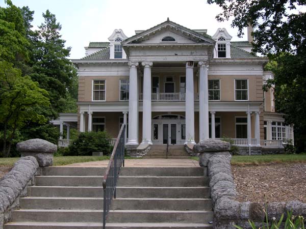
37°16′27″N 79°56′23″W / 37.27417°N 79.93972°WRoanoke 20 Huntingdon November 8, 1991 320 Huntingdon Boulevard
37°18′29″N 79°56′21″W / 37.30806°N 79.93917°WRoanoke 21 H.L. Lawson & Son Warehouse 
September 5, 2008 631 Campbell Avenue SE
37°16′20.22″N 79°55′59.61″W / 37.2722833°N 79.933225°WRoanoke 22 Lone Oaks 
April 11, 1973 3402 Grandin Road Extension SW
37°14′57.69″N 80°0′20.19″W / 37.2493583°N 80.0056083°WRoanoke 23 Monterey July 30, 1974 Tinker Creek Lane NE
37°18′30″N 79°54′49″W / 37.30833°N 79.91361°WRoanoke 24 Mount Moriah Baptist Church And Cemetery September 8, 1994 3521 East Orange Avenue
37°18′15″N 79°53′28″W / 37.30417°N 79.89111°WRoanoke 25 Mountain View 
October 31, 1980 714 13th Street SW
37°16′8″N 79°57′50″W / 37.26889°N 79.96389°WRoanoke Also known as the Junius Fishburn House 26 Norfolk and Western Railway Company Historic District 
January 27, 1999 88 and 108 Jefferson Street NW, and 209 Shenandoah Avenue
37°16′23″N 79°56′31″W / 37.27306°N 79.94194°WRoanoke 27 Roanoke Apartments 
November 9, 2006 1402 Maiden Lane
37°15′56″N 79°58′7″W / 37.26556°N 79.96861°WRoanoke 28 Roanoke City Firehouse No. 6 January 24, 1991 1015 Jamison Avenue SE
37°16′9″N 79°55′36″W / 37.26917°N 79.92667°WRoanoke 29 Roanoke City Market Historic District 
April 20, 1983 Roughly bounded by Williamson Rd., Norfolk Ave., S. Jefferson St., and Church Ave.
37°16′18″N 79°56′21″W / 37.27167°N 79.93917°WRoanoke Boundary increase (listed June 6, 2002): 302 Campbell Ave., SE; 9 Church Ave, SE 30 Roanoke Downtown Historic District 
September 14, 2002 Roughly bounded by 3rd St., Norfolk Ave., Jefferson St., and Bullitt Ave.
37°16′14″N 79°56′36″W / 37.27056°N 79.94333°WRoanoke Boundary increase (listed March 29, 2007): 310-324 Salem Ave. SW 31 Roanoke Star 
November 15, 1999 Mill Mountain
37°15′3″N 79°55′58″W / 37.25083°N 79.93278°WRoanoke 32 Roanoke Warehouse Historic District 
March 29, 1983 109-133 Norfolk Avenue SW
37°16′23″N 79°56′37″W / 37.27306°N 79.94361°WRoanoke 33 Salem Avenue-Roanoke Automotive Commercial Historic District 
August 8, 2007 Generally Salem Ave., Rorer Ave., Campbell Ave., bet. 3rd and 6th Sts.
37°16′18.54″N 79°56′59.55″W / 37.2718167°N 79.949875°WRoanoke Boundary increase (listed May 15, 2008): 500 & 600 blks. Campbell Ave. & 700 blk. Patterson Ave. 34 Southwest Historic District 
June 19, 1985 Roughly bounded by Salem Ave., Jefferson St., Roanoke River and 20th St.
37°16′3″N 79°57′21″W / 37.2675°N 79.95583°WRoanoke 35 St. Andrew's Roman Catholic Church 
May 7, 1973 631 North Jefferson Street
37°16′41″N 79°56′29″W / 37.27806°N 79.94139°WRoanoke 36 St. John's Episcopal Church 
August 23, 1991 Jefferson Street and Elm Avenue, SW corner
37°16′0″N 79°56′30″W / 37.266667°N 79.94167°WRoanoke 37 The Coffee Pot 
May 31, 1996 2902 Brambleton Avenue SW
37°14′35″N 79°59′29″W / 37.24306°N 79.99139°WRoanoke 38 Virginia Can Company-S.H. Heironimus Warehouse 
February 22, 2006 315 Albemarle Avenue SE
37°15′47.26″N 79°56′16.35″W / 37.2631278°N 79.937875°WRoanoke Built beside the Virginian Railway in 1912 to house Roanoke's first tin can company; later a clothing factory and then a department store warehouse[5] 39 Virginian Railway Passenger Station 
May 22, 2003 1402 Jefferson Street SE
37°15′35″N 79°56′28″W / 37.25972°N 79.94111°WRoanoke See also
- National Register of Historic Places listings in Virginia
- National Register of Historic Places listings in Roanoke County, Virginia
- List of National Historic Landmarks in Virginia
References
- ^ The latitude and longitude information provided in this table was derived originally from the National Register Information System, which has been found to be fairly accurate for about 99% of listings. For about 1% of NRIS original coordinates, experience has shown that one or both coordinates are typos or otherwise extremely far off; some corrections may have been made. A more subtle problem causes many locations to be off by up to 150 yards, depending on location in the country: most NRIS coordinates were derived from tracing out latitude and longitudes off of USGS topographical quadrant maps created under the North American Datum of 1927, which differs from the current, highly accurate WGS84 GPS system used by Google maps. Chicago is about right, but NRIS longitudes in Washington are higher by about 4.5 seconds, and are lower by about 2.0 seconds in Maine. Latitudes differ by about 1.0 second in Florida. Some locations in this table may have been corrected to current GPS standards.
- ^ "National Register of Historic Places: Weekly List Actions". National Park Service, United States Department of the Interior. Retrieved on November 10, 2011.
- ^ Numbers represent an ordering by significant words. Various colorings, defined here, differentiate National Historic Landmark sites and National Register of Historic Places Districts from other NRHP buildings, structures, sites or objects.
- ^ "National Register Information System". National Register of Historic Places. National Park Service. 2008-04-24. http://nrhp.focus.nps.gov/natreg/docs/All_Data.html.
- ^ Kelley, Brian (January 25, 2011). "Old Heironimus warehouse in Southeast Roanoke gets a new lift, new life". The Roanoke Times. Roanoke, Virginia. http://www.roanoke.com/news/roanoke/wb/274850. Retrieved January 26, 2011.
U.S. National Register of Historic Places Topics Lists by states Alabama • Alaska • Arizona • Arkansas • California • Colorado • Connecticut • Delaware • Florida • Georgia • Hawaii • Idaho • Illinois • Indiana • Iowa • Kansas • Kentucky • Louisiana • Maine • Maryland • Massachusetts • Michigan • Minnesota • Mississippi • Missouri • Montana • Nebraska • Nevada • New Hampshire • New Jersey • New Mexico • New York • North Carolina • North Dakota • Ohio • Oklahoma • Oregon • Pennsylvania • Rhode Island • South Carolina • South Dakota • Tennessee • Texas • Utah • Vermont • Virginia • Washington • West Virginia • Wisconsin • WyomingLists by territories Lists by associated states Other Categories:- Roanoke, Virginia
- National Register of Historic Places in Virginia
- Virginia-related lists
- National Register of Historic Places in Roanoke, Virginia
-


Wikimedia Foundation. 2010.