- North Cornelly
-
North Cornelly is a village in Cornelly, Bridgend county borough, Wales. The village is close to South Cornelly, Pyle and Porthcawl, and junction 37 of the M4 motorway, which runs along its southern side.
The village is accessible from the motorway, the A4229 and the A48. There are regular buses to Porthcawl, Bridgend and Port Talbot. The nearest railway station is Pyle.
North Cornelly is first recorded as 'The Vill of Walter Lupellus' in a 12th century document. The name North Cornelly probably derived from its close proximity to the crossroads where the road to the original village of Cornelly (present-day South Cornelly) branched off from the main road.[1]
References
Annual Gambo Race The Gambo Race traverses a route from the Prince of Wales Inn, Kenfig through North Cornelly towards Pyle RFC. Aimed at encouraging local community spirit together with raising monies for local charities, the Gambo Race has taken on a Carnival Type Atmosphere.
External links
Coordinates: 51°31′15″N 3°42′22″W / 51.52083°N 3.70611°W
Bridgend County Borough Bridgend County Borough Council Communities Brackla · Bridgend · Cefn Cribwr · Coity · Coychurch Higher · Coychurch Lower · Cornelly · Garw Valley · Laleston · Llangynwyd Lower · Llangynwyd Middle · Maesteg · Merthyr Mawr · Newcastle Higher · Ogmore Vale · Pencoed · Porthcawl · Pyle · St Bride's Minor · Ynysawdre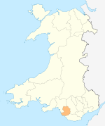
Towns and villages Aberkenfig · Bettws · Blackmill · Bridgend · Bryncethin · Brynmenyn · Bryntirion · Caerau · Cefn Cross · Cornelly · Coychurch · Cwmfelin · Danygraig · Garth · Heol-y-Cyw · Kenfig · Kenfig Hill · Litchard · Llangan · Llangeinor · Llangwynydd · Llangynwyd · Maudlam · Maesteg · Merthyr Mawr · Nantymoel · Newton · North Cornelly · Nottage · Pantygog · Pantyrawel · Pen-y-Fai · Pencoed · Pontycymer · Porthcawl · Price Town · Pyle · Sarn · South Cornelly · Tondu · Tythegston · Wild Mill · WyndhamCastles Rivers Categories:- Villages in Bridgend county borough
- M4 corridor
- Glamorgan geography stubs

Wikimedia Foundation. 2010.