- Nantymoel
-
Coordinates: 51°37′26″N 3°32′24″W / 51.624°N 3.540°W Nantymoel (Nant-y-moel) (Welsh for Stream from the bare mountain) is a village and includes the formerly separate village of Pricetown in the county borough of Bridgend, Wales on the River Ogmore, and is one of the constituent villages of the Ogmore Valley. It is bordered by the village of Wyndham to the south and by the Bwlch y Clawdd hill to the north.
As with the rest of Ogmore Vale, it was mainly a farming community up until the middle of the 19th century when coal mining became widespread across South Wales. The last coal mine (Wyndham/Western Colliery) closed in 1983, resulting in high unemployment at that time. Most residents today now travel to Bridgend or other larger towns for work.
The primary school was one of the few in the whole valley that didn't close in July 2003 and merge with the new Ogmore Primary School. It was refurbished in 2002 to combine with the nursery school that had previously closed.
The A4061 road passes through the village and goes north over Bwlch y Clawdd where it links to Treorchy and the Rhondda Valley to the north and the A4107 that goes west. The Bwlch, and surrounding large hillsides, offers a far-reaching view of the surrounding countryside. On a clear day, it is possible to see South West England over the Bristol Channel to the south, and the Brecon Beacons mountain range to the north.
Bridgend County Borough Bridgend County Borough Council Communities Brackla · Bridgend · Cefn Cribwr · Coity · Coychurch Higher · Coychurch Lower · Cornelly · Garw Valley · Laleston · Llangynwyd Lower · Llangynwyd Middle · Maesteg · Merthyr Mawr · Newcastle Higher · Ogmore Vale · Pencoed · Porthcawl · Pyle · St Bride's Minor · Ynysawdre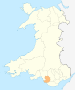
Towns and villages Aberkenfig · Bettws · Blackmill · Bridgend · Bryncethin · Brynmenyn · Bryntirion · Caerau · Cefn Cross · Cornelly · Coychurch · Cwmfelin · Danygraig · Garth · Heol-y-Cyw · Kenfig · Kenfig Hill · Litchard · Llangan · Llangeinor · Llangwynydd · Llangynwyd · Maudlam · Maesteg · Merthyr Mawr · Nantymoel · Newton · North Cornelly · Nottage · Pantygog · Pantyrawel · Pen-y-Fai · Pencoed · Pontycymer · Porthcawl · Price Town · Pyle · Sarn · South Cornelly · Tondu · Tythegston · Wild Mill · WyndhamCastles Rivers Categories:- Villages in Bridgend county borough

Wikimedia Foundation. 2010.