Sarakreek Airstrip — IATA: none – ICAO: SMSK Summary Airport type Public Operator Luchtvaartdienst Suriname Location … Wikipedia
Zoewatta — Infobox Settlement official name = Zoewatta other name = native name = nickname = settlement type = motto = imagesize = image caption = flag size = image seal size = image shield = shield size = image blank emblem = blank emblem type = blank… … Wikipedia
South Hills Mall — infobox shopping mall shopping mall name = South Hills Mall caption = Main Hallway location = Poughkeepsie, New York, United States opening date = 1974 closing date = 31 December 2007 manager = Dagar Group owner = Vornado Realty Trust developer … Wikipedia
Baikoetoe — Infobox Settlement official name = Baikoetoe other name = native name = nickname = settlement type = motto = imagesize = image caption = flag size = image seal size = image shield = shield size = image blank emblem = blank emblem type = blank… … Wikipedia
Brokopondo — Saltar a navegación, búsqueda Brokopondo Distrito de Surinam Capital … Wikipedia Español
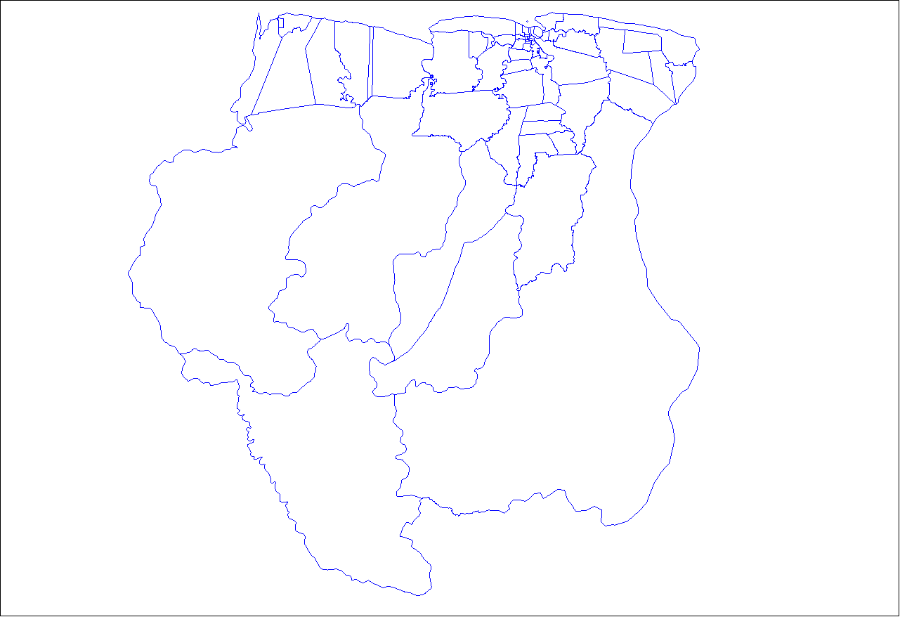
Districts of Suriname — Suriname This article is part of the series: Politics and government of Suriname Constitution President … Wikipedia
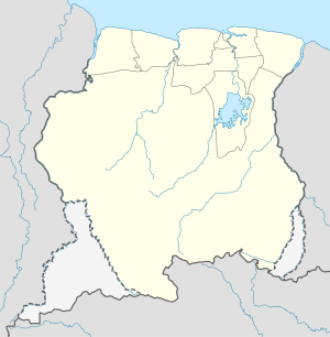
Commewijne District — Map of Suriname showing Commewijne district Commewijne is a district of Suriname, located on the right bank of the Suriname River. Commewijne s capital city is Nieuw Amsterdam. Alliance is another major town. The district has a population of… … Wikipedia
Brokopondo District — Brokopondo is a district of Suriname. Its capital city is Brokopondo; other towns include Brownsweg and Kwakoegron.The district has a population of 8,340, and an area of 7,364 square kilometres.Brokopondo district is the site of a large reservoir … Wikipedia
Coronie District — Map of Suriname showing Coronie district Coronie is a district of Suriname, situated on the coast. Coronie s capital city is Totness, with other towns including Corneliskondre, Friendship, Jenny. The district border the Atlantic Ocean to the… … Wikipedia
Marowijne District — Map of Suriname showing Marowijne district Marowijne is a district of Suriname, located on the north east coast. Marowijne s capital city is Albina, with other towns including Moengo and Wanhatti. The district borders the Atlantic Ocean to the… … Wikipedia
 Sarakreek
 Suriname