- Malvik
-
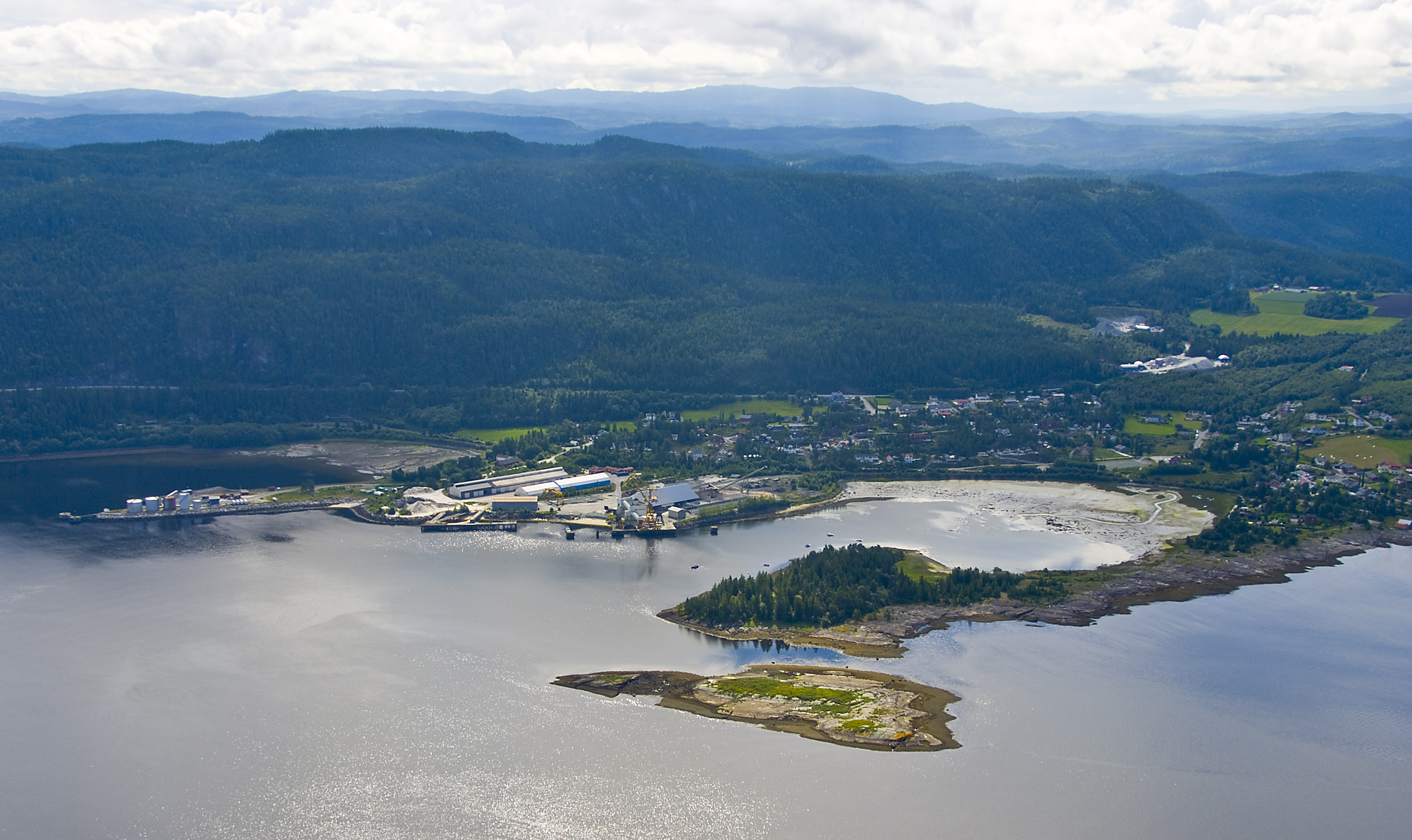
Malvik kommune — Municipality — View of Muruvik in Malvik

Coat of arms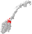
Sør-Trøndelag within
NorwayMalvik within Sør-Trøndelag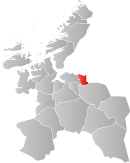
Coordinates: 63°22′22″N 10°45′3″E / 63.37278°N 10.75083°ECoordinates: 63°22′22″N 10°45′3″E / 63.37278°N 10.75083°E Country Norway County Sør-Trøndelag District Trondheim Region Administrative centre Hommelvik Government - Mayor (2007) Terje Granmo (Ap) Area - Total 168.54 km2 (65.1 sq mi) - Land 162.00 km2 (62.5 sq mi) - Water 6.54 km2 (2.5 sq mi) Area rank 350 in Norway Population (2010) - Total 12,550 - Rank 91 in Norway - Density 77.5/km2 (200.7/sq mi) - Change (10 years) 12.7 % Demonym Malvikbygg[1] Time zone CET (UTC+1) - Summer (DST) CEST (UTC+2) ISO 3166 code NO-1663 Official language form Bokmål Website malvik.kommune.no Data from Statistics Norway Malvik is a village and a municipality in Sør-Trøndelag county, Norway. It is part of the Trondheim Region. The administrative center of the municipality is the village of Hommelvik. Other villages in Malvik include Muruvika, Smiskaret, Sneisen, Vikhammer, and Hundhammeren.
While "Malvik" refers to the municipality as a whole, it also refers to the village of Malvik. Situated between Hommelvik and Vikhammer, this village is the original centre of the municipality, and is where the historic Malvik Church is located. The urban area of the municipality is 3.02 square kilometres (1.17 sq mi) and it has a population of 6,554. The population density is 2,170 inhabitants per square kilometre (5,600 /sq mi).[2]
Contents
General information
The municipality of Malvik was established in 1891 when it was separated from Strinda. On 1 January 1914, a small area of Lånke (population: 38) was transferred to Malvik. On 1 July 1953, a small area of Malvik (population: 37) was transferred to Strinda.[3]
Name
The municipality (originally the parish) is named after the old Malvik farm (Old Norse: Manvík), since the first church was built there. The first element is probably the word mǫn (stem form man-) which means "mane", referring to a mountain ridge behind the farm. (Mana which means "the mane" is a common name for many mountains in Norway, where the form of the mountain is compared with the mane of a horse.) The last element (Old Norse: Vík) is identical with the word vik which means "inlet".[4]
Coat-of-arms
The coat-of-arms is from modern times. They were granted on 23 July 1982. The arms show a capercaillie, chosen as a symbol for the rich nature in the area.[5]
Churches
The Church of Norway has two parishes (sokn) within the municipality of Malvik. It is part of the Deanery (prosti) of Stjørdal and the Diocese of Nidaros.
Churches in Malvik Parish
(Sokn)Church Name Year Built Location
of the ChurchHommelvik Hommelvik kirke 1886 Hommelvik Mostadmark kapell 1986 Sneisen Malvik Malvik kirke 1846 Malvik Geography
Malvik is just to the east of Trondheim, by far the largest town in the region (and one of Norway's largest). Many people in Malvik have their place of employment in Trondheim, though there is some local industry in Malvik itself.
The northern part of Malvik lies along the Trondheimsfjord, and it is along this coastal section that the vast majority of the population lives, and where schools, and places of employment are located. The municipal center is Hommelvik, situated about 25 kilometres (16 mi) east of Trondheim, and it has long been the main population area in Malvik. In the last few decades the area around Vikhammer and Hundhammeren (about 10 kilometres / 6.2 miles to the west) has grown larger than Hommelvik. The area has many new housing areas, businesses, and shopping. Collectively, the new area is referred to as the Malvik urban area.[2]
The southern part of the municipality consists mostly of farming and forest areas, with many attractive areas for hiking and cross-country skiing. The Homla river runs north to the Trondheimsfjord. The lake Jonsvatnet lies on the western border of the municipality.
In the southeastern part of Malvik there is the Jøsås exclaves. Three farmsteads, Øvre Jøsås, Store Jøsås, and Lille Jøsås belonging to Malvik municipality in Sør-Trøndelag county are exclaved inside Stjørdal municipality in Nord-Trøndelag county in two different exclaves. Øvre Jøsås and Store Jøsås are located in one exclave (the eastern one) while Lille Jøsås is making another exclave (the western one). The exclaves only have road access to Malvik municipality even though they are inside Stjørdal's borders. The distance between the two exclaves is very small, only about 8 metres (26 ft) at the nearest.[6]
Transportation
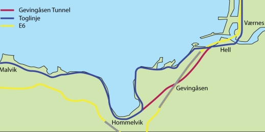
 Map of the tunnels from Malvik to Stjørdal
To the east of Malvik is the municipality of Stjørdal (in Nord-Trøndelag county), which includes Trondheim Airport, Værnes. The airport has frequent connections to many locations in Norway, and a growing range of direct air links abroad (currently including London, Amsterdam, Copenhagen, Stockholm, and Prague). The proximity of this airport means that Malvik, though a small community in a relatively isolated location, has rather good transport connections very close at hand. The European route E6 highway runs through Malvik and it has several tunnels, the longest of which is the Hell Tunnel.
The Nordlandsbanen railway line runs from Trondheim to Bodø (further north in Norway) and the Meråker Line runs east to Sweden. The railroad winds its way along the coast of the Trondheimsfjord in Malvik, and is a very scenic and pleasant journey[citation needed]. Malvik has two railway stations: Vikhammer Station and Hommelvik Station. The Gevingåsen Tunnel is being built to shorten the rail trip from Trondheim to Stjørdal. A side effect of this is that the scenic attractiveness of the trip will be somewhat reduced, as part of the section along the fjord will no longer form part of the trip. The railway junction where the line splits for Bodø or Sweden is just to the east of Malvik, at a small settlement called Hell. The station is well known to railway enthusiasts from its odd name (for English language speakers). It is indeed possible, in Malvik, to purchase "a single ticket to Hell" or a return "to Hell and back".
Notable residents
- Johan Nygaardsvold (1879–1952), Norway's prime minister from 1935 to 1945,
- Kåre Ingebrigtsen (1965–), football player (RBK)
- Ingvild Vaggen Malvik (1971–), Politician (SV)
References
- ^ "Personnemningar til stadnamn i Noreg" (in Norwegian). Språkrådet. http://www.sprakrad.no/nb-no/Sprakhjelp/Rettskrivning_Ordboeker/Innbyggjarnamn/.
- ^ a b Statistisk sentralbyrå (1 January 2009). "Urban settlements. Population and area, by municipality.". http://www.ssb.no/beftett_en/tab-2009-06-16-01-en.html.
- ^ Jukvam, Dag (1999). "Historisk oversikt over endringer i kommune- og fylkesinndelingen" (in Norwegian). Statistisk sentralbyrå. http://www.ssb.no/emner/00/90/rapp_9913/rapp_9913.pdf.
- ^ Rygh, Oluf (1901) (in Norwegian). Norske gaardnavne: Søndre Trondhjems amt (14 ed.). Kristiania, Norge: W. C. Fabritius & sønners bogtrikkeri. pp. 356. http://books.google.com/books?id=AGxBAAAAIAAJ.
- ^ Norske Kommunevåpen (1990). "Nye kommunevåbener i Norden". http://www.ngw.nl/int/nor/m/malvik.htm. Retrieved 26 October 2008.
- ^ Jan S. Krogh. "Domestic enclaves/exclaves of Norway". http://geosite.jankrogh.com/borders/no_exclaves.htm. Retrieved 2011-03-11.
External links
 Media related to Malvik at Wikimedia Commons
- Municipal Homepage (Norwegian)
- Sør-Trøndelag travel guide from Wikitravel
- Municipal fact sheet from Statistics Norway
- Weather forecast for Haugan in Malvik
Municipalities of Sør-Trøndelag  Categories:
- Malvik
- Municipalities of Sør-Trøndelag


Wikimedia Foundation. 2010.