- Glencoe, California
-
Coordinates: 38°21′15″N 120°35′06″W / 38.35417°N 120.585°W
Glencoe — Unincorporated community — Location in California
 Glencoe
Coordinates: 38°21′15″N 120°35′06″W / 38.35417°N 120.585°W Country United States State California County Calaveras County Elevation[1] 2,749 ft (838 m) Reference #: 280 Glencoe (formerly, Mosquito and Mosquito Gulch) is an unincorporated community in Calaveras County, California. It lies at an elevation of 2749 feet (838 m) and is located at 38°21′15″N 120°35′06″W / 38.35417°N 120.585°W. The community is in ZIP code 95232 and area code 209.
Glencoe was formerly called Mosquito Gulch. The business portion of the town was on the north side of Mosquito Gulch, but not one of the old buildings remains. The mines were first worked by Mexicans in the early 1850s. Quartz mining predominated but there was some placer mining as well.
The town today is registered as California Historical Landmark #280.
The first post office was opened at Mosquito in 1858 but closed in 1869; it was re-established as Mosquito Gulch in 1873. The name was changed to Glencoe in 1912; the post office closed again in 1916, but was re-established in 1947.[2]
Politics
In the state legislature Glencoe is located in the 1st Senate District, represented by Republican Dave Cox, and in the 25th Assembly District, represented by Republican Kristin Olsen. Federally, Glencoe is located in California's 3rd congressional district, which has a Cook PVI of R +7[3] and is represented by Republican Dan Lungren.
References
- ^ U.S. Geological Survey Geographic Names Information System: Glencoe, California
- ^ Durham, David L. (1998). California's Geographic Names: A Gazetteer of Historic and Modern Names of the State. Quill Driver Books. p. 777. ISBN 9781884995149.
- ^ "Will Gerrymandered Districts Stem the Wave of Voter Unrest?". Campaign Legal Center Blog. http://www.clcblog.org/blog_item-85.html. Retrieved 2007-10-20.
External links
Municipalities and communities of Calaveras County, California City 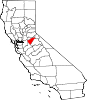
CDPs Arnold | Avery | Copperopolis | Dorrington | Forest Meadows | Mokelumne Hill | Mountain Ranch | Murphys | Rail Road Flat | Rancho Calaveras | San Andreas | Vallecito | Valley Springs | Wallace | West Point
Unincorporated
communitiesAlabama Hill | Big Bar | Big Meadow | Big Trees | Big Trees Village | Big Valley | Blue Lake Junction | Blue Lake Springs | Bummerville | Burson | Calaveritas | Camp Connell | Camp Pardee | Campo Seco | Canyon View | Carmen City | Cave City | Cedar Vista | Copper Cove Subdivision | Copper Cove Village | Cottage Springs | Douds Landing | Douglas Flat | Ebbetts Pass Highlands | Felix | Fisher Place | Fly-In Acres | Fort Jones | Fourth Crossing | Fuchs | Ganns | Glencoe | Goodmans Corner | Grizzly Ridge | Hams | Hanford Hill | Happy Valley | Hathaway Pines | Hathaways Mountain Pines | Independence | Indian Creek | Indian Hills | Jenny Lind | Jesus Maria | La Honda Park | Lake Camanche Ranches | Lakemont Pines | Lakeside Terrace | Lilac Park | Lombardi | Lost City | Lynn Park Acres | Manuel Mill | McKay | Meadowmont | Milton | Mother Lode Acres | Mountain Ranch Subdivision | Mountain Retreat | Mumbert Acres | Oak Grove | Oak Park Estates | Paloma | Pinebrook | Ponderosa Park | Porter | Quail Oaks | Red Apple | Rich Gulch | Rocky Hill | Sandoz | Sandy Gulch | Scenic Valley Ranchos | Sheep Ranch | Sherman Acres | Skyhigh | Snowshoe Springs | South Camanche Shore | Sunset Point | Tamarack | Tamarack Springs | Telegraph City | The Shores of Poker Flat | Timber Trails | Toyanza Subdivision | Toyon | White Pines | Wilseyville | Wyldewood
Former
settlementsAltaville | Antelope House | Balaklava Hill | Blue Mountain | Brownsville | Buckeye Hill | Camanche | Camp Spirito | Carson Hill | Chichi | El Dorado Bar | Fremont Valley | Greasertown | Hodson | Independence Flat | Lower Calaveritas | Mammoth Cave | McLeans Bar | McLeans Ferry | Melones | Mill Valley | North American House | Norval | Oregon Bar | Pattees Ranch | Poverty Bar | Sandy Bar | Spanish Bar | Stony Bar | Stoutenburg | Taylors Bar | Tremont House | Yaqui Camp
Categories:- Populated places in Calaveras County, California
- Unincorporated communities in California
- California Historical Landmarks
- Calaveras County, California geography stubs


Wikimedia Foundation. 2010.