- Mont-Joli Airport
-
Mont-Joli Airport 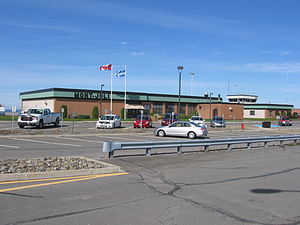
IATA: YYY – ICAO: CYYY
– WMO: 71718Summary Airport type Public Operator Régie Intermunicipale Location Mont-Joli, Quebec Elevation AMSL 172 ft / 52 m Coordinates 48°36′32″N 068°12′27″W / 48.60889°N 68.2075°WCoordinates: 48°36′32″N 068°12′27″W / 48.60889°N 68.2075°W Map Location in Quebec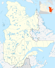
 CYYY
CYYYRunways Direction Length Surface ft m 06/24 5,000 1,524 Asphalt 15/33 3,954 1,205 Asphalt Statistics (2010) Aircraft movements 5,798 Sources: Canada Flight Supplement[1]
Environment Canada[2]
Movements from Statistics Canada[3] Plane getting ready to take-off at the Mont-Joli Airport
Mont-Joli Airport, (IATA: YYY, ICAO: CYYY), is located 1.5 NM (2.8 km; 1.7 mi) north northwest of Mont-Joli, Quebec, Canada.
Contents
History
In the summer of 1940 the Royal Canadian Air Force selected a flat area of farmland between Mont-Joli Station (on the Montreal-Halifax Canadian National Railway mainline) and the Saint Lawrence River for a military airfield. Construction on the aerodrome began in October 1941 and was completed by April 1942 at a cost of $200,000. Three paved runways and 50 buildings were constructed for what became known as RCAF Station Mont-Joli.
Inaugurated on April 15, 1942, RCAF Station Mont-Joli was used as part of the British Commonwealth Air Training Plan for a bombing and gunnery school until the end of World War II. Less well-known was RCAF Station Mont-Joli's critical role during the Battle of the St. Lawrence when RCAF Eastern Air Command used it as a coastal patrol base; during 1942-1944, dozens of Canadian cargo and warships were sunk by German U-boats in an effort to close the critical Saint Lawrence Seaway off to shipping. Aircraft staging out of Mont-Joli were crucial to warding off U-boats and ensuring the safety of shipping out to the eastern tip of the Gaspé Peninsula at Cap-Gaspé.
 World War 2 plane in operation at Mont-joli airport
RCAF Station Mont-Joli was decommissioned by the air force in 1945 and became the property of the Department of Transport (now Transport Canada) on December 15, 1945 for use as a civilian airport, and its ownership was transferred in 1995 to the "Régie intermunicipale de l’aéroport régional de Mont-Joli". It is the busiest airport in Eastern Quebec, though still very far from the Québec/Jean Lesage International Airport in Quebec City and Montréal-Pierre Elliott Trudeau International Airport in Montreal.
In 2007 a second runway (15/33) was opened and the 06/24 runway decreased in length from 6,000 ft (1,829 m) to 5,000 ft (1,524 m).
Airlines and destinations
Airlines Destinations Air Canada Express operated by Jazz Air Baie-Comeau, Montreal-Trudeau Pascan Aviation Baie-Comeau, Montreal-Saint-Hubert, Quebec City, Sept-Îles, Wabush References
- ^ Canada Flight Supplement. Effective 0901Z 20 October 2011 to 0901Z 15 December 2011
- ^ Synoptic/Metstat Station Information
- ^ Total aircraft movements by class of operation — NAV CANADA flight service stations
External links
- Past three hours METARs, SPECI and current TAFs for Mont-Joli Airport from NAV CANADA as available.
Airports in Canada By name A–B · C–D · E–G · H–K · L–M · N–Q · R–S · T–ZBy location indicator CA · CB · CC · CD · CE · CF · CG · CH · CI · CJ · CK · CL · CM · CN · CO · CP · CR · CS · CT · CV · CW · CY · CZBy province/territory National Airports System Calgary · Charlottetown · Edmonton · Fredericton · Gander · Halifax · Iqaluit · Kelowna · London · Moncton · Montréal-Mirabel · Montréal-Trudeau · Ottawa · Prince George · Québec · Regina · Saint John · St. John's · Saskatoon · Thunder Bay · Toronto · Vancouver · Victoria · Whitehorse · Winnipeg · YellowknifeRelated List of airports by ICAO code: C · List of defunct airports in Canada · List of heliports in Canada · List of international airports in Canada · National Airports System · Operation Yellow Ribbon Category ·
  Portal ·
  WikiProjectCategories:
- Airports in Quebec
- Airports of the British Commonwealth Air Training Plan
- Royal Canadian Air Force stations
- Transportation in Bas-Saint-Laurent


Wikimedia Foundation. 2010.