- Newbridge, Isle of Wight
-
Coordinates: 50°41′14″N 1°25′12″W / 50.68725°N 1.42009°W
Newbridge 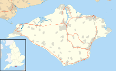
 Newbridge
Newbridge shown within the Isle of WightOS grid reference SZ410876 Unitary authority Isle of Wight Ceremonial county Isle of Wight Region South East Country England Sovereign state United Kingdom Post town YARMOUTH Postcode district PO41 Dialling code 01983 Police Hampshire Fire Isle of Wight Ambulance Isle of Wight EU Parliament South East England UK Parliament Isle of Wight List of places: UK • England • Isle of Wight Newbridge is a hamlet on the Isle of Wight. It is situated on a small hill, nine kilometres to the west of Newport on the western half of the island. The village has a social club, situated in the old school house, and a holiday park with indoor and outdoor swimming pools and the villages only remaining shop. There are no churches in Newbridge, however there were two chapels. One was demolished in the early 1980's, and the remaining Newbridge Wesleyan Methodist Chapel is now part of a residence. Newbridge is part of Shalfleet parish council. The name Newbridge is explained by the bridge near the edge of the village which crosses the Caul Bourne this being litterely the "New Bridge".
The Caul Bourne stream running through Calbourne passes through Newbridge and Shalfleet and discharges into the Solent at Newtown.
Until September 2010 the village was linked to other parts of the Island by Southern Vectis circular bus route 7,[1] Following the withdrawal of this service[2] Newbridge is served by the infrequent Wightbus service 35/36.
References
- ^ "Southern Vectis - bus route 7". www.islandbuses.info. 2008. http://www.islandbuses.info/r7.shtml. Retrieved 2008-05-04.
- ^ "Southern Vectis - latest news". Southern Vectis. 2010. http://www.islandbuses.info/newsstory.php?articleid=188. Retrieved 2010-09-26.
External links
 Media related to Newbridge, Isle of Wight at Wikimedia Commons
Ceremonial county of Isle of Wight Unitary authorities Major settlements Rivers Topics Categories:- Villages on the Isle of Wight
- Isle of Wight geography stubs

Wikimedia Foundation. 2010.