- Pennsylvania Route 724
-
PA Route 724
Route information Maintained by PennDOT Length: 30 mi[1] (48 km) Existed: 1962 – present Major junctions West end:  US 422 in Sinking Spring
 US 222 in Spring Township


US 222 Bus. in Shillington
 I-176 in Cumru Township
US 422 in North Coventry Township.East end:  PA 23 in East Pikeland Township
Location Counties: Berks, Chester Highway system Roads in Pennsylvania
Interstate • US • State • Legislative←  PA 722
PA 729  →
→Pennsylvania Route 724 is a 30-mile (48 km) road spanning from Sinking Spring, Pennsylvania to Phoenixville, Pennsylvania. 724 travels through the counties of Berks and Chester. The road was signed in 1962, taking place of Route 83, which extended to Ridgewood, as well as additional unsigned roads to reach its current terminus.
PA 724 shares stretches of road with PA 345 in Birdsboro, PA 10 in Reading, and US 222 Business in Shillington.
Contents
Route description
Berks County
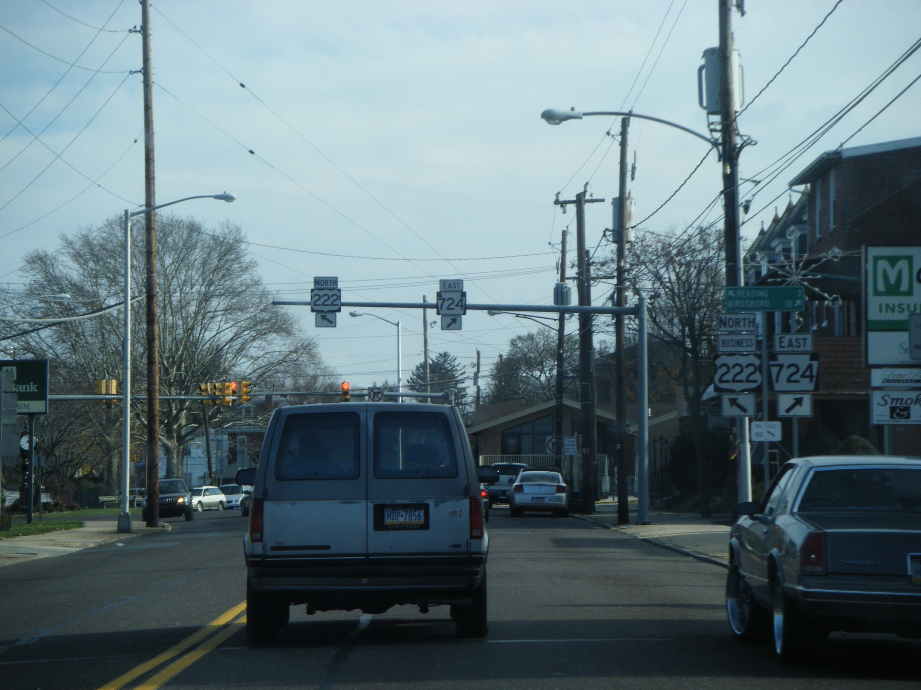
 PA 724 eastbound approaching split with US 222 Business in Shillington
PA 724 begins at an intersection with U.S. Route 422 in Sinking Spring as Shillington Road. PA 724 begins heading towars the southeast as Revere Road. In Spring Township, PA 724 interchanges with U.S. Route 222 at the newly built highway. Before 2004, US 222 use to run where US 222 Business runs today. In Shillington, PA 724 has a concurrency with US 222 Business for less than a mile. After leaving US 222 BUS, PA 724 starts to just head east. In the borough of Kenhorst, PA 724 is called Philadelphia Avenue and PA 724 intersects Pennsylvania Route 625. In Cumru Township, has a small concurrency with Pennsylvania Route 10. East of PA 10, PA 724 begins to parallel the Schuylkill River and intersects Interstate 176 at exit 10 in a Diamond interchange. In Robeson Township, PA 724 is called Main Street and intersects the eastern terminus of Pennsylvania Route 568. In Birdsboro, PA 724 enters the borough as Main Street and has a concurrency with Pennsylvania Route 345 which was formerly part of Pennsylvania Route 82. PA 345 diverges south from PA 724 in Birdsboro where PA 345 formerly ended before it was extended in 2008. PA 724 continues east as East Main Street paralleling the Schuylkill River.
Chester County
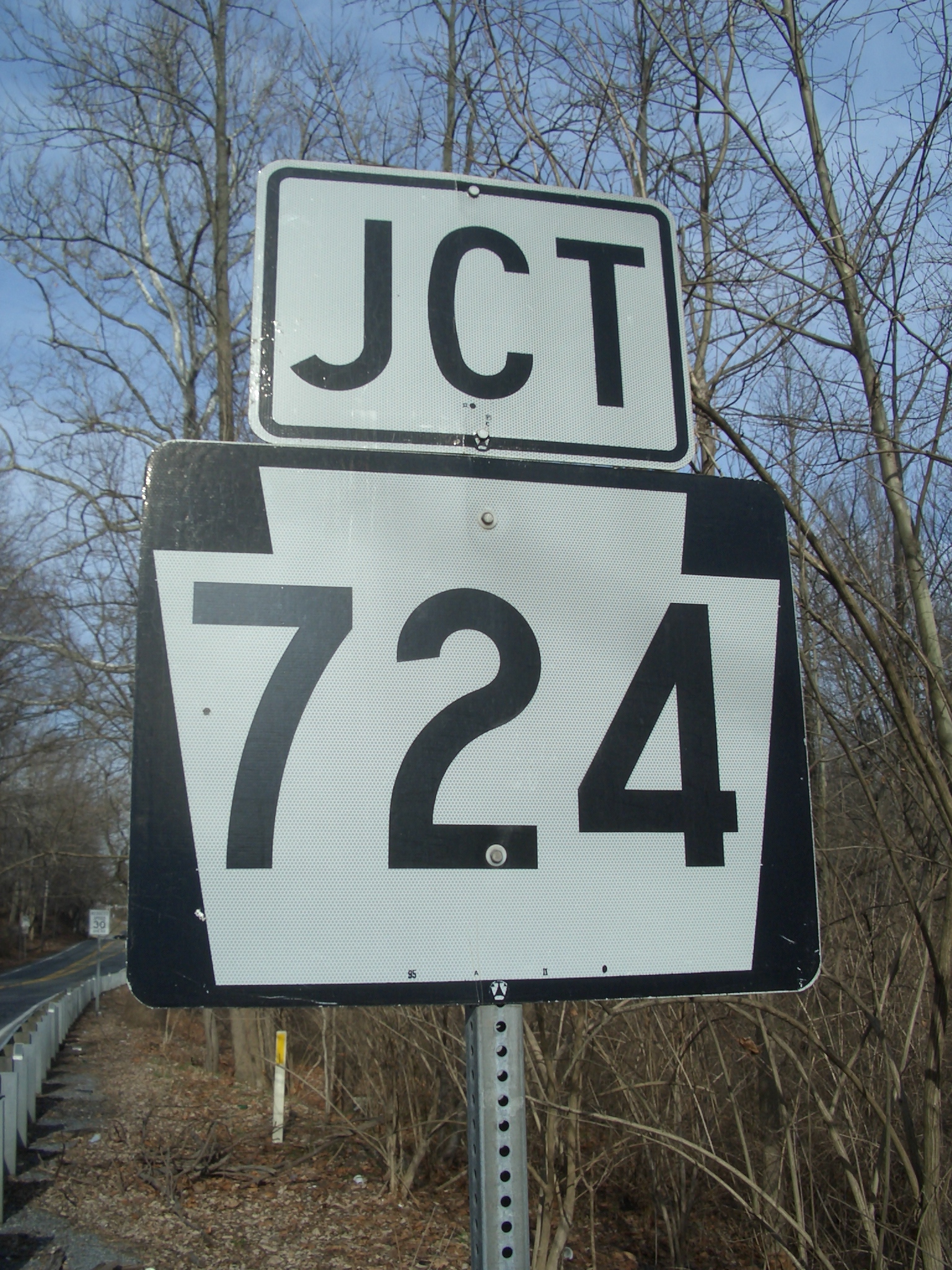
 A PA Route 724 sign
PA 724 enters Chester County as Schuylkill Avenue. In the village of Pottstown Landing, PA 724 interchanges with Pennsylvania Route 100. In the village of Kenilworth, PA 724 interchanges with U.S. Route 422 at a Trumpet interchange. East of US 422, PA 724 continues southeast as a straight road named Schuylkill Road. PA 724 passes by the borough of Spring City. Two miles southeast of Spring City, PA 724 terminates (ends) at an "Y" intersection with Pennsylvania Route 23.
Names
Along the route, 724 has some alternative names which include Shillington Road, Schuylkill Road, Revere Boulevard, West Lancaster Avenue, Philadelphia Avenue, Furnace Street, Thomas Avenue, East Main Street, West Schuylkill Road, and New Schuylkill Road.
Rail trail
The entire route of PA 724 runs parallel to the Schuylkill River Trail, a rail trail following the right-of-way of the former Schuylkill Branch of the Pennsylvania Railroad. The highway crosses the trail twice in Birdsboro, and is within striking distance in Parker Ford, a hamlet within East Coventry Township. The Schuylkill Branch was abandoned due to the rise in automobile traffic on PA 724.
History
PA 724 is referenced in the liner notes of Daryl Hall & John Oates' 1973 album "Abandoned Luncheonette". Hall, a Pottstown, PA native, and Oates approached Talmadge W. Faulk at his restaurant "Toggs" on Route 724 (New Schuylkill Rd.), on the eastern outskirts of town. The duo requested permission to photograph Faulk's defunct Rosedale Diner, which had been sitting dormant across the street since 1965. The photograph became the cover image for "Abandoned Luncheonette". In the liner notes, Faulk is simply credited as "The man on Rt. 724". In exchange for his verbal permission, Faulk received an autographed copy of the first album off the presses. The Rosedale Diner remained in the same spot until it was scrapped in 1983, due to the dilapidated condition it had incurred at the hands of souvenir-hunting Hall & Oates fans. The structure where Hall & Oates met with Faulk to request his permission still stands on PA 724 at Peterman Road, long abandoned under the name "Pizza World". Debris from the Rosedale Diner can still be found across the street, next to Towpath Park. Faulk died in 2007.
 The Meeting House Law Building, Route 724 at Mennonite Church Road, Spring City
Along PA 724 in Spring City, Chester County, where signed as Schuylkill Road, is located the historic former Vincent Mennonite Church and Rhoad's Burying Ground Mennonite Cemetery. The former meeting house was constructed in 1797, and razed to the ground and rebuilt in 1889. The cemetery has grave markers dating to 1759, and also a large unmarked mass burial plot along PA 724 for Irish laborers who died in an epidemic while building the Schuylkill Canal.[2][3] The site is now home to The Meeting House Law Building & Gallery and ImaginAIRium.
Major intersections
County Location Mile[4] Destinations Notes Berks Sinking Spring 0.0 US 422 (Penn Avenue)Spring Township 1.3 US 222 (Warren Street Bypass)Interchange. Shillington 2.4
US 222 Bus. south (Lancaster Pike)West end of US 222 Bus. concurrency 2.9
US 222 Bus. north (Lancaster Avenue)East end of US 222 Bus. concurrency Kenhorst 4.2  PA 625 (New Holland Road)
Cumru Township 5.3  PA 10 south (Morgantown Road)
West end of PA 10 concurrency 5.4 PA 10 north (Morgantown Road)East end of PA 10 concurrency 7.0 I-176 (Morgantown Expressway)Hamlet of Ridgewood.
Exit 10 (I-176).Robeson Township 8.8  PA 568 (Green Hills Road)
Hamlet of Gibraltar; eastern terminus of PA 568. Birdsboro 12.4  PA 345 north (North Furnace Street)
West end of PA 345 concurrency, former PA 82 13.2 PA 345 south (Chestnut Street)East end of PA 345 concurrency Chester North Coventry Township 21.2  PA 100 (Pottstown Pike)
Interchange. 22.9 US 422 (Pottstown Bypass)Interchange. East Pikeland Township 30.4 PA 23 (Ridge Road, Schuylkill Road)1.000 mi = 1.609 km; 1.000 km = 0.621 mi References
External links
 Media related to Pennsylvania Route 724 at Wikimedia CommonsCategories:
- State highways in Pennsylvania


Wikimedia Foundation. 2010.