- Longyearbyen
-
Coordinates: 78°13′N 15°39′E / 78.22°N 15.65°E
Longyearbyen The town centre of Longyearbyen, Svalbard

Coat of armsMotto: "unikt, trygt og skapende"
(Norwegian: "unique, secure and creative")Location of Longyearbyen and Svalbard
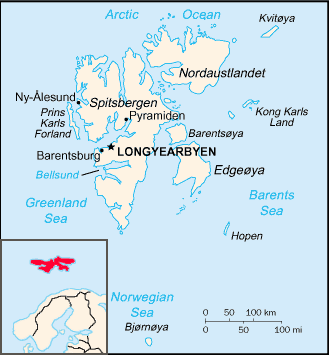
Coordinates: 78°13′N 15°33′E / 78.217°N 15.55°E Sovereign state Norway Territory Svalbard Island Spitsbergen Founded 1906 Incorporated January 1, 2002 Government - Mayor Kjell Mork (Ap) Area - Total 242.86 km2 (93.8 sq mi) Population (2007) - Total 2,075 (Svalbard: 1st) Website http://www.lokalstyre.no/ Longyearbyen is the largest settlement and the administrative centre of Svalbard, Norway. It is located on the western coast of Spitsbergen, the largest island of the Svalbard archipelago, on the southern side on Adventfjorden (English: the Advent fjord), which continues inland with Adventdalen (English: the Advent valley). The Governor of Svalbard and his administration reside in Longyearbyen.
Longyearbyen has approximately 2,060 inhabitants (at the end of 2007[1]). It is the world's most northerly town, and the most northerly settlement with a population greater than 1,000.[2]
Contents
History
Svalbard and the Spitsbergen Treaty
Svalbard was probably discovered by Icelanders and referred to as Svalbarði fundinn in 1194, according to Landnámabók from the 11th century[3] and again in 1596 by the Dutch navigator Willem Barentsz[3]. Since the 17th century, people of different nationalities have carried out various activities on Svalbard including hunting, trapping, research and mining. In the first half of the 17th century, the right to catch whales in Svalbard was in dispute between several European nations - with conflicts occasionally resulting in bloodshed. Denmark-Norway and England both claimed sovereignty over the region; but as neither permanently settled the region, it remained a terra nullius.
At the beginning of the 20th century, the development of the mining industry created the need for change: it was important to have sole ownership of land and mineral deposits, and there was a need for legislation and courts to settle disputes, such as those between mining companies and their workers. Only with the Treaty of Versailles at the end of World War I was an agreement reached in the form of the Spitsbergen Treaty. This made Svalbard part of the Kingdom of Norway but the Treaty allowed citizens of other signing nations equal rights to residence, property, commercial activities and research on the island. As a result, people from many nations live on Svalbard today.[4]
The Longyearbyen American period
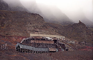 Mine #2b "Santa Claus" in Longyearbyen
During the summer of 1900, businessmen from Trondheim formed Kulkompagniet Trondhjem-Spitsbergen (English: The Trondheim-Spitsbergen Coal Company) and occupied the coal mines in Longyearbyen. The company looked for foreign buyers, and in 1905 a deal was made with two American businessmen, John Munroe Longyear and Frederick Ayer; they established The Arctic Coal Company (ACC) in Boston, which developed the mining operation in what was called Longyear City, later the Norwegian Longyearbyen (byen in Norwegian means the town/city).[4]
The period 1906-1915 (during which ACC ran the mines) is known as The American period. A few hundred miners were working in Longyearbyen every year; most came from Norway or Sweden, while the management was British or American. This pioneer period saw discontent and strikes. The workers’ living conditions were primitive: they were quartered in large 32- or 64-man barracks, in stalls for 4. Hygiene and food were poor due to limited supply, and the workers probably stayed due to the good wages, compared to those in the mines and construction sites on the mainland.[4]
The Norwegian period
In 1916, ACC and the American properties were sold to the Norwegian Det Norske Spitsbergensyndikat. The syndicate also bought the coal field in Grønfjorden, and in November 1916 Store Norske Spitsbergen Kullkompani AS (SNSK) was founded. During the winter of 1917-1918, around 180 men and 34 women and children overwintered. By 1920 the number had increased to 289, out of which 37 were women and children.[4]
The Svalbard Treaty then gave Norway sovereignty over Svalbard. This had a minimal effect on the community in Longyearbyen, which was run as a private company town by SNSK.[4]
World War II
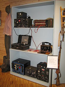 Communication equipment from WWII on Svalbard, exhibited in the Svalbard Museum in Longyearbyen
During World War II, both Norwegian and German soldiers were stationed on Svalbard. There was little military action, the soldiers' duty being that of collecting weather data, which would be useful for other military operations further south. British convoys sailed from Scotland to the Soviet Union with allied supplies (the so-called Murmansk convoys), passing through the waters between Svalbard and Norway, which (together with the working coal mines) turned Svalbard into a strategic military location.[4]
In the autumn of 1941, the year the Germans established the first weather stations, the whole population of Svalbard was evacuated, a decision of the Norwegian Exile Government (in London) with the Allied Forces. In 1942 a small Allied force arrived in Svalbard on the ships Isbjørn and Selis, hoping to hold position in the Isfjorden area. The boats were bombed and sunk by the Germans in Grønfjorden, and the survivors moved to Barentsburg. The Germans then sent the battleships Tirpitz and Scharnhorst to Svalbard in 1943. These ships' crews shelled and burned Barentsburg, Grumant and Longyearbyen; later, a German submarine destroyed Svea and most houses in Van Mijenfjorden.[5]
Modern times
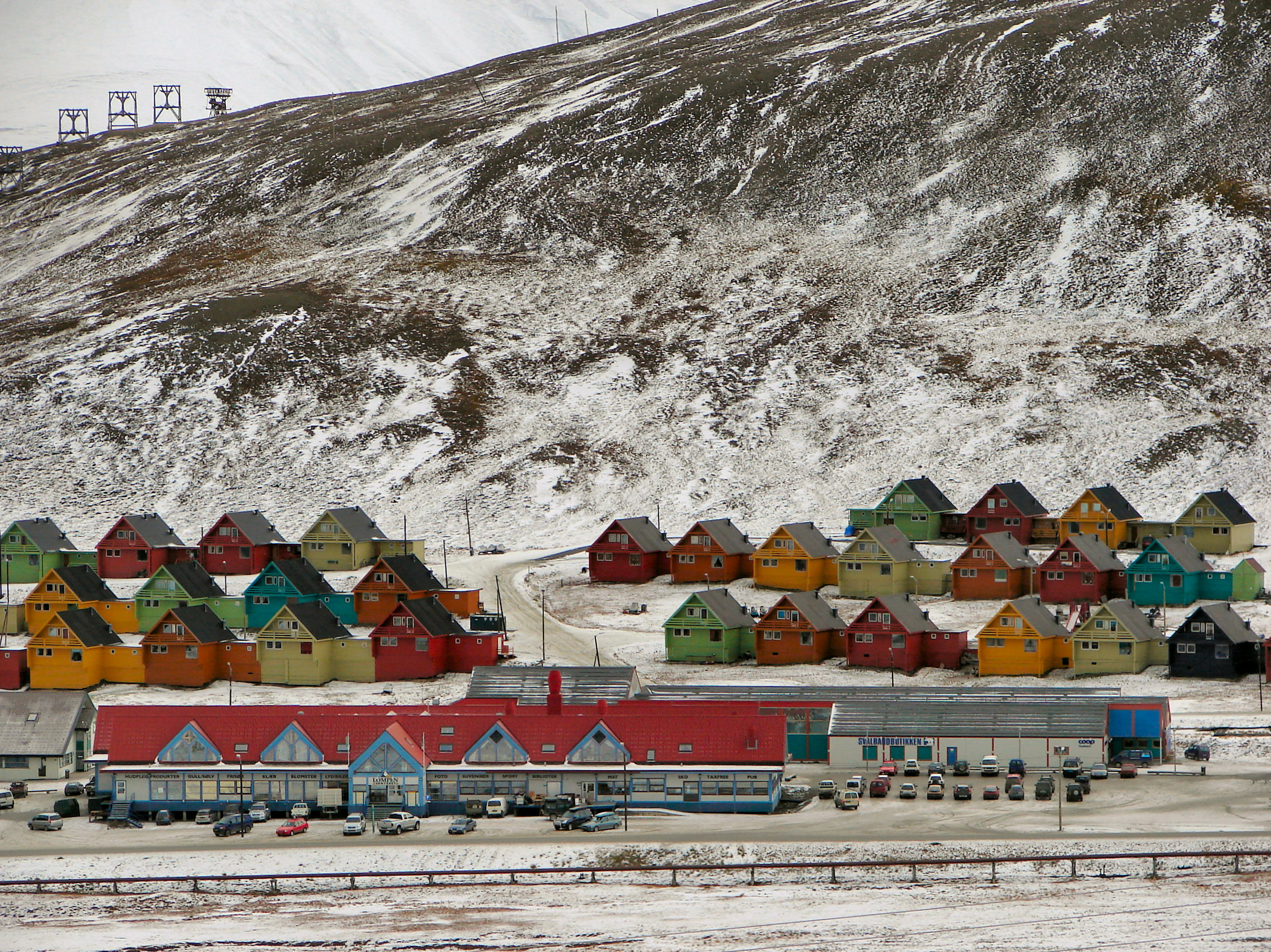
 View of Longyearbyen, Adventfjorden and Adventdalen
It was only in the 1960s that demand for modernisation and normalisation[clarification needed] arose. Development[clarification needed] rapidly increased in the 1970s, when the Norwegian authorities became actively engaged in Svalbard politics. Their aim was that Longyearbyen should become a family community, like any other town in Norway.[4]
The opening of the airport in 1975 ended the isolation during the winter months. In 1976, the Norwegian state took over the shares in SNSK[citation needed] and hence control of the development[clarification needed] of Longyearbyen.
The coal mining industry was the major employer in Longyearbyen until the early 1990s - daily life revolving around the mining business. With the closure of many of the town's coal mines since, however, this is no longer the case.
Today, the community offers a wide range of activities and facilities, including a swimming hall, a climbing wall, a big sports hall, a grocery store, four pubs, seven hotels, one church (Svalbard Church), several tourist shops, a cinema, one night club, and a squash court. There is also the University Centre in Svalbard, which represents four Norwegian universities and provides university-level education in Arctic studies.
At the end of 2007, Longyearbyen had around 2060 inhabitants.[citation needed] About 300 people, or 15% of the population, are non-Norwegian nationals - with Thailand, Sweden, Russia and Ukraine being the most highly-represented nationalities.[1]
Geography
See also: Geography of Svalbard Winter panorama down the Longyear Valley
Longyearbyen has an Arctic tundra climate and terrain, moderated slightly by the sea - cf. Climate of Longyearbyen. It lies on the shoreline of the Adventfjorden, part of the fjord of Isfjorden, with most of the town below 100 metres (330 ft) in altitude. The Longyear river runs through the town (though is frozen for much of the year) and its valley heads inland, southwards. The landscape is mountainous and tree-less, giving it a snowy landscape in winter and spring, and a generally bare landscape without the snow cover.
In the 1930s it was discovered that bodies buried in the town's graveyard were not decomposing, because the permafrost was preserving them. People may not be buried there, and so those who fall gravely ill must be taken to another part of Norway, where they can be buried if they die.[6]
Districts
The town has a number of named districts. To the west of the Longyear river are Bykaia (the modern port), Sjøområdet ("Lake District"; the old harbour area), Skjæringa (where the Governor's residence is) and Gamle Longyearbyen ("Old Longyear Town"; where the church is). To the east of the river are Sjøskrenten (towards the river delta), the new town centre (including the Radisson hotel), and the Gruvedalen ("Mine Valley") and Lia residential districts. To the south is Haugen ("The Hill") where the town's school and main sports hall are, as well as the Spitsbergen Hotel. Further south, uphill and detached from the main settlement, is the small settlement of Nybyen ("New Town").[7]
Longyearbyen lokalstyre
 The incorporated area of Longyearbyen in Svalbard
The town was incorporated in 2002 — the community extends much further than the town, encompassing the Adventfjorden, the Adventdalen and several small valleys from the fjord,[8] in total covering 242.86 square kilometres (93.77 sq mi). Other places of settlement are Nybyen to the south and the airport to the west. With incorporation the town now has local democracy, a local authority (the "lokalstyre") and a mayor.
Economy
Mining still plays a major role in the community. The Norwegian mining company, Store Norske Spitsbergen Kulkompani, runs two coal mines (Longyearbyen #7 and Svea), and coal mining employs about half the residents.
The Svalbard Global Seed Vault is a secure underground facility capable of storing millions of crop seeds located near Longyearbyen, administered by the Global Crop Diversity Trust. The facility has been designed to protect against natural and human disasters, including global warming, floods and fires, and nuclear holocaust. The site was chosen for a number of factors including its remoteness, sound geology and the ambient temperature of the permafrost.[9]
Education and research
 Nybyen, a settlement uphill from Longyearbyen
In 1993, the University Centre in Svalbard (UNIS) was opened; it is a cooperation of all four Norwegian universities, providing lectures in geophysics, Arctic biology, geology and Arctic technology as well as bachelor, master and PhD positions. The faculty consists of 20 full-time professors, 21 assistant professors and 120 guest lecturers. English is the official language of work, and currently about 350 international students take at least one course per year at UNIS. The student body consists of 50% Norwegian and 50% international students; there are no tuition fees, and most students live in six renovated mining barracks in Nybyen.[10]
Research also includes ionospheric and magnetospheric facilities in regard to the EISCAT radar, the Auroral observatory and a magnetometer belonging to the IMAGE chain.
Media
Longyearbyen has one newspaper, the weekly (Norwegian language) Svalbardposten.[11] In addition there is an English language online "newspaper" called icepeople.[12]
Tourism
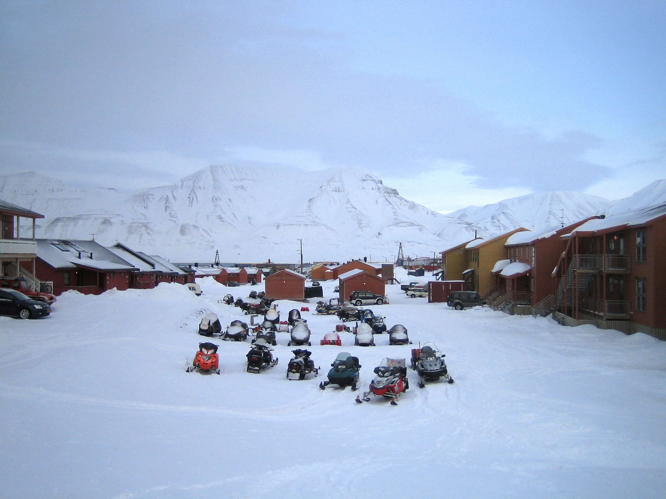
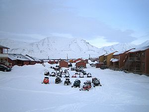 A parking lot with snowmobiles in Longyearbyen
Most tourists to Longyearbyen arrive during spring and summer. Spring is very popular since Spitsbergen is one of the few places in Norway where a snowmobile can be driven in open country without special permission.[citation needed] However, due to strict environmental laws not all of the main island of Spitsbergen is accessible. From February until November several tour operators provide a wide range of guided trips.
Longyearbyen is the world's most northern readily-accessible settlement, with Svalbard Airport just outside town offering regular public flights to and from Tromsø and Oslo. In recent years the airport serves over 120,000 passengers per annum. Longyearbyen is also the northernmost town over 1000 inhabitants; it houses a large number of northernmost places and objects of interest: the northernmost church, hospital, tourist office, ATM, airport with scheduled flights, and commercial sea port. A large Radisson Hotel has also opened in the settlement, offering the world's most northern public bar.[13]
Climate
Longyearbyen features a polar climate, with cool summers and long, cold winters. Summers in the city are chilly, with average high temperatures being 7°C (45°F) in July. Winters in Longyearbyen are very cold with the average low temperatures of -21°C (-6°F) in February. The city sees roughly 300 mm of precipitation per year, a majority of which falls as snow.
Climate data for Longyearbyen Month Jan Feb Mar Apr May Jun Jul Aug Sep Oct Nov Dec Year Average high °C (°F) −13
(8.6)−13
(8.6)−13
(8.6)−9
(15.8)−3
(26.6)3.0
(37.4)7.0
(44.6)6.0
(42.8)1.0
(33.8)−4
(24.8)−8
(17.6)−11
(12.2)−4.75
(23.45)Average low °C (°F) −20
(−4.0)−21
(−5.8)−20
(−4.0)−16
(3.2)−7
(19.4)−1
(30.2)3.0
(37.4)2.0
(35.6)−3
(26.6)−9
(15.8)−14
(6.8)−18
(−0.4)−10.33
(13.40)Precipitation mm (inches) 22.0
(0.866)28.0
(1.102)29.0
(1.142)16.0
(0.63)13.0
(0.512)18.0
(0.709)24.0
(0.945)30.0
(1.181)25.0
(0.984)19.0
(0.748)22.0
(0.866)25.0
(0.984)271
(10.67)Source: Climate and daylight in Svalbard (Longyearbyen)[14] The winters in Longyearbyen are about 20 degrees warmer than at similar latitudes in other parts of the world because of the warm North Atlantic Current that also keeps western Europe and Iceland relatively warm. Average winter temperatures tend to be warmer than in most of Siberia and parts of central Asia. For example, mean January temperature in Astana, the capital of Kazakhstan, is lower than that of Longyearbyen.
The most notable feature of Longyearbyen's climate is the lack of sunlight for almost 4 months of the year (the "polar night" — lasting in Svalbard from 28 October to 14 February) and an even longer period of 24-hour sunlight[15] (the "polar day" — lasting in Svalbard from 19 April to 23 August),[14] caused by its proximity to the North Pole.
References
- ^ a b About Longyearbyen from its official website. In Norwegian. Retrieved January 4th, 2009.
- ^ Rosenthal, Elisabeth (March 3, 2008). "A Speck of Sunlight Is a Town’s Yearly Alarm Clock". The New York Times. http://www.nytimes.com/2008/03/03/world/europe/03sun.html. Retrieved March 16, 2010. ("this remote Arctic settlement — which bills itself as the northernmost town in the world ... The 2,000 inhabitants of Longyearbyen...")
- ^ a b http://snl.no/Svalbard
- ^ a b c d e f g The Svalbard Museum in Longyearbyen. Retrieved January 4th, 2009.
- ^ History of Svalbard from the Norwegian Polar Institute. Retrieved January 5th, 2009.
- ^ Bartlett, Duncan (2008-07-12). "Why dying is forbidden in the Arctic". BBC News (Norway: BBC). http://news.bbc.co.uk/2/hi/programmes/from_our_own_correspondent/7501691.stm. Retrieved 2008-09-07.
- ^ UNIS — Map of Longyearbyen and Nybyen
- ^ Svalbard interactive map
- ^ The Seed Bank Atop the World. latimes.com. Retrieved October 12, 2007.
- ^ The University Centre in Svalbard. Retrieved January 5th, 2009.
- ^ Svalbardposten website
- ^ icepeople English language "alternative newspaper"
- ^ "Spitsbergen Hotel: Radisson Blu (SAS) Polar Hotel Spitsbergen, Longyearbyen". http://www.radissonblu.com/hotel-spitsbergen. Retrieved 9 September 2011.
- ^ a b "Climate and daylight in Svalbard (Longyearbyen)". NordicVisitor. June 2011. http://svalbard.nordicvisitor.com/travel-guide/climate-and-daylight/. Retrieved May 2011.
- ^ GAISMA: Longyearbyen, Svalbard and Jan Mayen - Sunrise, sunset, dawn and dusk times, table
External links
- Longyearbyen travel guide from Wikitravel
- Official municipal website
- Longyearbyen.net News from Svalbard
- Official tourist information
- Webcams in Longyearbyen
- UNIS — Map of Longyearbyen and Nybyen
- Svalbardposten – News from Svalbard (In Norwegian)
- Icepeople – Alternative Svalbard newspaper in English
- The University Centre on Svalbard
- The Kjell Henriksen Observatory – the northern lights observatory
- Svalbard Science Forum SSF – Information for and about research in Svalbard
- The Store Norske Coal Mining Company
- Svalbard Airport:Facts and pictures from Avinor
- Island railways north of Europe
- "A Speck of Sunlight Is a Town’s Yearly Alarm Clock," Elisabeth Rosenthal. The New York Times, March 3, 2008.
- Spitsbergen Airship Museum
Svalbard General Politics Settlements Former settlements Bölscheøya · Grumant · Kobbefjorden · Lægerneset · Pyramiden · Smeerenburg · Virgohamna · Ytre NorskøyaEnvironment Islands Barentsøya · Bjørnøya · Edgeøya · Hopen · Kong Karls Land · Kvitøya · Nordaustlandet · Prins Karls Forland · Sjuøyane · Spitsbergen · Tusenøyane · WilhelmøyaNational parks Forlandet National Park · Indre Wijdefjorden · Nordenskiöld Land · Nordre Isfjorden Land · Northwest Spitsbergen · Sassen – Bünsow Land · Sør-SpitsbergenCompanies Research Arctic Yellow River Station · Norwegian Polar Institute · Polish Polar Station · Seed Vault · Undersea Cable · University Centre · Himadri StationTransport Categories:- Longyearbyen
- Populated places established in 1906
- Populated places of Arctic Norway
- Populated places in Svalbard
- 1906 establishments in Norway
- Port cities and towns in Norway


Wikimedia Foundation. 2010.