- New York State Route 299
-
NYS Route 299
Route information Maintained by NYSDOT, Ulster County and the village of New Paltz Length: 12.39 mi[2] (19.94 km) Existed: 1930[1] – present Major junctions West end: 
 US 44 / NY 55 in Gardiner
 I-87 / Thruway in New Paltz
East end:  US 9W in Highland
Location Counties: Ulster Highway system Numbered highways in New York
Interstate • U.S. • N.Y. (former) • Reference • County←  NY 298
NY 300  →
→New York State Route 299 (NY 299) is a short but important state route entirely within Ulster County, New York, United States. Centered around its interchange with the New York State Thruway outside New Paltz, it provides access from that road to the popular recreational attractions of the Shawangunk Ridge to the west and Poughkeepsie to the east. Only the eastern section is a state highway; from Shawangunk to New Paltz, it is owned and maintained by Ulster County.
Contents
Route description
NY 299 leaves the concurrent US 44 and NY 55 in Gardiner just below the Trapp cliffs of the Mohonk Preserve, one of the most popular and renowned climbing sites in the Northeast. It weaves gently through the woods as it descends towards New Paltz. A mile or so from the western terminus, traffic headed in that direction will have a fantastic view of Mohonk and its famous tower. The section of the highway from US 44 eastwards towards the junction with Ulster County Route 7 south (Libertyville Road) is also signed as Ulster County Route 8; It is known as the New Paltz-Minnewaska Road, though not signed as such. From the Libertyville Road junction to the Springtown Road junction just west of the Carmine Liberta Bridge over the Wallkill River, NY 299 also carries the Ulster County Route 7 sign. From the western end at US 44 to the bridge, NY 299 is maintained by the Ulster County Department of Public Works, rather than the New York State Department of Transportation. It is one of three state routes in Ulster County that is maintained by the county, the others being NY 213 between US 209 and NY 28A (as County Route 4) and part of NY 28A, which comprises parts of County Routes 50 and 51. NY 299 still carries reference markers in the county-maintained sections.
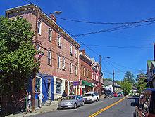 Downtown New Paltz
The woods give way to fields, and the highway levels out into the flood plain of the Wallkill River. The crossing is the western limit of the village of New Paltz itself. Huguenot Street, the oldest continuously-inhabited neighborhood in Anglo-America and a National Historic Landmark, leaves to the north almost immediately after the bridge. A gentle climb and a few blocks later, the first traffic light heralds both the northern end of NY 208 and the beginning of the half-mile through downtown New Paltz shared with NY 32.
This stretch is often heavily trafficked and difficult to park in due to the proximity of the State University of New York at New Paltz. A college-town atmosphere is evident in the bars and bohemian clothing boutiques lining the street.
Near the eastern boundary of the village, at New Paltz Middle School, 32 turns southward while 299 continues steadily east. It widens slightly with turning lanes at junctions as the quirky village ambiance gives way toward a more standard commercial strip populated with fast food chains, supermarkets and gas stations. Eventually, the Thruway junction is reached and development ceases.
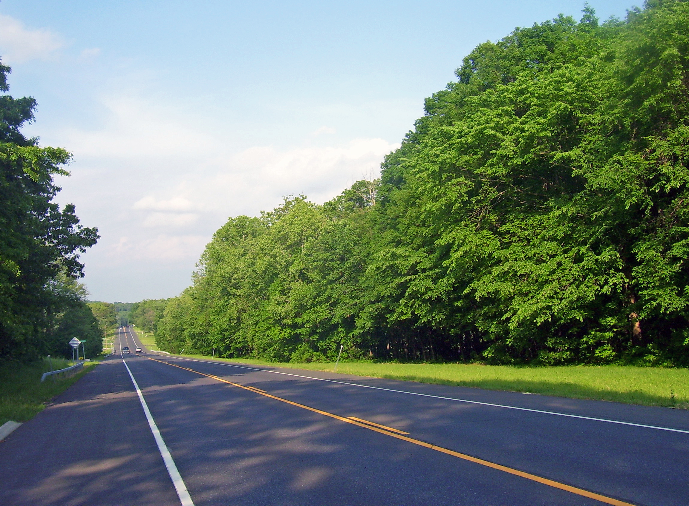
 Route 299 east of New Paltz
The eastern half of the road is a two lane road with intermittent turning lanes at some junctions, there are traffic signals at the junctions of Ohioville Road (Ulster County 22A), South Street (Ulster County 22) and Old New Paltz Road (Ulster County Highway 12 and the original route of NY 299). There are also unsignalized junctions with Riverside Road (Ulster County 15). It runs straight through partly undeveloped land until it ends at US 9W north of Highland in Lloyd. The Mid-Hudson Bridge is approximately 2.5 miles (4.0 km) south of this junction.
History
NY 299 was assigned as part of the 1930 renumbering of state highways in New York to the portion of its modern alignment east of New Paltz.[1] It was extended westward to its current western terminus in Gardiner in the early 1950s.[3][4]
Major intersections
The entire route is in Ulster County.
Location Mile[2] Destinations Notes Gardiner 0.00 US 44 / NY 55Village of New Paltz 5.97 
 NY 32 north / NY 208
Western terminus of NY 32 / NY 299 overlap; northern terminus of NY 208 6.48 NY 32 southEastern terminus of NY 32 / NY 299 overlap Town of New Paltz 7.23 I-87 / ThruwayExit 18 (I-87/Thruway) Highland 12.39 US 9W1.000 mi = 1.609 km; 1.000 km = 0.621 mi References
- ^ a b Standard Oil Company of New York (1930). Road Map of New York (Map). Cartography by General Drafting.
- ^ a b "2008 Traffic Volume Report for New York State" (PDF). New York State Department of Transportation. June 16, 2009. p. 209. https://www.nysdot.gov/divisions/engineering/technical-services/hds-respository/NYSDOT%20TVR%202008%20by%20Route.pdf. Retrieved February 1, 2010.
- ^ Sunoco (1952). New York (Map). Cartography by Rand McNally and Company.
- ^ Esso (1954). New York with Special Maps of Putnam–Rockland–Westchester Counties and Finger Lakes Region (Map). Cartography by General Drafting (1955–56 ed.).
External links
Categories:- State highways in New York
- Shawangunks
- Transportation in Ulster County, New York


Wikimedia Foundation. 2010.