- County of Stanley, Queensland
-
Stanley
Queensland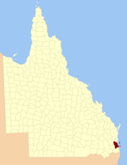
Location within QueenslandLands administrative divisions around Stanley Cavendish Canning Pacific Ocean Churchill Stanley Pacific Ocean Churchill Ward Pacific Ocean  Map of Stanley county in 1886
The County of Stanley is a county in Queensland, Australia. Like all counties in Queensland[citation needed], it is a non-functional administrative unit, that is used mainly for the purpose of registering land titles. It was named after Edward Stanley, who was three times British Prime Minister in the 1850s and 1860s.[1] It is bounded by the Logan River in the south, the Brisbane River at what is now Lake Wivenhoe in the west, the Stanley River at what is now Lake Somerset in the north-west, and Caboolture River in the north. It includes Moreton Island and Stradbroke Island.
The county takes in the cities of Brisbane, Ipswich and Redcliffe, among others.
It was formerly a county in New South Wales between the establishment of Brisbane in 1826, and the formation of Queensland as a separate colony in 1860. In 1852 it had an area of 2,000,000 acres (8,000 km²) and population of 2,000, and was the most northerly county of New South Wales. Wheat, coffee, cotton and tobacco were described as being important crops. It was part of the New South Wales electoral district of Stanley between 1856 and 1859.
Parishes
Stanley is divided into parishes, listed as follows:
References
See also
Counties1 of Australian capital cities Cumberland (Sydney) · Bourke (Melbourne) · Stanley (Brisbane) · Adelaide (Adelaide) · Perth2 (Perth) · Buckingham3 (Hobart) · Murray (Canberra4) · Palmerston (Darwin)
1Lands administrative divisions; no political function. 2Former. 3Renamed Land District. 4Land area pre-1909, no longer in Murray.
Categories:- Counties of Queensland


Wikimedia Foundation. 2010.