- Croyde
-
Coordinates: 51°08′00″N 4°13′00″W / 51.133333°N 4.216667°W
Croyde 
 Croyde
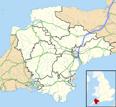
Croyde shown within DevonOS grid reference SS4492639512 Shire county Devon Region South West Country England Sovereign state United Kingdom Police Devon and Cornwall Fire Devon and Somerset Ambulance South Western EU Parliament South West England UK Parliament England List of places: UK • England • Devon Croyde is a village on the west-facing coastline of North Devon, England. The village lies on the South West Coast Path near to Baggy Point, which is owned by the National Trust. It lies within the North Devon Coast Area of Outstanding Natural Beauty. Croyde village and its beach faces the Atlantic Ocean near the western limit of the Bristol Channel.
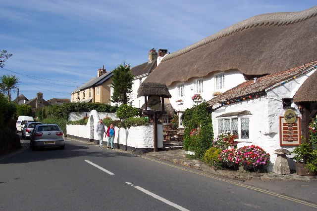
Croyde Stream runs through the village, eventually leading to the beach. The centre of the village is roughly at the intersection of Hobbes' Hill, Jones' Hill and St. Mary's Road. At this spot, Croyde Bridge carries the road over the stream.
Public services are provided by the North Devon District Council (NDDC) based in Barnstaple. The village is in the Parish of Georgeham, which is within the Diocese of Exeter.
Contents
Today
The village has several small campsites, a small retail area and a large holiday park, Ruda Holiday Park, operated by Parkdean Holidays.
The past 30 years has seen large increases in younger-age visitors develop around surfing. The impact of tourism on the village has been varied. Some local landowners have benefited from the increased property prices. Tourism has helped to create jobs that were lost in agriculture. Local farming has declined, with former farmland converted into caravan sites and fields for seasonal camping. Like many seaside villages, the phenomenon of second homes has pushed house prices beyond the reach of most local people. There is little year-round employment, because tourism is seasonal, and most businesses are closed out of season.
Since 1999 Croyde has hosted an annual surfing and music festival (Goldcoast Oceanfest) on the weekend closest to the summer solstice. Croyde also hosts the "Senior Endeavourers' Camp" during the summer months.
During the summer season there is an outdoor market each Tuesday which is held in a field off Moor Lane past Ruda Holiday Park heading towards Baggy Point.
Transport
The nearest railway station is Barnstaple, 10 miles (16.5 km) away. On Monday-to-Saturday there is an hourly bus service to Croyde from Barnstaple, with a two-hourly frequency on Sundays.
Road transport from the M5 motorway is 47 miles (75 km) via the A361 trunk road.
Education
Croyde has no education resources in the village. Children have access to Georgeham Primary School; secondary education is provided by Braunton School and Community College.
Beach
 Panorama of Croyde Beach
The sandy 875 yard (800 m) beach,which has Blue Flag status, stands in a sheltered bay. A large dune system has formed past the high-tide mark. Sand underlies the land surface between the beach and the centre of Croyde village, 600 yards to the east. The beach forms the middle section of a trio of sandy beaches north of the Taw Estuary. 3¾ miles (6 km) long Saunton Sands is ⅔ mile (1 km) to the south, 1.8 miles (3 km) long Woolacombe Sands, divided into Putsborough and Woolacombe beaches, 0.93 miles (1.5 km) to the north.
Croyde is used for surfing; the rides are generally short as the waves tend to pitch up and break quickly. There is a point break off Down End. There is a reef break at the northern (Baggy Point) end of the beach that works for about 60 minutes during some high tides. The shape of the bay funnels waves towards the beach. The beach is also steeper than either Woolacombe, Putsborough or Saunton Sands. Due to this, rip currents are extremely strong especially near the rocks at either end of the beach and at low tide, even when there is only a small swell. These currents present danger to the strongest of swimmers. Any bathing should be done within the lifeguard-patrolled area. The break is very compact at low tide, resulting in many injuries.
External links
- http://www.blueflag.org/Menu/Awarded+sites/2011/Northern+Hemisphere/England/SouthWest/CroydeBay
- Georgeham Parish Council
- Old map
- Croyde at the Open Directory Project
Towns and villages in North Devon 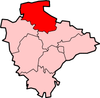 Barbrook · Barnstaple · Berrynarbor · Braunton · Charles · Colleton · Combe Martin · Creacombe · Croyde · East Anstey · East Buckland · Filleigh · Fremington · Furzehill · Georgeham · Hele Bay · Ilfracombe · Instow · Kentisbury · Knowle · Knowstone · Landkey · Lee · Lee Bay · Lynmouth · Lynton · Malmsmead · Meshaw · Mortehoe · Oldways End · Parracombe · Rackenford · Roachill · Saunton · Shallowford · Week · West Down · West Lynn · Westward Ho! · Woolacombe · Wrafton · YellandCategories:
- Villages in Devon
- Seaside resorts in England
- Surfing locations in England


Wikimedia Foundation. 2010.