- Dighton Rock
-
Dighton Rock

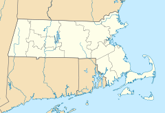

Location: Berkley, Massachusetts Nearest city: Dighton, Massachusetts Coordinates: 41°48′45.92″N 71°6′38″W / 41.8127556°N 71.11056°WCoordinates: 41°48′45.92″N 71°6′38″W / 41.8127556°N 71.11056°W Built: 1964 Governing body: State NRHP Reference#: 80000438[1] Added to NRHP: July 1, 1980 The Dighton Rock is a 40-ton boulder, originally located in the riverbed of the Taunton River at Berkley, Massachusetts (formerly part of the town of Dighton). The rock is noted for its petroglyphs, carved designs of ancient and uncertain origin, and the controversy about their creators. In 1963, during construction of a coffer dam, state officials removed the rock from the river for preservation. It was installed in a museum in a nearby park, Dighton Rock State Park. In 1980 it was listed on the National Register of Historic Places (NRHP).
The boulder was most likely deposited in the riverbed during the last Ice Age, approximately 10,000-13,000 years ago. The boulder has the form of a slanted, six-sided block, approximately 5 feet (1.5 m) high, 9.5 feet (2.9 m) wide, and 11 feet (3.4 m) long. It is gray-brown crystalline sandstone of medium to coarse texture. The surface with the inscriptions has a trapezoidal face and is inclined 70 degrees to the northwest. It was found facing the water of the bay.
In 1680, the English colonist Rev. John Danforth, made a drawing of the petroglyphs, which has been preserved in the British Museum. In 1690 Rev. Cotton Mather described the rock in his book, The Wonderful Works of God Commemorated:
“Among the other Curiosities of New-England, one is that of a mighty Rock, on a perpendicular side whereof by a River, which at High Tide covers part of it, there are very deeply Engraved, no man alive knows How or When about half a score Lines, near Ten Foot Long, and a foot and half broad, filled with strange Characters: which would suggest as odd Thoughts about them that were here before us, as there are odd Shapes in that Elaborate Monument.…”[2]
For more than three hundred years, people have proposed many hypotheses as to who made the original markings. They were deeply cut and would have required people sometimes standing in water to make them. Theories varied because of the English colonists' and later American inability to decipher the petroglyphs. Their world views influenced their interpretations. They attempted to fit North American history into what they knew based on the Bible and classical history. They did not recognize a relation between the Native Americans whom they encountered and the ancient monuments discovered in the lands.
Hypotheses about the creation of the markings include:
- Indigenous peoples of North America - considered most probable by modern scholars[citation needed]
- Ancient Phoenicians - proposed in 1783 by Ezra Stiles in his "Election Sermon."
- Norse - proposed in 1837 by Carl Christian Rafn
- Portuguese - proposed in 1912 by Edmund B. Delabarre [3][4]
- Chinese -proposed by Gavin Menzies in his 2002 book 1421: The Year China Discovered America
The controversy entered popular culture, especially in the nineteenth century. In 1848, Massachusetts writer James Russell Lowell suggested, concerning Presidential candidates letters to newspapers:
"[I]f letters must be written, profitable use might be made of the Dighton rock hieroglyphic or the cuneiform script, every fresh decipherer of which is enabled to educe a different meaning".[5]
Lowell made other references to the rock in his widely circulated satirical writing, and may thus have helped to popularize it.
In November 1952, the Miguel Corte-Real Memorial Society Memorial Society of New York City acquired 49½ acres (200,000 m²) of land adjacent to the rock to create a park. However, in 1951 the Massachusetts Legislature expropriated the same land for a State Park. More land was purchased. Dighton Rock State Park now has an area of 100 acres (400,000 m²). The vicinity of Dighton Rock has been beautified and furnished with parking and picnic facilities.
 Seth Eastman on Dighton Rock (c. 1853)
Notes
- ^ "National Register Information System". National Register of Historic Places. National Park Service. 2007-01-23. http://nrhp.focus.nps.gov/natreg/docs/All_Data.html.
- ^ Edward Brecher (June 1958). "The Enigma Of Dighton Rock". American Heritage. http://www.americanheritage.com/content/enigma-dighton-rock. Retrieved August 2, 2011.
- ^ http://www.brown.edu/Administration/News_Bureau/Databases/Encyclopedia/search.php?serial=D0090
- ^ DelaBarre 1928
- ^ Lowell, James R. The Biglow Papers (VIII) London, Trubner (1861), via Project Gutenberg- accessed 2007-12-08
External links
 Media related to Dighton Rock at Wikimedia Commons
- Dighton Rock State Park, Massachusetts Department of Conservation and Recreation
- Edward Brecher, "The Enigma of Dighton Rock", American Heritage, June 1958, Volume 9, Issue 4
U.S. National Register of Historic Places Topics Lists by states Alabama • Alaska • Arizona • Arkansas • California • Colorado • Connecticut • Delaware • Florida • Georgia • Hawaii • Idaho • Illinois • Indiana • Iowa • Kansas • Kentucky • Louisiana • Maine • Maryland • Massachusetts • Michigan • Minnesota • Mississippi • Missouri • Montana • Nebraska • Nevada • New Hampshire • New Jersey • New Mexico • New York • North Carolina • North Dakota • Ohio • Oklahoma • Oregon • Pennsylvania • Rhode Island • South Carolina • South Dakota • Tennessee • Texas • Utah • Vermont • Virginia • Washington • West Virginia • Wisconsin • WyomingLists by territories Lists by associated states Other  Category:National Register of Historic Places •
  Portal:National Register of Historic PlacesCategories:
- Landforms of Bristol County, Massachusetts
- Pre-Columbian trans-oceanic contact
- National Register of Historic Places in Massachusetts
- Petroglyphs in the United States
- Rock formations in Massachusetts


Wikimedia Foundation. 2010.