- Napa County Airport
-
Napa County Airport 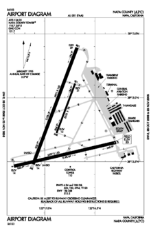
IATA: APC – ICAO: KAPC – FAA LID: APC Summary Airport type Public Public Works Operator Napa County Location Napa County, near Napa, California Elevation AMSL 35 ft / 11 m Coordinates 38°12′47.50″N 122°16′50.50″W / 38.213194°N 122.280694°WCoordinates: 38°12′47.50″N 122°16′50.50″W / 38.213194°N 122.280694°W Runways Direction Length Surface ft m 6/24 5,007 1,526 Concrete 18R/36L 5,931 1,808 Concrete 18L/36R 2,510 765 Asphalt Napa County Airport (IATA: APC, ICAO: KAPC, FAA LID: APC), also known as Napa Valley Airport, is a public airport located five miles (8 km) south of Napa, in Napa County, California, USA.[1] It has three runways.
During 2008, the airport's 1960-era control tower received extensive radio, plumbing and electrical upgrades and renovations funded by the federal government. At the time of these renovations, airport officials claimed that the airport had about 122,000 flights take off or land at the facility annually.[2]
Contents
History
The airport was built by the United States Army Air Force about 1942, and was known as Napa Flight Strip. It was an emergency landing airfield for military aircraft on training flights. It was expanded later in the war and was re designated as Napa Army Airfield, becoming an auxiliary airfield of the Fourth Air Force Hamilton Army Airfield.[3] 4th Air Force used the base as a training base for replacement fighter pilots, primarily flying P-38 Lightnings before being deployed to combat units in overseas areas.
Following World War II, the airfield property was deeded to Napa County by the War Assets Administration for civilian use. The airport soon became a business hub for what was once a rural, sparsely populated portion in the southern end of the county. Jonesy's Restaurant opened for business in 1946 at the airport and was a longtime favorite of locals and visitors.[4] The restaurant remained in business for 63 years before closing in 2010. [5]By 1947 half a dozen small businesses had opened at the facility but only Bridgeford Flying Service remained open past the first year and still remains in business today. In 1971 International Air Services Company and Japan Airlines opened a flight training school at the airport. [6] In June 2010 Japan Airlines announced that it would be closing its training facility as part of a bankruptcy reorganization plan. [7]
See also
References
 This article incorporates public domain material from websites or documents of the Air Force Historical Research Agency.
- Shaw, Frederick J. (2004), Locating Air Force Base Sites History’s Legacy, Air Force History and Museums Program, United States Air Force, Washington DC, 2004.
- ^ "Napa County Airport". Geographic Names Information System, U.S. Geological Survey. http://geonames.usgs.gov/pls/gnispublic/f?p=gnispq:3:::NO::P3_FID:1653757. Retrieved 2009-05-04.
- ^ KERANA TODOROV In the air above Napa The Napa Valley Register. 2008-08-22.
- ^ Ford, Jim. Gearing up for war. The Napa Valley Register. 2007-10-22.
- ^ Treleven, Mike. Business benchmarks: Jonesy’s Famous Steak House. The Napa Valley Register. 2007-05-12.
- ^ Treleven, Mike Jonesy's Restaurant closes for business. The Napa Valley Register. 2010-08-17.
- ^ Stanley, Pat Napa airport is big business. The Napa Valley Register 2003-06-07.
- ^ HUFFMAN, JENNIFER Japan Airlines to leave Napa The Napa Valley Register 2003-06-07.
External links
- Napa Valley Airport (official site)
- FAA Airport Diagram (PDF), effective 20 October 2011
- Resources for this airport:
- AirNav airport information for KAPC
- ASN accident history for APC
- FlightAware airport information and live flight tracker
- NOAA/NWS latest weather observations
- SkyVector aeronautical chart, Terminal Procedures for KAPC
Airports in the San Francisco Bay Area International Federal General aviation (tower) Concord/Buchanan (KCCR) · Hayward (KHWD) · Livermore (KLVK) · Napa (KAPC) · Palo Alto (KPAO) · San Jose/Reid-Hillview (KRHV) · San Carlos (KSQL) · Santa Rosa/Sonoma County (KSTS)General aviation (non-tower) Angwin-Parrett (2O3) · Byron (C83) · Cloverdale (O60) · Marin County/Gnoss (KDVO) · Half Moon Bay (KHAF) · Healdsburg (O31) · Hollister (KCVH) · Vacaville/Nut Tree (KVCB) · Petaluma (O69) · Rio Vista (O88) · Sonoma Skypark (0Q9) · Sonoma Valley (0Q3) · San Martin/South County (E16) · Watsonville (KWVI)Historical Categories:- Airports in the San Francisco Bay Area
- Airports in Napa County, California
- Flight Strips of the United States Army Air Forces
- Airfields of the United States Army Air Forces in California

Wikimedia Foundation. 2010.