- Old Town Pasadena
-
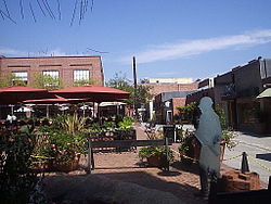
Old Pasadena Historic District
 One Colorado Market Place, one of the largest development project in Old Pasadena.
Location: Roughly bounded by Interstate 210, Fair Oaks, Raymond Aves., Arroyo Pkwy., Del Mar Blvd., and S.R. 134. NRHP Reference#: 83001200 Added to NRHP: September 15, 1983 Old Pasadena is the original commercial center of Pasadena, a city in California, United States that arose from one of the most prosperous areas of the state, and had a latter day revitalization after a period of decay. Old Pasadena is often referred to as Old Town Pasadena or just Old Town.
Old Pasadena began as the center of an enlighted "Athens of the West" that gave rise to Caltech, JPL, as well as Beckman Instruments, Aerojet and numerous other industrial giants. The area also housed, schooled and provided stomping grounds for numerous famous and infamous free thinkers, poets, artists and rapscallions such as General George Patton, Alexander Calder, Upton Sinclair, L. Ron Hubbard, Jack Parsons, Albert Einstein, Bobby Fischer and David Lee Roth. It was also the home to Andy Warhol's west coast debut, the Pasadena Museum of Modern Art (one of the earliest and best modern art museums in the country, now the Norton Simon Museum), and before that a center of suffragist and pacifist movements, and other liberal causes. By the late 1940s, the area was blighted by flop houses, seedy bars and pawn shops. It later became a hippie mecca with head shops, adult bookstores and massage parlors. By the late 1980s, urban renewal was in full swing with the trendy set.
Old Pasadena is now a designated historic district of the Pasadena Charter defined by its boundaries 1) to the North, Holly Street from Fair Oaks Avenue to Arroyo Parkway; 2) on the East, Arroyo Parkway south to Green Street, jogging one half block west to the old Santa Fe RR right-of-way and continuing 3) South to encompass the Old Train Station and Central Park, then north on Fair Oaks to De Lacey Street, then west to Pasadena Blvd.; 4) on the West by Pasadena Blvd. north to Union Street, back to Fair Oaks Boulevard. and north to Holly Street.
The Historic Old Pasadena District was chartered in 1980 as a means of revitalizing the oldest part of Pasadena which had fallen derelict though not abandoned, but was for all intents and purposes economically and commercially dead. By this charter, a strictly controlled redevelopment was able to be established with federal tax incentives to qualifying investors. Under strict guidelines, buildings were able to be stripped of old paint, revealing some of the finer—as well as some of the roughest—of early brickwork fasciae. All renovations or remodeling came under the scrutiny of a city commission which approved materials, colors and styles, most of which were to reflect the period of 1925 to 1940, the time after which these buildings had lost their appeal.
The Old Pasadena Historic District was listed in the National Register of Historic Places in 1983.
Contents
History of Old Pasadena
Fair Oaks and Colorado Boulevard
Old Pasadena has at its center the postal zero/zero intersection of all Pasadena, Fair Oaks Avenue (N-S) and Colorado Boulevard (E-W). It was here that the first of the businesses of the original Indiana Colony were established. Barney Williams had opened his general store on the Northwest corner. It served as the main supplier for the town as well as the post office when mail came up from Los Angeles.
On the Southwest corner was the Grand Hotel. This was replaced by the Dodsworth Building in 1902 and that building now houses the popular Cheesecake Factory.
Schoolhouse Block
In its infancy, the Indiana Colony was a quiet farming community centered around Orange Grove Avenue, about a half mile west of Fair Oaks. Fair Oaks just south of Colorado Blvd. was a fine place to build a school, a gift from Benjamin "Don Benito" Wilson. Simply called the Fair Oaks schoolhouse, it soon became exposed to the bustling activity of the developing center of town. Fearing for the safety of children, the council of city fathers sought to move the schoolhouse, but its benefactor, Mr. Wilson had died and his estate was willed to family members still living in the area. The council sought permission from the family with a proviso that they would move the building immediately now for the benefit of the children, and build a finer new school somewhere outside the Old Pasadena area soon thereafter.
Modern attempts to ascertain the location to which the school was moved was all but lost. But the block of Fair Oaks, Colorado Boulevard, Raymond Avenue, and Green Street were somehow always referred to as the "schoolhouse block." The location was discerned by interpolating the texts from several historical accounts. Hiram Reid in his History of Pasadena, 1895, states that the schoolhouse was "moved several feet east to a frontage on Raymond 500 feet north of a line parallel to the north wall of the Post Office building." Another book shows that in 1895 the Post Office was in the Morgan Block just north of Kansas Street (Green Street). Then Reid's book says "A beautiful new edifice stands there now." He was speaking of the Van der Vort building built in 1894. That's where the schoolhouse ended up. Eventually that building was sold to someone who moved it away for a residence, and a new Wilson School was built somewhere miles outside of Old Pasadena later.
Castle Green
 the Castle Green
In 1887 one Mr. E. C. Webster began construction of a hotel on the southeast corner of Raymond Avenue and Kansas Street (1929 Green St.) When he was unable to complete the job, a newcomer to the area, Colonel G. G. Green, took over the construction and finished the Green Hotel, which opened in 1888.
Green was a friend of Mr. Andrew McNally, a prominent printer from Chicago who had moved West and made his home in Altadena. McNally had invited Green to come out and join him in this new community. Together Green and McNally invested heavily in the short-lived Altadena Railroad, which provided them private sidings at their residences and which Green rode daily to the construction site of his new hotel. Green and Andrew McNally were next door neighbors on Mariposa Street just west of Lake Ave. The McNally home still stands and the old Green Carriage house remains and can be seen from the rear parking lot of the Altadena Library. The old Green carriage house is currently occupied as a residence.
The new Green Hotel was a mammoth 6-story edifice that faced Central Park on South Raymond, just north of the original Victorian Pasadena Train Station, where trains stopped on their way between Chicago and Los Angeles. That station was replaced by the current station, in the Southwestern style.
In 1898, Green built an even more impressive Mediterranean style hotel on the opposite side of Raymond. The first became referred to as the annex, and the second became the winter home for some of the most prominent magnates of industry in the Eastern United States. The two buildings were connected by a bridge across Raymond, and a tunnel under it. Guests arriving by train would pass through the annex, to the second floor, and be trammed across the bridge. In the main residence they would simply retire to their suites. The luggage would follow via the tunnel.
Many of the servants and attendants of the guests were forced to find quartering in the adjacent buildings. In 1902 the Green had a wing built along Kansas (now Green Street) to the P. G. Wooster Block, home of Throop University, (forerunner to Caltech). This was all run as the Hotel Green.
In 1924 the Hotel converted to all residential apartments. The original building (annex) was razed to its first floor. All that is left of that original hotel is a portico on the corner of Raymond and Green. The building is now owned by Stats Floral Supply. In 1970 the government's HUD project acquired the 1902 wing and separated the buildings into the Green Hotel on Green and the Castle Green on Raymond.
Other prominent buildings
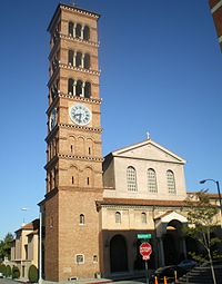 St. Andrew's Catholic Church on Raymond Avenue and Chestnut Street
In 1887, a Chicago land speculator by the name of Morgan built a three story block next to the site of the County Jail. In 1895, John Woodbury built a modest office building for himself which he shared with Jared S. Torrance. This building was replaced by the Marsh Block in 1902 which took up the whole corner lot of Raymond and Kansas south of the Morgan. In 1894 Van der Vort constructed the building that still bears his name at 32 S. Raymond. In 1889, Robert MacComber built the MacComber block on the northwest corner of Raymond and Kansas. In 1906 Braley built his bike manufacturing building which eventually became his Oldsmobile dealership.
Doty Block/Mikado Hotel/The Hotel Carver: In 1887 a three story Victorian red brick building with bay windows and a turret on the southeast corner was constructed at 107 South Fair Oaks on the northwest corner at Dayton Street. It was named the "Doty Block" and housed a stage coach or carriage showroom. In later years it became The Mikado Hotel serving the Japanese American Community.[1] It became a freight depot for the Pasadena and Los Angeles Railroad, which later became part of the Pacific Electric Railway. Above the second floor windows on the south wall can be seen the faint lettering "Pasadena and Los Angeles" that advertised that service. In the 1940s it became Pasadena's first Black-owned hotel, The Hotel Carver when it was purchased and operated by Percy Clark and his sons Percy Jr., Robert, and Littleton. In the basement was a prominent jazz club known at one point as The Onyx Club and later as The Cobra Club. In 1970 the hotel was sold and the building was converted to artist and performance studios. Over the next fifteen years hundreds of artists, musicians, writers, dancers, and filmmakers rented space at The Hotel Carver. The building was most well known during this period for The John Bull English Pub operated by Danny and Denise Sharp, and for the quirky word mural by Paul Waszink on the north wall that said "My people are the people of the dessert," said T.E. Lawrence, picking up his fork. Several art shows were held in the third floor ballroom[2] and other parts of the building. In 1985 the artists were evicted and the building closed.[3] The 1987 Whittier Narrows earthquake caused the collapse of building immediately to the north of The Carver and caused a large section of bricks on the top of the North wall to fall to the ground taking out part of Waszink's T.E. Lawrence mural. Following the earthquake, the north wall was re-bricked and the building remodeled and earthquake retrofitted, as part of the general re-development of Old Town.
Robertson Motors built an auto factory just south of the Green Hotel Annex. That now stands as Fishbeck Furnishings.
In 1911 City Hall occupied a building at Union and Fair Oaks. Since then City Hall moved several times, and the building was lost, only to be replaced in 2003 by a quasi replica now known as the Container Store. The California National Guard used several buildings about Old Pasadena before they built The Armory on Raymond above Holly. The old brick building on Holly across from the senior center was a National Guard motor depot.
In 1929 Colorado Street (now Colorado Boulevard) was widened on the north side and many of the elaborate Victorian faces of the buildings were lost to reconstruction and replaced with more contemporary and less costly frontages. An additional 14 feet in width was added to Colorado Street as a result. In 1929 Kansas Street was widened and renamed Green Street. Union and Holly Streets were part of a city gateway that were to lead toward City Hall (1933) from the statue and flag at Orange Grove and Colorado Blvd. The whole plan was scaled down, but the streets were put in.
Old Pasadena today
Pasadena’s downtown declined between 1930 and 1980, but it has since been revived as “Old Pasadena,” one of Southern California’s most popular shopping and entertainment destinations. Dedicating parking meter revenue to finance public improvements in the area since 1993 has played a major part in this revival.
Old Pasadena today is mostly a business district with some mixed use. It now boasts a shopping mall, upscale restaurants, a movie theater, nightclubs, shops, posh outdoor cafés, pubs, and comedy clubs. Hence, the nightlife is very active in the area and it remains a popular tourist attraction for locals and out-of-towners alike. Most of the buildings also have offices and apartments on the upper floors.
Old Pasadena is connected to Downtown Los Angeles via the Metro Gold Line light rail. The Del Mar Station is two blocks south of Colorado Blvd, while the Memorial Park Station enters from Holly and Arroyo Parkway. The Norton Simon Museum is located at Orange Grove and Colorado Blvd. Pacific Oaks College Eureka campus is located at Fair Oaks Ave. and Eureka St., the very north end of old Town Pasadena. On New Years Day the Tournament of Roses Parade travels through Old Pasadena on Colorado Boulevard. The spectacle draws on average 1.5 million spectators each year, thousands of whom camp out on the route in a 24-hour vigil to have the best view of the parade.
ArtPerformance offers free concerts on multiple stages throughout Old Pasadena. This annual outdoor music event showcases emerging and nationally recognized talent in conjunction with PasadenART Weekend, a three day citywide event.[4]
Two street intersections in Old Pasadena, Colorado/DeLacey and Colorado/Raymond, use the Pedestrian scramble system, like those in Tokyo, on the strip in Las Vegas, or on Rodeo Drive in Beverly Hills.
References
- ^ http://www.californiajapantowns.org/pasadena.html
- ^ ^ Keller, L. , Four man show at Carver Hotel, Pasadena Star News, July 13, 1979
- ^ Burry, Jennifer “Opening new windows onto Old Pasadena: Artists reclaim trendy enclave. Pasadena Star-News, 111 (229), p. A1, Friday August 16, 1996
- ^ http://www.pasadenaart.org
External links
Sources
- Hiram Reid, History of Pasadena, out of print, rare book, 1895.
- Pasadena City Hall, Hall of Records and Office of Cultural History
- Pasadena Museum of History
U.S. National Register of Historic Places Topics Lists by states Alabama • Alaska • Arizona • Arkansas • California • Colorado • Connecticut • Delaware • Florida • Georgia • Hawaii • Idaho • Illinois • Indiana • Iowa • Kansas • Kentucky • Louisiana • Maine • Maryland • Massachusetts • Michigan • Minnesota • Mississippi • Missouri • Montana • Nebraska • Nevada • New Hampshire • New Jersey • New Mexico • New York • North Carolina • North Dakota • Ohio • Oklahoma • Oregon • Pennsylvania • Rhode Island • South Carolina • South Dakota • Tennessee • Texas • Utah • Vermont • Virginia • Washington • West Virginia • Wisconsin • WyomingLists by territories Lists by associated states Other  Category:National Register of Historic Places •
  Portal:National Register of Historic Places
History 
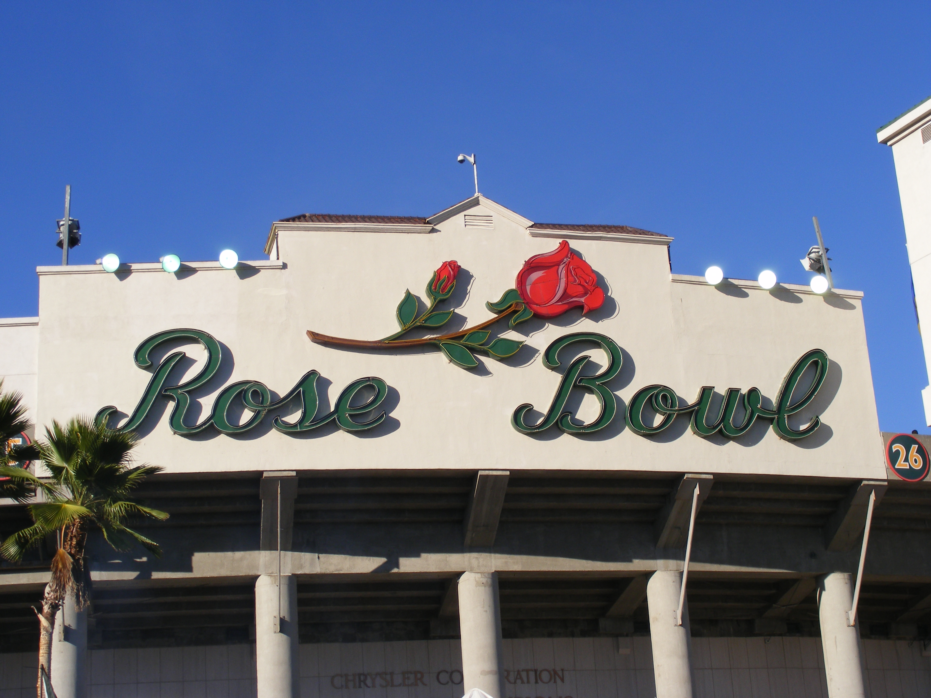
Government Mayor · City Council · Pasadena ARTS · Pasadena Unified School District · Pasadena Police DepartmentCulture Brookside Golf Course · Convention Center · Kidspace Children's Museum · Norton Simon Museum · Pacific Asia Museum · Rose Bowl · Rose Bowl Aquatics CenterNeighborhoods DowntownCivic Center · Old PasadenaNorthwestBanbury Oaks · Brookside Park/Arroyo Terrace · Garfield Heights · La Pintoresca · Lincoln-Villa · Linda Vista · Muir Heights · The Oaks · Orange Heights · Prospect Park · Villa ParkeNorth LakeNortheastFar EastSouthwestSoutheastCategories:- Historic districts in California
- Populated places in Los Angeles County, California
- National Register of Historic Places in Pasadena, California
- Neighborhoods in Pasadena, California
- Pasadena, California
- San Gabriel Valley


Wikimedia Foundation. 2010.