- Oudomxay Province
-
Oudomxay Province Location of Oudomxay Province in Laos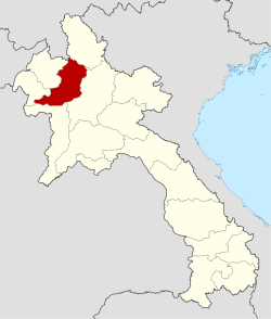
Country Laos Established Capital Muang Xay Area – Total 15,370 km2 (5,934.4 sq mi) Population (2004) – Total 275,300 – Density 17.9/km2 (46.4/sq mi) Time zone UTC+07 ISO 3166 code LA-XI Oudomxay or Oudômxai (Lao: ອຸດົມໄຊ) is a province of Laos, located in the northwest of the country. The province capital is Muang Xai.
Contents
History
The province was created in 1976, when it was split off from Luang Prabang. Around 1987 the capital of the province was moved from Ban Nahin to Muang Xay.
In 1992, the districts Paktha and Pha Oudom were reassigned to Bokeo province.[1]
According to local history books,[2] the first people who settled in Oudomxay around the year 700 were "Khom" (also known as Khmu). About 1260, Lao Ly came from the region Sipsongpanna ("12 thousand rice fields") in Southern China and build a village called Ban Luang Cheng ("big village" or "big district") in the area of today's province capital Muang Xay. The former Lao Ly village is now part of Muang Xaya and is called Bang Cheng.
Ly culture, which was marked by Buddhism on the one hand and the old Khom traditions on the other hand, grew and became very influential on the region. Khom and Leu lived together and shared the same rice fields. To provide protection they erected fortifications between the villages of Na Sao and Na Lai.
Around 1828, Hmong tribes coming from China began to settle in Oudomxay.
Geography
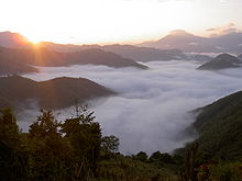 A sea of clouds in Pak Beng, Oudomxay Province
Oudomxay borders with the following provinces: Phongsali, Luang Prabang, Sainyabuli, Bokeo and Louang Namtha. In the northwest there is a 15 kilometer border with the autonomous area of Xishuangbanna of the People's Republic of China.
Oudomxay expands over 15,370 square kilometers and therefore is the ninth biggest province in Laos.
Topography
The topography of Oudomxay is very mountainous. Altitudes vary between 300 and 1,800 meters above sea level.
Watercourses
Approximately 60 rivers flow through Oudomxay Province, as for example Nam Phak, Nam Sae, Nam Beng, Nam Kor and Nam Nga.
The Nam Kor flows through the province capital Muang Xay.
Demography
Ethnic Minorities
The exact proportions of the approximately 14 different ethnic groups living in Oudomxay are still not precisely known. According to the province administration, the following estimations can be assumed:
- Khmu (among them Khmu Lu, Khmu Khong, Khmu Am, Khmu Bit) 60–80 %
- Lao Loum 25 %
- Hmong (among them Hmong Khao, Hmong Dam und Hmong lai) 15 %
In minor percentages, these ethnic groups also live in the province:[3]
- Akha
- Phouthai (Thai Dam & Thai Khao)
- Phou Noy (Phou Xang, Phou Kongsat, Phou Nhot)
- Lao Houy (also „Lenten“)
- Phouan
- Ly
- Yang
- Ikho
- Ho
Climate
Oudomxay Province has got a moderate monsoon climate. Due to high altitudes there are more variations in temperature during the year and a colder dry season in northern Laos as in the rest of the country.[4]
- April to September: Rainy season
- October to January: Cold dry season
- February to March: Warm dry season
The yearly amount of rain is about 1,900mm–2,600mm. Temperatures in February and March average between 18 and 19 °C, from April to May temperatures climb over 31 °C.[5]
Infrastructure
 Street scene in Oudomxay
Due to the particular topographic conditions in Oudomxay, improvements of infrastructure are very difficult and costly. Therefore for example the expansion of the road networks are only very slowly pressed ahead. Many villages do not have any access to roads - a condition, which impedes an access to important social facilities as schools or hospitals. The population of these villages is furthermore cut off the regional markets, where otherwise they could sell their agricultural products. It is also very difficult or even impossible for administrative institutions to reach the people living in remote areas.
The extremely limited accessibility of the mountain villages additionally impedes economic development of rural regions.[6]
In many areas, electricity supply of households is under 10 %. Only in the few bigger towns like Muang Xay a sufficient supply of electricity is guaranteed.
Agriculture and Forestry
Approximately 40,000 hectares of land are cultivated in Oudomxay, with rice being the main crop.
Subsistence Agriculture
In Oudomxay province, most of the population still practices subsistence agriculture. Predominantly "slash-and-burn"-agriculture is used, often linked with growing mountain rice – 45 % of rural villages in Oudomxay depend on swidden agriculture, due to the province's mountainous topography. This form of agriculture is very labour-intensive and takes up huge areas of land, as soils need a long time until their original productivity is recovered.
Cropping rice using the wet-field paddy system is just gay possible in plain lowlands, which, in Oudomxay, are scarce.[5]
Both mountain rice grown at the mountain sides, as well as most of the few cultivable areas in the lowlands are merely irrigated by natural rainfalls. Very few rice fields in the lowlands have artificial irrigation systems.
Besides rice, other important crops are corn, soybeans, fruits, vegetables, cassava (maniok), sugarcane, tobacco, cotton wool, tea and peanuts.
In cooperation with international organisations, the government is working to increase production intensity proposing a sustainable usage of natural resources.[7]
Besides the use of land for agricultural purposes, approximately 40,000 hectares of land are aforested or used as meadows.[3] Lifestock breeding, above all of water buffalos, pigs, cattle and chickens, is an important component for the livelihood of rural population. According to estimations of the IUCN, approximately 12% of Oudomxay forests are primary forests, 48 % secondary forests.[3] For the population, the forests are not only source of wood, but also contribute to family incomes providing fruits, herbs and meat.
Cash Crops
The region, which was merely dominated by shifting cultivation and subsistence agriculture for a long time, now opens more and more for using the uplands for multifunctional and commercial purposes.[4]
Besides traditional subsistence agriculture, "Cash Crops" got more important in the past years, corn and sugarcane being the most important export products: In 2004, approximately 10,000 tons of sugarcane and 45,000 tons of corn were produced. Besides, also onions, watermelons and tobacco are exported. Amounts of production vary strongly from year to year, as world market prices change and give different impulsions for the farmers choosing between different crops.
This is especially to consider when talking about sugarcane and corn - agricultural products, which are mainly exported to China, where they are processed to industrial sugar or alcohol. Further processing in the region, Oudomxay, is not practiced - a lost opportunity to open up new possibilities to create added value.
Often individual farmers agree to contracts with Chinese investors who offer better emblements as usual, but who also determine the product to be cultivated, as well as its price. Thereby, a certain dependence is created, which is common practice on the world market. It is also common that Lao cultivable land is rented to Chinese, which then is tilled by Chinese migratory labourers.[8]
Tourism
Since some years, efforts are taken to support tourism in Oudomxay, which is considered a chance to minimize poverty of the population. Since 1997 there is a tourism office in Muang Xay, which is supported by German Development Service (DED) since 2005. The support of DED aims to raise the incomes especially of the rural population and small-scale enterprises by tourism and thereby protect natural resources. .[9] In August 2007 the tourism office was upgraded to a “Provincial Tourism Department”.
Development
Due to Oudomxay’s location as the most important traffic junction in northern Laos (the only road from Luang Prabang up north crosses Oudomxay), in the past few years the province was mainly visited by foreigners on the journey through.
The average length of stay was low. Oudomxay had the image of being a touristically undeveloped cross-point, which, in 2004 was also reflected in the articles about the town in popular tourist guide books.
Since some years, this image is changing. Oudomxay is nowadays more seen as a province in which discovering the “original” Laos is possible, especially in terms of ecotourism. Since some years the tourism office offers guided trekking tours,[10] a Lao cookery course and a workshop in traditional paper making.[11] In Oudomxay there are now two travel agencies, one of them offering guided bicycle tours through Laos.
According to the „Statistical Report on Tourism in Laos 2008“ by the „Lao National Tourism Administration“, the number of tourists has increased from approximately 18.600 to 102.000 from 2001 to 2008. According to the statistic, approximately 17% of all 1,7 Mio. tourists visiting Laos in 2008 came to Oudomxay as well. Oudomxay disposes of eight hotels and approximately 52 guesthouses.,[12] most of them located in the province capital Muang Xay and the riverine traffic junction Pak Beng.
Potential
 Inside of Chom Ong Cave
Overall, about 1286 beds were available in Oudomxay in 2006.
In 2008, occupancy rates of these available beds have been approximately at 60% (comparison with Luang Prabang: 73%).[12]
Bad infrastructural conditions though often impede an optimal exhaustion of touristic potential in Oudomxay province. This gets especially clear considering the example of the recently new discovered “Chom Ong Cave”:
“Chom Ong Cave”, located about 45 km from Oudomxay, is the biggest known cave in northern Laos. It has got a length of more than 16 km, ceiling heights up to 50m, a stream course flowing in the cave[13] and is entitled “exceptional” [14] and “the most significant find and the biggest highlight” [13] in northern Laos by several speleological magazines.
Though, road conditions on the way to the village Ban Chom Ong Thai (from where it is possible to get to the cave marching about an hour) are very bad, especially in the rainy season. Due to difficult access to the cave, two days must be planned to get to the village and get back, starting from Muang Xay – an inhibition which causes that until now the cave has not ever been visited by anyone but scientists.
Summarizing, touristic commercialization of the cave is very difficult due to lacks of infrastructure – a situation which can be seen as a case study for the difficulties in developing touristic structures in Oudomxay.
Concerning other offers, as for example trekking tours to villages of ethnic minorities (e.g. Khmu), these infrastructural limitations do not have an impact, so that these offers are a bit more often purchased.
Biota
Vegetation in Oudomxay is rich by virtue of the monsoon climate. Several kinds of bamboo and a broad range of bloomy plants (for example orchids) are to find in the region. Also hardwoods like teak and mahogany trees grow in Oudomxay and are important sources of income for the population.[15]
Mineral Resources
Oudomxay disposes of salt, bronze, zinc, antimony, brown coal, kaolin and iron deposits.[3]
Administrative divisions
The province is made up of the following districts:
Code District Lao 04-01 Xai (Xay) ເມືອງໄຊ 04-02 La ເມືອງຫຼາ 04-03 Namo (Namor) ນາໝໍ້ 04-04 Nga ເມືອງງາ 04-05 Beng ແບ່ງ 04-06 Houn (Hoon) ຮຸນ 04-07 Pakbeng ປາກແບ່ງ References
- ^ Christensen, Karen; Levinson, David. Encyclopedia of modern Asia. 1. p. 304. ISBN 0684312425. http://www.bookrags.com/research/bokeo-ema-01/.
- ^ Khana Sinam Gaan Khon Khua Hiabhiang (Provincial Government Leader Group of Research and Data Collection): "Phavatsaat Muunsya Khweeng Oudomxay" (History of Oudomxay Province), 2004, p. 19-28
- ^ a b c d Oudomxay Provincial Tourism Department: Brochure Welcome to Oudomxay Lao PDR In: Reference Library Provincial Tourism Department Oudomxay, Province Administration Oudomxay
- ^ a b Leek 2007: Rural Livelihood Strategies and Natural Recources in Oudomxay, Lao PDR p.1
- ^ a b W. Roder Slash and Burn Rice Systems in the Hills of Northern Lao P.D.R.: Description, Challenges, and Opportunities. 2001
- ^ [www.laoatlas.net/index.html Lao Atlas 2009]. Last opened 10th of Dezember 2009.
- ^ Agriculture in Oudomxay Province. Website of the Provincial Tourism Department Oudomxay. Last opened 19th of November 2009.
- ^ S. Thongmanivong und Y. Fujita 2006: Recent Land Use and Livelihood Transitions in Northern Laos; in "Mountain Research and Development", p. 242-244
- ^ Deutscher Entwicklungsdienst: Jahresbericht Oudomxay 2009
- ^ Trekking Tours Website des Provincial Tourism Department Oudomxay. Retrieved 15 January 2010.
- ^ Activities in Town. Website des Provincial Tourism Department Oudomxay. Retrieved 15 January 2010.
- ^ a b Lao National Tourism Administration; Planning an Cooperation Department; Statistics Unit: "2008 Statistical Report on Tourism in Laos"
- ^ a b British Cave Research Association: Speleology, 13. Mai 2009, S.34
- ^ Michael Laumanns/Francois Brouiquisse La nouvelle plus longe grotte du Nord Laos In: Spelunca Nr. 113, 2009, S. 9.
- ^ Lonely Planet 2008: Laos p. 73
External links

 Yunnan, China
Phongsaly Province Louang Namtha Province 
Luang Prabang Province  Oudomxay Province

Bokeo Province Sainyabuli Province Provinces of Laos Attapeu • Bokeo • Bolikhamxai • Champasak • Houaphan • Khammouan • Loung Namtha • Louangphabang • Oudomxai • Phongsali • Sainyabuli • Salavan • Savannakhet • Sekong • Vientiane • Xiangkhoang • Prefecture: Vientiane
 Categories:


Wikimedia Foundation. 2010.