- Cosmeston Lakes Country Park
-
Cosmeston Lake 
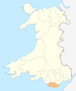
from the East Location Penarth, Vale of Glamorgan, U.K. Coordinates 51°25′N 3°10′W / 51.417°N 3.167°WCoordinates: 51°25′N 3°10′W / 51.417°N 3.167°W Lake type artificial, flooded quarry Basin countries United Kingdom Surface area 15 ha (37 acres) Max. depth 20 m (66 ft) Islands none Settlements Cosmeston Medieval Village Cosmeston Lakes Country Park is a public country park in Britain. It is situated between Lower Penarth and Sully, Vale of Glamorgan, 7.3 miles (11.7 kilometres) from Cardiff. The park is open all year and access is free, but its visitor centre is usually closed in winter.
Contents
General
At its centre the park features a large lake. It is located next to the site of Cosmeston Medieval Village. The reconstruction of this 14th-century village, discovered during the landscaping of the park, has been described as the best of its kind in Britain. Altogether there are almost 250 acres (1.0 km2) of lakes, woodland and country walks in the park.
Park History
The park is located on land that was once the enclosed fields of croft farms. The farming would have been poor because of the combination of underlying limestone with being kept permanently wet by many natural springs.
From the 1890s until 1970 the site was a commercial limestone quarry operation, serving the Snocem Concrete Factory just across the road. The deep quarry was constantly wet from the many active water sources and had to be permanently pumped dry. When the concrete factory closed and was converted into The Schooner public house and Harvester restaurant, pumping ceased and the main quarry was allowed to fill with water, quickly becoming the lake and wetlands seen today. The lake is very deep, in places as deep as fifty or sixty feet, with steep sides almost at the water's edge particularly on the Penarth and Dinas Powys sides of the lake. During quarry operations the large Scammell dumper lorries and cranes working on the quarry bottom and in the many side tunnels were dwarved by the quarry sides towering above them.
The park was subsequently developed through funding from the Countryside Commission. A circular path was constructed around the lake, in some places on raised duckboards and bridges through the shallow reed beds at the Lavernock end of the Lake. It was during the laying of the paths, thinning of dense undergrowth and general landscaping that the remains of the former village were found, excavated and developed into a visitor attraction.
The park shares its eastern boundary with the historic Glamorganshire Golf Club.
Facilities
Facilities at the park include extensive carparking, coach parking, picnic benches, plus an information centre and ice cream kiosk. The lake is populated by a wide range of water fowl, including swans, Canada geese, mallards, grebe and coot etc.
External links
Categories:- Parks in the Vale of Glamorgan
- Country parks in the United Kingdom
- Country parks in Wales
- Lakes of Wales
- Sites of Special Scientific Interest in Mid & South Glamorgan
Wikimedia Foundation. 2010.


