- Ruyton-XI-Towns
-
Coordinates: 52°47′37″N 2°53′56″W / 52.7935°N 2.899°W
Ruyton-XI-Towns 
The Cross in Ruyton-XI-Towns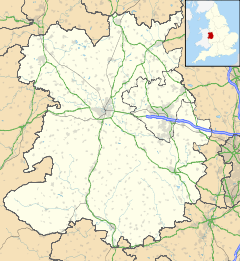
 Ruyton-XI-Towns
Ruyton-XI-Towns shown within ShropshirePopulation 1,500 OS grid reference SJ393221 Unitary authority Shropshire Ceremonial county Shropshire Region West Midlands Country England Sovereign state United Kingdom Post town SHREWSBURY Postcode district SY4 Dialling code 01939 Police West Mercia Fire Shropshire Ambulance West Midlands EU Parliament West Midlands UK Parliament North Shropshire List of places: UK • England • Shropshire Ruyton-XI-Towns (pronounced /ˌraɪtən ɨˈlɛvən taʊnz/[1] "ryetən eleven towns"), formally Ruyton of the Eleven Towns or simply Ruyton, is a large village and civil parish in Shropshire, England. It has a population of around 1,500 people and lies on the River Perry. Nearby is the large village of Baschurch and to the north the smaller village of Wykey. grid reference SJ393221
The village acquired its unusual name in the twelfth century when a castle was built, and it became the major manor of eleven local townships. The Roman numeral for eleven is included in its name. Some of the eleven ancient townships, mostly situated to the north and west of Ruyton, still survive as hamlets today; although some, like Coton, are just a collection of farm buildings. The eleven were Ruyton, Coton, Shotatton, Shelvock, Eardiston and Wykey, which remain in the parish; and Felton, Haughton, Rednal, Sutton and Tedsmore, now in the parish of West Felton.
Lying in the Welsh Marches, the castle was destroyed in 1202, rebuilt by 1313 and destroyed again by Owain Glyndŵr. In 1308, an attempt was made to refound the town as New Ruyton. It was awarded a charter which briefly gave it the same status as the County of Bristol, but as raiding continued, it declined and lost most of its rights.
Notable buildings in the village include its parish church, part of which dates from the 1130s, and the gardens of Brownhill House.
The Preparatory school Packwood Haugh is near the village.
References
- ^ BBC Pronouncing Dictionary of British Names (Oxford, 1971), cited in Wells, John (15 January 2010). "Ruyton how many?". John Wells's phonetic blog. http://phonetic-blog.blogspot.com/2010/01/ruyton-how-many.html. Retrieved 5 March 2010.
External links
External links
 Media related to Ruyton-XI-Towns at Wikimedia Commons
Ceremonial county of Shropshire Boroughs or districts Major settlements Rivers Topics - Geology
- Settlements
- History
- Museums
- Parliamentary constituencies
- Railways
Categories:- Villages in Shropshire
- Civil parishes in Shropshire


Wikimedia Foundation. 2010.