- Mount Aspiring National Park
-
Mount Aspiring National Park IUCN Category II (National Park)Map of New Zealand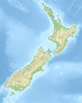

Nearest city Wanaka, New Zealand Coordinates 44°23′S 168°44′E / 44.383°S 168.733°ECoordinates: 44°23′S 168°44′E / 44.383°S 168.733°E Area 3555 km² Established 1964 Governing body Department of Conservation  West Matukituki Valley and the Matukituki River seen from Cascade Saddle.
Mount Aspiring National Park is located in the Southern Alps of the South Island of New Zealand, north of Fiordland National Park, and between Otago and south Westland. The park forms part of the Te Wahipounamu World Heritage site.
Contents
Geography
It was established in 1964 as New Zealand's tenth National Park. The park covers 3,555 km² at the southern end of the Southern Alps, directly to the west of Lake Wanaka, and is popular for tramping, walking and mountaineering. Mount Aspiring / Tititea (3033 m) is the mountain which gives the park its name. Other prominent peaks within the park include Mount Pollux (2542 m) and Mount Brewster (2519 m).
The Haast Pass, one of the three principal road routes across the Southern Alps, is found in the north-eastern corner of the park.
History
Landsborough Station added
In April 2005 the Nature Heritage Fund purchased private land in the Landsborough River valley as an addition to the park.[1]
Milford Sound tunnel proposal
In 2006, the Milford Dart Company asked the Department of Conservation to amend the Mt Aspiring National Park Management Plan to allow an additional road within the park for a bus tunnel from the Routeburn Road to the Hollyford Valley to take tourists to Milford Sound.[2]
In December 2007, the New Zealand Conservation Authority declined to adopt the amendment to the Management Plan. The Conservation Authority considered the proposed road would not add to the use and enjoyment of Mount Aspiring National Park and that the adverse effects of construction and use of the road in the National Park would outweigh any benefits.[3]
Tourism
Tramping/hiking
Popular tramping tracks in the park include:
- Gillespie Pass circuit
- Matukituki Valley
- Routeburn Track
- Rees-Dart circuit
Mining
In 2009 the National-led government of New Zealand has indicated that Mount Aspiring National Park may be opened up to mining. Around 20% of the total area of the park, mainly in the western portions around the Red Hill Range, and the north eastern parts could be removed from the park and mined.[4][5] Prospectors here are particularly interested in carbonatite deposits including Rare earth elements and tungsten. The Green Party has warned that the park is one of New Zealand's main tourism drawcards, and that mining here could do significant damage to the country's image.[6]
See also
References
- ^ Honourable Chris Carter, Landsborough Station purchased for national park, Media Release, New Zealand Government, 22 April 2005
- ^ "Amendment to park plan proposed for Milford Dart" (Press release). New Zealand Conservation Authority. 2006-03-08. http://www.doc.govt.nz/about-doc/news/media-releases/2006/amendment-to-park-plan-proposed-for-milford-dart/. Retrieved 2010-03-04.
- ^ "Roading Amendment to National Park Management Plan is declined" (Press release). Kerry Marshall, Chair, NZ Conservation Authority. 2007-12-13. http://www.doc.govt.nz/getting-involved/nz-conservation-authority-and-boards/nz-conservation-authority/media-releases/roading-amendment-to-national-park-management-plan-is-declined/. Retrieved 2008-03-23.
- ^ Green Party - documents released under the OIA.
- ^ "Leaked report recommends mining option for Mt Aspiring". The New Zealand Herald. NZPA. 1 December 2009. http://www.nzherald.co.nz/nz/news/article.cfm?c_id=1&objectid=10612737. Retrieved 26 October 2011.
- ^ "Miners press to enter the green zone". The New Zealand Herald. 6 March 2010. http://www.nzherald.co.nz/pollution/news/article.cfm?c_id=281&objectid=10630166&pnum=0. Retrieved 26 March 2010.
External links
- Mount Aspiring National Park (Department of Conservation webpage)
National parks of New Zealand North Island South Island Abel Tasman · Aoraki/Mount Cook · Arthur's Pass · Fiordland · Kahurangi · Mount Aspiring · Nelson Lakes · Paparoa · WestlandStewart Island Categories:- IUCN Category II
- Mount Aspiring National Park
- Otago Region
- Protected areas established in 1964


Wikimedia Foundation. 2010.