- Hatfield, South Yorkshire
-
Coordinates: 53°35′N 1°00′W / 53.58°N 1.00°W
Hatfield 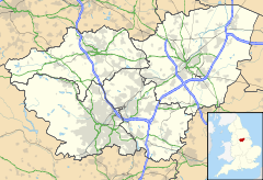
 Hatfield
Hatfield shown within South YorkshirePopulation 16,184 (2001) Parish Hatfield Metropolitan borough Doncaster Metropolitan county South Yorkshire Region Yorkshire and the Humber Country England Sovereign state United Kingdom Post town DONCASTER Postcode district DN7 Dialling code 01302 Police South Yorkshire Fire South Yorkshire Ambulance Yorkshire EU Parliament Yorkshire and the Humber UK Parliament Don Valley List of places: UK • England • Yorkshire Hatfield is a town and civil parish in the Metropolitan Borough of Doncaster in South Yorkshire, England. It has a population of 16,184.[1]
Contents
Geography
It is located within the historic boundaries of the West Riding of Yorkshire on the border of Yorkshire and Lincolnshire, and is bisected by the M18 motorway. Junctions 4 and 5 of the M18, and Junction 1 of the M180 motorway are all within the parish. Hatfield forms part of the parliamentary constituency of Don Valley.
Anglo-Saxon history
Hatfield (also called Heathfield historically) near Doncaster is an ancient settlement and a Palace of the Northumbrian Kingdom called Meicen[citation needed] (may also be referred to as Meigen).
On October 12 633 AD, King Edwin was killed in battle at Hatfield near Doncaster by Penda, King of Mercia. Penda was assisted in the battle by the Welsh under the leadership of Cadwallon ap Cadfan, Welsh (British) King of Gwynedd. Osric, a possible successor to Edwin, was also killed in the battle. Edwin’s son Edfrith also surrendered to Penda. See Battle of Hatfield Chase.
It is thought that this battle gave rise to the name of Slay Pit Lane in Hatfield where it is rumoured that the battle took place and the bodies of soldiers lay close by.
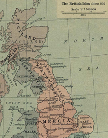 Section from Shepherd's map of the British Isles about 802 AD showing the kingdom of Northumbria. Click on the Picture to see the Meicen Capital – Hatfield (Heathfield)
Constituent settlements
Hatfield contains the following villages:
Dunscroft
Dunscroft lies on the A18 road, about six miles (10 km) from the centre of Doncaster. It is located at approximately 53°34′10″N 1°1′0″W / 53.56944°N 1.016667°W, at an elevation of around five metres above sea level. There is the Sheep Dip Lane primary school. The church is dedicated to St Edwin.
The village was enhanced in June 2005 by the addition of a pharmacy.
Dunsville
Dunsville lies on the A18 road, about five miles (8 km) from the centre of Doncaster. It is located at approximately 53°33′40″N 1°1′30″W / 53.56111°N 1.025°W, at an elevation of around five metres above sea level.
Hatfield
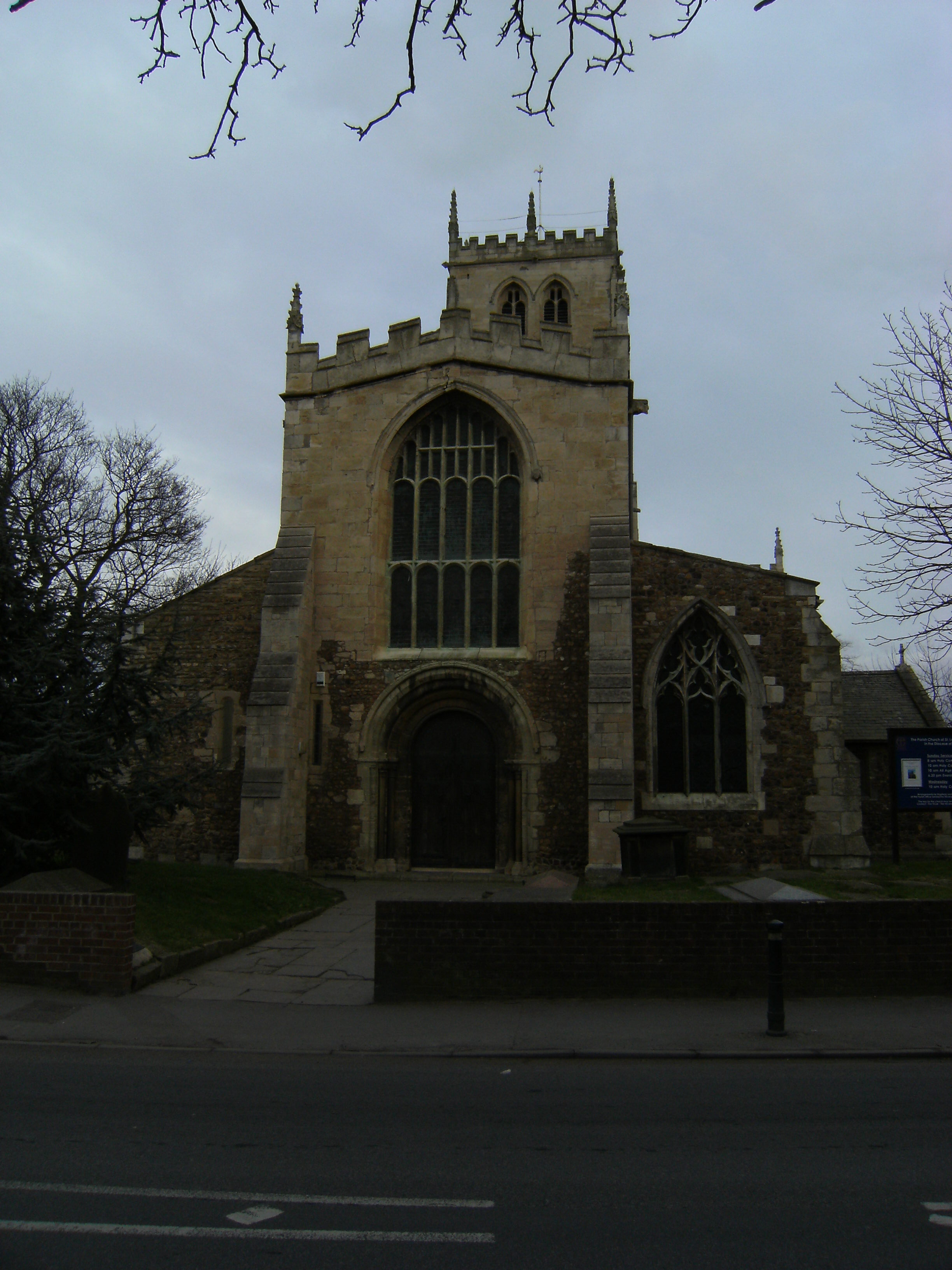
 Hatfield's parish church
Hatfield lies on the A18 road, about seven miles (11 km) from the centre of Doncaster. It is located at approximately 53°34′40″N 1°0′0″W / 53.57778°N 1°W, at an elevation of around five metres above sea level. It is served by the Hatfield and Stainforth railway station in Stainforth and Thorne.
The Domesday Survey of 1086 mentions a church at Hatfield but nothing of that building remains to be seen. The present imposing parish church of St. Lawrence was probably begun in the twelfth century. The south and west doors are Norman and so is the lower part of the outer walls of the nave. The Norman pebble construction can be seen quite clearly outside.
Hatfield has numerous public houses, including The Bay Horse, The Hatfield Chase, Hatfields, The Blue Bell, The Ingram Arms and The Green Tree. The original building known as the Abbey or Dunscroft Grange was demolished in 1966–7. For the final twenty years, this building was owned by Mr Harry Lewis. The old Abbey was possibly a dormitory to Roche Abbey at Maltby. Unfortunately, it had to be demolished because the 12th-century masonry and stonework were unstable. The main school for the area is Hatfield Visual Arts College. There is the Hatfield Manor C of E junior school and Hatfield Crookesbroom primary school.
Hatfield Woodhouse
Hatfield Woodhouse lies on the A614 road, about seven miles (11 km) from the centre of Doncaster. It is located at approximately 53°34′10″N 0°59′0″W / 53.56944°N 0.983333°W, at an elevation of around five metres above sea level. One and a half miles (2½ km) south of the settlement are the Lindholme and Moorland prisons, while to the north, on the A1146 road, is Hatfield Prison.[1]
Hatfield Woodhouse also gave rise to RAF Hatfield Woodhouse two miles south of the village. The airfield was later named RAF Lindholme and is now the location of the aforementioned prison.
The village pub is called the Robin Hood and Little John (and has probably always been called this, and certainly since the 1960s). This is consistent with the many Robin Hood legends suggesting that he roamed not only Sherwood Forest, but also Barnsdale Forest. The new Robin Hood Airport Doncaster Sheffield is nearby, at Finningley close to the border with Nottinghamshire. Although there has been much debate surrounding the use of the name Robin Hood in the name of the airport, the longstanding existence of the pub helps to justify the case for the name.
Recently an application has been proposed to allow the demolition of the pub and several flats to be built in its place. This application has recently been denied due to rallies by locals to have the plans rejected. There is the Hatfield Woodhouse primary school.
West End
West End is a small village to the south-west of Hatfield Woodhouse. It is located at approximately 53°33′40″N 0°59′40″W / 53.56111°N 0.99444°W, at an elevation of around five metres above sea level.
See also
- Timeline of the Anglo-Saxon invasion and takeover of Britain
References
- ^ Office for National statistics : Census 2001 : Parish Headcounts : Doncaster Retrieved 2009-08-27
External links
- Hatfield Town Council
- Hatfield Parish Church
- Health statistics for Hatfield
- Hatfield Water Park
- Former Hatfield Main colliery
- Health centre
Ceremonial county of South Yorkshire Metropolitan districts Major settlements Askern • Barnsley • Bawtry • Brierley • Conisbrough • Dinnington • Doncaster • Edlington • Hatfield • Hoyland • Maltby • Mexborough • Penistone • Rotherham • Sheffield • South Kirkby and Moorthorpe • Stainforth • Stocksbridge • Swinton • Thorne • Tickhill • Wath upon Dearne • Wombwell
See also: List of civil parishes in South YorkshireRivers Topics Castles • Grade I listed buildings • People • Monastic houses • Windmills • MuseumsCategories:- Towns in South Yorkshire
- Villages in Doncaster
- Civil parishes in South Yorkshire


Wikimedia Foundation. 2010.