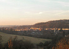
- Maltby, South Yorkshire
-
- This article is about the town of Maltby, South Yorkshire. For other uses, see Maltby.
Coordinates: 53°25′34″N 1°12′36″W / 53.426°N 1.210°W
Maltby 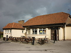
Maltby Manor Pub, on Braithwell Road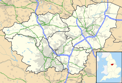
 Maltby
Maltby shown within South YorkshirePopulation 17,247 (2001) OS grid reference SK5292 Parish Maltby Metropolitan borough Rotherham Metropolitan county South Yorkshire Region Yorkshire and the Humber Country England Sovereign state United Kingdom Post town ROTHERHAM Postcode district S66 Dialling code 01709 Police South Yorkshire Fire South Yorkshire Ambulance Yorkshire EU Parliament Yorkshire and the Humber UK Parliament Rother Valley List of places: UK • England • Yorkshire Maltby is a town and civil parish of 17,247 inhabitants in the Metropolitan Borough of Rotherham, South Yorkshire, England, situated in a rural area about 7 miles east of Rotherham and 12 miles north-east of Sheffield.[1] It lies on the A631 between Hellaby and Tickhill at the junction with the A634 from Blyth, close to Junction 1 of the M18 motorway.
Contents
History
Maltby has its historical roots in Roman times, and there are several local examples of Roman roads running through the town. Maltby is mentioned in the Domesday Book as "by-malt", and was for centuries a very small village with the benefits of a fairly large stream nearby and very rich land for farming available. Since the discovery of coal in the area in the late 19th century, however, the population of Maltby has risen from around 500 at the turn of the 19th century to about 17,980 by the 2007 census.
Maltby Main Colliery was the site of mass protests during the 1984-1985 miners' strike, and remains today one of only three collieries still open in the area, the only one within Rotherham Metropolitan Borough.
During the Second World War, a munitions factory, ROF Maltby, was established on the outskirts of Maltby close to the colliery, though this has long since been closed. Maltby also had a very successful factory, Byfords, which produced knitwear for such companies as Pringle - this has long since closed and the new police station was built on the site.
Maltby railway station on the South Yorkshire Joint Railway served the town from 1910 until 1929.
 Maltby
There is a historic feature just outside of Maltby called Roche Abbey, which was ruined during the Dissolution of the Monasteries in the reign of Henry VIII.
Community and governance
In order to house its workers the colliery company built a large estate known as the 'Model Village' to the east of the town centre.
Maltby has a large Roman Catholic congregation, predominantly first or second generation Irish immigrants, many of whom were navvies and "sunk" Maltby Colliery in the early 20th century. There is a working men's club for Catholics, Maltby Catholic Club, situated on Millindale.
The Maltfriscans[2] are a lay community, predominantly Roman Catholic, that began with a group of punk rockers and other young people in Maltby. The name comes from Maltby franciscans, as they take St Francis of Assisi as one of their inspirations. There are very few remaining now in Maltby.
The town is served by a variety of shops and businesses. There is a large Tesco in the town centre on the site of what was once an indoor and outdoor market.
There are several pubs in the town, the oldest of which is the White Swan (16th century)[citation needed]. The Queen's Hotel was once frequented by the Maltby Mortis[citation needed], an outlaw biker motorcycle club. Unfortunately the Queens now lie boarded up and in a very bad state of repair. Other pubs include two owned by the Tadcaster based Samuel Smith's Brewery, the Lumley Arms and the Manor.
Maltby Comprehensive School[3] on Braithwell Road (B6376). The school closed at the end of December 2009, and Maltby Academy[4] opened in January 2010. There is a Roman Catholic primary school in Maltby - St Mary's Primary School.
The ancient game of "beck ball" was revived in the mid 1980s to some success; this is a sort of rugby game, where opposing teams generally fight a turf war in the local stream.
The town lies in the South Yorkshire constituency of Rother Valley, currently held by Labour MP Kevin Barron, a seat which he has held continuously since 1983. At local level, the town is governed by several Labour councillors, and some independent councillors.[5]
Hard times
Maltby was once, in modern terms, a small village of only several thousand inhabitants, but since the war and particularly the 1950s, it has seen a massive increase in its population. Many "new" housing estates were built in the 1970s and 1980s for private ownership. Maltby's main council housing stock went into serious disrepair during the 1980s with areas like "White City" becoming near-slum dwellings. These hard done-by areas were rejuvenated in the 1990s and Maltby has benefited from local government funding since 1997.
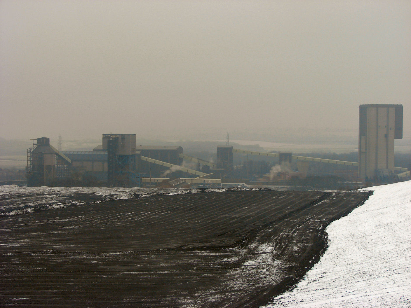
Maltby Colliery
Main article: Maltby Main Colliery Maltby Colliery - February 2007
With a history dating back to 1907 when work on sinking the original shafts began, Maltby today has the most modern equipment and the highest quality coal extracted from the Parkgate seam some 1,040 metres below ground.
Access to the reserves is gained by two shafts, No.2 984m deep and No.3 991m deep, with the capability of winding up to 1,500 tonnes of mineral an hour to the surface.
Output serves a range of markets, including sales for the production of coke, quality smokeless fuels, industry and power stations.
Investment of around £12m is planned during 2004/5, including nearly 5,000 metres of strategic drivages to reserves in the north east area of the mine, two surface boreholes and the refurbishment of equipment. The colliery employs 520 people.[1]
During the 1984-1985 miners' strike, there was a degree of poverty among the large local mining population and some children went without adequate food and clothing due to government denial of social security benefits to the strikers. A riot occurred when thousands of miners picketed the colliery as agency workers were bused into the mine (see BBC News item). The rioting and violence was not at the same level of the Battle of Orgreave, but left a bitter division between the police, the strikers and the miners who returned to work ("scabs"). The scars of the strike have not healed in many people's minds and some still hold on to their resentment towards the families of strike-breakers, more than twenty years after the end of the strike.
The local NUM delegate for Maltby Colliery, Bob Mounsey, featured in many of the pickets at various collieries and was pictured in major books and newspapers being attacked by police at Orgreave.
Many such miners went on to win compensation from the police in 1992.
The Miners' Welfare Institute (locally known as the "stute"), a working mens club for miners, is still open to this day.
In 2007 the colliery was guaranteed a future when it was bought by Hargreaves Services, for £21.5m, safeguarding around 500 jobs [2].
Notable people
The town once had the tallest twins in Britain, Jonathan and Mark Carratt, who earned a mention in the 1980 Guinness Book of Records. Both brothers still live in Maltby today, though are no longer classed as Britain's tallest twins. At the time - they appeared on the local 'Calendar News' programme, and as local football referees were filmed kicking a football on the local Manor Field.
Maltby used to be the home to the Chuckle Brothers and cricketer Fred Trueman was educated at Maltby Hall School. He moved to Maltby from Stainton with his parents and lived just off Morrell Street. Fred also worked at Maltby Colliery as also did his father.
Maltby was also the home to Lynne Perrie, an actress who played the role of Ivy Brennan in Coronation Street for 23 years. She lived in the Cliff Hills area until her death in March 2006. Her brother Duggie Brown, also an entertainer (ex Brookside) lived in the Maltby area before moving away during the 1970s.
Bill Waddington, who played Percy Sugden (again a Coronation Street character), married the sister of the Chuckle Brothers and died in a retirement home in the centre of the town.
Maltby was the setting for the book Welcome to Everytown, by writer and philosopher Julian Baggini, who lived in the area for six months. This stay was to uncover the English mind as the area is demographically a representation of English.
References
External links
Ceremonial county of South Yorkshire Yorkshire Portal Metropolitan districts Major settlements Askern • Barnsley • Bawtry • Brierley • Conisbrough • Dinnington • Doncaster • Edlington • Hatfield • Hoyland • Maltby • Mexborough • Penistone • Rotherham • Sheffield • South Kirkby and Moorthorpe • Stainforth • Stocksbridge • Swinton • Thorne • Tickhill • Wath upon Dearne • Wombwell
See also: List of civil parishes in South YorkshireRivers Topics Castles • Grade I listed buildings • People • Monastic houses • Windmills • MuseumsCategories:- Towns in South Yorkshire
- Geography of Rotherham


Wikimedia Foundation. 2010.