- Chelsea railway station, Melbourne
-
Chelsea 
Station information Code CSA Distance from
Flinders Street32.1 km Operator Metro Trains Melbourne Lines Frankston # Platforms 2 # Tracks 2 Status Unmanned station Metlink profile Link Melway map Link Google map Link Metcard / Myki Zone 2 Chelsea is a railway station in Melbourne, Victoria, Australia, located in the suburb of Chelsea, on the Frankston railway line. Chelsea is unmanned and is in Metcard Zone 2.
Contents
Facilities
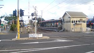
Chelsea is located at the southern end of the Chelsea Road level crossing, and between the Nepean Highway and Station Street, with station access from all three.
The station consists of two side platforms; Platform 1 has a large weatherboard building, while platform 2 has a smaller weatherboard building. A large Metcard ticket vending machine is located at the entrance to platform 1, which is able to dispense most ticketing options available and also accept notes and coins. A small coin-only Metcard ticket vending machine is located at the entrance to platform 2, as well as at the entrance to platform 1. There are also myki ticket machines on both platforms.
As part of the Victorian Transport Plan extra car parking spaces were added to Chelsea Station. Chelsea Station has also received secure 'Parkiteer' bicycle cages.
Platforms and services
Platform 1:
- Suburban Metro Trains services to Flinders Street
Platform 2:
- Suburban Metro Trains services to Frankston
Service frequencies
Time Frequency Monday-Friday (peak) every 5–10 minutes Monday-Friday (off peak daytime) every 10 minutes Saturday (daytime) every 20 minutes Sunday (morning) every 30 minutes Sunday (afternoon) every 20 minutes Evening (Monday - Friday) every 20 minutes Evening (Saturday - Sunday) every 30 minutes History
Chelsea station opened on 4 February 1907.[1]
Community groups
As part of Community Renewal, Chelsea & Bonbeach Train Station Group will manage community driven action items between now and 2013.
Aspects to be covered include, Safety improvements, security for a greater sense of safety, aesthetics (forming of "friends of station" groups, pedestrian safety, graffiti removal and prevention programs, vandalism prevention and maintenance and care taking). Please see http://cbts.org.au/
Gallery
-

Entrance to the Flinders Street bound platform
-

Looking north from platform 2
References
Station Navigation Frankston line ← Previous Station Edithvale | Bonbeach Next Station → Entire network Melbourne's public transport - Metlink Modes and network Ticketing Metropolitan rail operators Metro Trains Melbourne (heavy rail) • KDR Melbourne - Yarra Trams (tram/light rail)Regional rail operators V/Line (heavy rail)Metropolitan and regional bus operators Broadmeadows Bus Service • Cardinia Transit • Cranbourne Transit • Driver Bus Lines • Dyson's Bus Services • Eastrans • East West Bus Company • Grenda's • Hope Street Bus Line • Invicta Bus Services • Ivanhoe Bus Company • Kastoria Bus Lines • Martyrs Bus Service • Melbourne Bus Link • McKenzie's • Moonee Valley • Moorabbin Transit • Moreland Buslines • NationalBus • Panorama Coaches • Peninsula Bus Lines • Portsea • Reservoir • Ryan Brothers Bus Service • Sita Buslines • Skybus Super Shuttle • Sunbury Bus Service • Tullamarine Bus Lines • US Bus Lines • Ventura Bus Lines • WestransPlanned infrastructure Melbourne Metro • Regional Rail Link • Proposed Rail ExtensionsAuthorities Coordinates: 38°03′07″S 145°06′57″E / 38.0520°S 145.1159°E
Categories:- Railway stations in Melbourne
- Railway stations opened in 1907
- Melbourne rail transport stubs


Wikimedia Foundation. 2010.