- Crockham Hill
-
Coordinates: 51°14′10″N 0°03′52″E / 51.235973°N 0.064405°E
Crockham Hill 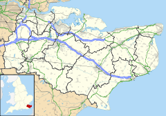
 Crockham Hill
Crockham Hill shown within KentOS grid reference TQ442505 District Sevenoaks Shire county Kent Region South East Country England Sovereign state United Kingdom Police Kent Fire Kent Ambulance South East Coast EU Parliament South East England UK Parliament Sevenoaks List of places: UK • England • Kent Crockham Hill is a village in the Sevenoaks district of Kent, England. It is about 3 miles (5 km) south of Westerham, and Chartwell is nearby.
The village street is on the line of a Roman road, the London to Lewes Way.[1]
References
- ^ I D Margary, Roman Ways in the Weald 1965 Phoenix House
External links
 Media related to Crockham Hill at Wikimedia Commons
Towns and villages in the Sevenoaks district of Kent, England 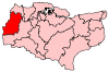 Ash · Badgers Mount · Bough Beech · Brasted · Brasted Chart · Chartwell · Chevening · Chiddingstone · Chiddingstone Causeway · Chiddingstone Hoath · Chipstead · Cowden · Crockenhill · Crockham Hill · Dunton Green · Edenbridge · Eynsford · Farningham · Fawkham · Fawkham Green · Fordcombe · Four Elms · Godden Green · Halstead · Hartley · Hever · Hextable · Hodsoll Street · Horton Kirby · Ide Hill · Kemsing · Knockholt · Leigh · Markbeech · New Ash Green · Otford · Penshurst · Ridley · Riverhead · Seal · Seal Chart · Sevenoaks · Sevenoaks Weald · Shoreham · South Darenth · Sundridge · Swanley · Swanley Village · Toys Hill · Underriver · Well Hill · Westerham · West Kingsdown
List of places in Kent Categories:- Sevenoaks
- Villages in Kent
- Kent geography stubs


Wikimedia Foundation. 2010.