- Nishimeya, Aomori
-
Nishimeya
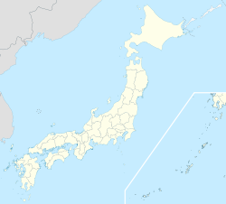
西目屋村— Village — Location of Nishimeya in Aomori
 Nishimeya
Coordinates: 40°34′37″N 140°17′41″E / 40.57694°N 140.29472°ECoordinates: 40°34′37″N 140°17′41″E / 40.57694°N 140.29472°E Country Japan Region Tōhoku Prefecture Aomori District Nakatsugaru District Area – Total 246.58 km2 (95.2 sq mi) Population (October 2009) – Total 1,470 – Density 18.5/km2 (47.9/sq mi) Time zone Japan Standard Time (UTC+9) City Symbols - Bird Black Woodpecker Phone number 0172-85-2111 Address 144 Inamoto, Tashiro
Nishimeya-mura, Nakatsugaru-gun
Aomori-ken
036-1492Website official homepage Nishimeya (西目屋村 Nishimeya-mura) is a village located in the Nakatsugaru District of southern Aomori Prefecture in the Tōhoku region of Japan. As of 2009, the village had an estimated population of 1,470 and a density of 5.97 persons per km². Its total area was 246.58 km².
Contents
Geography
Nishimeya is located in the far southern edge of Aomori Prefecture, bordering Akita Prefecture and the Shirakami-Sanchi mountain range. The village has a cold maritime climate characterized by cool short summers and long cold winters with heavy snowfall. The mountainous area is home to many indigenous plant and animal species. Wildlife includes Japanese Macaque monkeys, kamoshika, tanuki and Asian black bears.
Neighbouring municipalities
History
The area around Nishimeya was controlled by the Nambu clan of Morioka Domain a during the Edo period. It became a village of the Nakatsugaru District on April 1, 1898.
Economy
The economy of Nishimeya is heavily dependent on agriculture and forestry.
External links
- (Japanese) Nishimeya official website
 Aomori Prefecture
Cities 
Districts See also: Towns and villages by districtCategories:- Villages in Aomori Prefecture

Wikimedia Foundation. 2010.