- Oxbow, Saskatchewan
-
Oxbow — Town — Oxbow water tower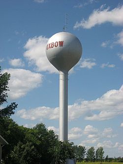
Motto: Progress with Pride 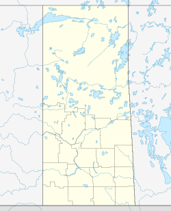
 Oxbow
OxbowCoordinates: 49°14′00″N 102°10′00″W / 49.2333333°N 102.1666667°WCoordinates: 49°14′00″N 102°10′00″W / 49.2333333°N 102.1666667°W Country Canada Province Saskatchewan First settled 1882 Incorporated 1904 Government - Mayor Doug Pierce Area - Total 3.10 km2 (1.2 sq mi) Population (2006) - Total 1,139 - Density 366.8/km2 (950/sq mi) Postal code S0C 2B0 Area code(s) 306 Website oxbow.ca 
Oxbow is a Canadian town in the southeast of the province of Saskatchewan.
Contents
Basic information
According to the 2006 Canadian census, the town's population is 1,139; the town's area is 3.10 square km; and population density is 366.8 per square km.[1]
The mayor is Doug Pierce, who was elected by acclamation.[2][3]
The town's official motto is "Progress with Pride", but the town's weekly paper, the Oxbow Herald, has long included two other unofficial town mottoes on its masthead: "Queen of the Scenic Souris" (a reference to the Souris River, near which Oxbow is situated) and "Where Oil and Agriculture Meet" (a reference to the town's two major industries[4].
The town's postal code is S0C 2B0 and the phone numbers in town are prefixed with either "483" or "485"; (thus, they all take the form 1-306-483-####, or 1-306-485-####).
Federally, the town is located in the constituency of Souris—Moose Mountain, and provincially, in the constituency of Cannington.
History
Settlement
The first settlers in the area around Oxbow - mainly of English, Irish, and Scottish descent - began homesteading the area in 1882.[4] The town's weekly newspaper, the Oxbow Herald, was founded in 1903.[4] The town was incorporated in 1904.[4]
The town was named after the "oxbow" in the Souris River near which the town is situated. Etymologically, the word "oxbow", as applied to a river, is a metaphor for the oxbow worn by an ox.[4] The Latin word for "oxbow" is "boscurvis", and, therefore, the word "Boscurvis" has long been a favourite of the town, being a name of a street, a school, and the Masonic Lodge. Although most residents now prefer the term "Oxbowite", traditionalists insist on being called "Boscurvites".
The town grew rapidly in the years following incorporation, reaching a population of 678 in 1916.[4] The town's population then hovered around 600-700 for the next several decades.[4]
In the mid-1950s, oil companies began developing the oilfields around Oxbow.[4] This set off a boom time, as personnel moved to Oxbow to work on drilling rigs and provide other services to the oil industry.[4] Agriculture and oil remain the two major industries of the town.[4]
October 1982 RCMP officer death
October 16, 1982 - Royal Canadian Mounted Police (RCMP) Officer Cst. Butler was killed while on duty in Oxbow. A high speed pursuit had begun earlier west of Oxbow with the pursuit heading towards Oxbow. Cst. Butler had set up a road block with his RCMP cruiser across the roadway. A high speed collision occurred with Cst. Butler still in the vehicle. He later died of his injuries. Two occupants of the evading vehicle were also killed.[5]
July 1995 plough wind
A destructive plough wind went through Oxbow and the surrounding area. Numerous houses were damaged and trees were uprooted. Even though a portion of the Bow Manor Hotel roof was torn off, no serious injuries were reported.
Education
The main school in Oxbow is Oxbow Prairie Horizons School (OPHS), a K–12 school, with a Preschool Program. Oxbow Prairie Horizons School opened in the 2010-11 school year.[6][7]
Prior to the construction of Oxbow Prairie Horizons School, Oxbow had two schools: (1) Oxbow Prairie Heights School (OPHS), which taught Grades 6 through 12 (Oxbow Prairie Heights School opened in 1986, following renovations to the former Oxbow High School, which had taught Grades 7 through 12); and (2) Oxbow Elementary School, which was Grades K through 6 until 1985, and taught Grades K through 5 from 1985 to 2010.
In addition to the elementary school and high school, the Glenn McGuire School used to provide educational opportunities for intellectually and physically challenged students ranging in age from three to twenty-two years of age. As of September 1, 2008 the Glenn McGuire school has been demolished, and the physically challenged students have been integrated into the elementary school and high school.
Literary references
Renowned Canadian journalist Ralph Allen came from Oxbow. Allen was the author of several books, including the novel Peace River Country (1958) and Ordeal By Fire: Canada, 1910–1945 (1961), a history of Canada during the period of the two world wars. In 1967, Christina McCall Newman edited a collection of Allen's columns from Maclean's entitled The Man From Oxbow. Oxbow's town museum is named in Allen's honour.
There is a reference to Oxbow in My Discovery of America by Farley Mowat (1985). The book is a memoir detailing why Mowat was denied entry to the US in 1985. In the Appendix, he points out that one of the reasons was that he had supported an Oxbow group that was opposed to nuclear weapons at the Minot Air Force Base.
Oxbow was also infamously the target of an article by Edmonton author W. P. Kinsella (who was catapulted to fame when his book Shoeless Joe (1980) was made into the movie Field of Dreams by Kevin Costner in 1989). Kinsella was sent to Oxbow by Saturday Night magazine after Oxbow had the dubious distinction of having Canada's highest per-capita murder rate.
Notable Oxbowites
- Ralph Allen - Editor of Maclean's
- Theoren Fleury - Retired NHL hockey player
- Reg Kerr - Retired NHL hockey player
- Kris Porter - Retired professional hockey player
References
- ^ 2006 Census Profile
- ^ "Oxbow Administration & Council". Town of Oxbow. Archived from the original on 28 September 2011. http://www.webcitation.org/622TKjEZl.
- ^ Willick, Liz (6 October 2009). "THE RACE IS ON". Sask News Now. Archived from the original on 28 September 2011. http://www.webcitation.org/622TOsS0I.
- ^ a b c d e f g h i j McLennan, David. "Oxbow". The Encyclopedia of Saskatchewan. University of Regina. Archived from the original on 28 September 2011. http://www.webcitation.org/622SfG9UW.
- ^ "Constable Douglas Ambrose Mark Butler". Officer Down Memorial Page. Archived from the original on 28 September 2011. http://www.webcitation.org/622TAn64r.
- ^ Provincial Government Press Release
- ^ Marlin Johnson (Journalist) (2008-08-07). "Sask News Now" (in English). Oxbow Herald. http://www.sasknewsnow.com/index.cfm?sid=150850&sc=430. Retrieved 2009-03-01.
External links
Categories:- Towns in Saskatchewan


Wikimedia Foundation. 2010.