- Broadmoor, California
Infobox Settlement
official_name = Broadmoor, California
other_name =
native_name =
nickname =
settlement_type = CDP
motto =
imagesize =
image_caption =
flag_size =
image_
seal_size =
image_shield =
shield_size =
image_blank_emblem =
blank_emblem_type =
blank_emblem_size =
imagesize =
image_caption =
flag_size =
image_
seal_size =
image_shield =
shield_size =
image_blank_emblem =
blank_emblem_type =
blank_emblem_size =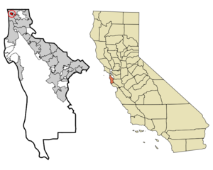
mapsize = 250x200px
map_caption = Location in San Mateo County and the state ofCalifornia
mapsize1 =
map_caption1 =
image_dot_
dot_mapsize =
dot_map_caption =
dot_x =
dot_y =
pushpin_
pushpin_label_position =
pushpin_map_caption =
pushpin_mapsize =
subdivision_type = Country
subdivision_name =United States
subdivision_type1 = State
subdivision_name1 =California
subdivision_type2 = County
subdivision_name2 = San Mateo
subdivision_type3 =
subdivision_name3 =
subdivision_type4 =
subdivision_name4 =
government_footnotes =
government_type =
leader_title =
leader_name =
leader_title1 =
leader_name1 =
leader_title2 =
leader_name2 =
leader_title3 =
leader_name3 =
leader_title4 =
leader_name4 =
established_title =
established_date =
established_title2 =
established_date2 =
established_title3 =
established_date3 =
area_magnitude =
unit_pref =
area_footnotes =
area_total_km2 = 1.2
area_land_km2 = 1.2
area_water_km2 = 0
area_total_sq_mi = 0.4
area_land_sq_mi = 0.4
area_water_sq_mi = 0
area_water_percent =
area_urban_km2 =
area_urban_sq_mi =
area_metro_km2 =
area_metro_sq_mi =
area_blank1_title =
area_blank1_km2 =
area_blank1_sq_mi =
population_as_of = 2000
population_footnotes =
population_note =
population_total = 4026
population_density_km2 = 3355
population_density_sq_mi = 10065
population_metro =
population_density_metro_km2 =
population_density_metro_sq_mi =
population_urban =
population_density_urban_km2 =
population_density_urban_sq_mi =
population_blank1_title =
population_blank1 =
population_density_blank1_km2 =
population_density_blank1_sq_mi =
timezone = PST
utc_offset = -8
timezone_DST = PDT
utc_offset_DST = -7
latd = 37 |latm = 41 |lats = 33 |latNS = N
longd = 122 |longm = 28 |longs = 44 |longEW = W
elevation_footnotes =
elevation_m = 106
elevation_ft = 348
postal_code_type =ZIP code
postal_code = 94014
area_code = 650
blank_name = FIPS code
blank_info = 06-08338
blank1_name = GNIS feature ID
blank1_info = 0255917
website =
footnotes =Broadmoor is a
census-designated place (CDP) in San Mateo County,California ,United States . The population was 4,026 at the 2000 census. The city has a largeFilipino American population, and is surrounded byDaly City , which also has a large Filipino population.Geography
Broadmoor is located at coor dms|37|41|33|N|122|28|44|W|city (37.692433, -122.478901)GR|1.
According to the
United States Census Bureau , the CDP has a total area of 0.4square mile s (1.2km² ), all of it land.Demographics
As of the
census GR|2 of 2000, there were 4,026 people, 1,275 households, and 984 families residing in the CDP. Thepopulation density was 8,998.9 people per square mile (3,454.3/km²). There were 1,295 housing units at an average density of 2,894.6/sq mi (1,111.1/km²). The racial makeup of the CDP was 49.13% White, 1.84% African American, 0.45% Native American, 35.00% Asian, 1.12% Pacific Islander, 6.51% from other races, and 5.96% from two or more races. Hispanic or Latino of any race were 18.11% of the population.There were 1,275 households out of which 34.9% had children under the age of 18 living with them, 60.0% were married couples living together, 13.0% had a female householder with no husband present, and 22.8% were non-families. 16.2% of all households were made up of individuals and 8.6% had someone living alone who was 65 years of age or older. The average household size was 3.11 and the average family size was 3.48.
In the CDP the population was spread out with 23.2% under the age of 18, 7.4% from 18 to 24, 27.6% from 25 to 44, 26.7% from 45 to 64, and 15.1% who were 65 years of age or older. The median age was 40 years. For every 100 females there were 93.2 males. For every 100 females age 18 and over, there were 90.0 males.
The median income for a household in the CDP was $69,836, and the median income for a family was $71,250. Males had a median income of $47,700 versus $37,784 for females. The
per capita income for the CDP was $24,608. About 3.9% of families and 5.1% of the population were below thepoverty line , including 4.8% of those under age 18 and 5.1% of those age 65 or over.Public Safety
The Broadmoor Police Protection District is the last operational police protection district in the state of California. A special property tax assessment funds the [http://www.pd.broadmoor.ca.us/ Broadmoor Police Department] , which was founded in 1948 after residents grew concerned of long response times from the San Mateo County Sheriff's Department -- most of whose deputies are based in the southern end of the county. Fire protection is provided by the Colma Volunteer Fire Protection District. The Broadmoor Police Department is staffed by eight full time police officers, including the chief of police, and twenty-five part time police officers.
The Broadmoor Police Protection District is governed by a Police Commission, the Broadmoor Police Protection District Board of Police Commissioners, which consists of three residents elected at large every four years.
In 2007 State Senator Leland Yee (California's Eighth District) authored legislation sponsored by the Broadmoor Police Department to recognize Broadmoor as a municipal or city police department. Senate Bill 230, which was signed by Governor Schwarzenegger, provides Broadmoor Police with the same legal recognition and status of a city or municipal police department.
Politics
In the state legislature Broadmoor is located in the 8th Senate District, represented by Democrat
Leland Yee , and in the 12th Assembly District, represented by DemocratFiona Ma . Federally, Broadmoor is located inCalifornia's 12th congressional district , which has a Cook PVI of D +22 [cite web | title = Will Gerrymandered Districts Stem the Wave of Voter Unrest? | publisher = Campaign Legal Center Blog | url=http://www.clcblog.org/blog_item-85.html | accessdate = 2008-02-10] and is represented by DemocratJackie Speier .References
External links
* "Gateway to the Peninsula" by Samuel C. Chandler, Daly City, CA: The City of Daly City, 1973. [http://www.dalycityhistory.org/Gateway/Ch25.pdf Chapter 25: "Broadmoor"] .
* [http://sfgate.com/cgi-bin/article.cgi?f=/c/a/2007/07/30/BAGO6R9DVP1.DTL "Tiny community may finally get police powers"] by John Coté, "San Francisco Chronicle ", July 30, 2007.
Wikimedia Foundation. 2010.