- El Granada, California
Infobox Settlement
official_name = El Granada, California
other_name =
native_name =
nickname =
settlement_type = CDP
motto =
imagesize =
image_caption =
flag_size =
image_
seal_size =
image_shield =
shield_size =
image_blank_emblem =
blank_emblem_type =
blank_emblem_size =
imagesize =
image_caption =
flag_size =
image_
seal_size =
image_shield =
shield_size =
image_blank_emblem =
blank_emblem_type =
blank_emblem_size =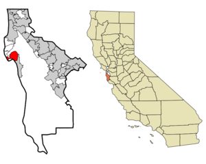
mapsize = 250x200px
map_caption = Location in San Mateo County and the state ofCalifornia
mapsize1 =
map_caption1 =
image_dot_
dot_mapsize =
dot_map_caption =
dot_x =
dot_y =
pushpin_
pushpin_label_position =
pushpin_map_caption =
pushpin_mapsize =
subdivision_type = Country
subdivision_name =United States
subdivision_type1 = State
subdivision_name1 =California
subdivision_type2 = County
subdivision_name2 = San Mateo
subdivision_type3 =
subdivision_name3 =
subdivision_type4 =
subdivision_name4 =
government_footnotes =
government_type =
leader_title =
leader_name =
leader_title1 =
leader_name1 =
leader_title2 =
leader_name2 =
leader_title3 =
leader_name3 =
leader_title4 =
leader_name4 =
established_title =
established_date =
established_title2 =
established_date2 =
established_title3 =
established_date3 =
area_magnitude =
unit_pref =
area_footnotes =
area_total_km2 = 13.9
area_land_km2 = 13.9
area_water_km2 = 0
area_total_sq_mi = 5.4
area_land_sq_mi = 5.4
area_water_sq_mi = 0
area_water_percent =
area_urban_km2 =
area_urban_sq_mi =
area_metro_km2 =
area_metro_sq_mi =
area_blank1_title =
area_blank1_km2 =
area_blank1_sq_mi =
population_as_of = 2000
population_footnotes =
population_note =
population_total = 5724
population_density_km2 = 411.8
population_density_sq_mi = 1060
population_metro =
population_density_metro_km2 =
population_density_metro_sq_mi =
population_urban =
population_density_urban_km2 =
population_density_urban_sq_mi =
population_blank1_title =
population_blank1 =
population_density_blank1_km2 =
population_density_blank1_sq_mi =
timezone = PST
utc_offset = -8
timezone_DST = PDT
utc_offset_DST = -7
latd = 37 |latm = 30 |lats = 14 |latNS = N
longd = 122 |longm = 28 |longs = 24 |longEW = W
elevation_footnotes =
elevation_m = 12
elevation_ft = 39
postal_code_type =ZIP code
postal_code = 94018
area_code = 650
blank_name = FIPS code
blank_info = 06-21936
blank1_name = GNIS feature ID
blank1_info = 1659720
website =
footnotes =El Granada is a
census-designated place (CDP) in thecoast al area of northern San Mateo County,California ,United States . The population was 5,724 at the 2000 census.Geography
El Granada is located at coor dms|37|30|14|N|122|28|24|W|city (37.503766, -122.473230)GR|1, on the less densely populated Pacific
coast side of San Mateo County, approximately convert|25|mi|km south of San Francisco and convert|45|mi|km north ofSanta Cruz, California . Neighboring towns include Montara and Moss Beach to the north and Half Moon Bay to the south.According to the
United States Census Bureau , the CDP has a total area of 5.4 square miles (14.0 km²), all of it land.Demographics
As of the
census GR|2 of 2000, there were 5,724 people, 2,028 households, and 1,512 families residing in the CDP. Thepopulation density was 1,062.7 people per square mile (410.0/km²). There were 2,097 housing units at an average density of 389.3/sq mi (150.2/km²). The racial makeup of the CDP was 84.21% White, 0.56% African American, 1.05% Native American, 2.85% Asian, 0.19% Pacific Islander, 6.81% from other races, and 4.33% from two or more races. Hispanic or Latino of any race were 15.72% of the population.There were 2,028 households out of which 39.3% had children under the age of 18 living with them, 61.8% were married couples living together, 8.2% had a female householder with no husband present, and 25.4% were non-families. 17.8% of all households were made up of individuals and 2.9% had someone living alone who was 65 years of age or older. The average household size was 2.82 and the average family size was 3.18.
In the CDP the population was spread out with 26.8% under the age of 18, 6.0% from 18 to 24, 31.7% from 25 to 44, 29.1% from 45 to 64, and 6.4% who were 65 years of age or older. The median age was 38 years. For every 100 females there were 102.1 males. For every 100 females age 18 and over, there were 99.8 males.
The median income for a household in the CDP was $91,979, and the median income for a family was $96,095. Males had a median income of $54,122 versus $48,065 for females. The
per capita income for the CDP was $38,832. About 1.1% of families and 3.0% of the population were below thepoverty line , including 3.0% of those under age 18 and 7.3% of those age 65 or over.History
El Granada's unusual concentric-circular street layout was designed by the influential architect and city planner
Daniel Burnham . Burnham's other works included overseeing the design for the 1893Columbian Exposition in Chicago and designing the 1902Flatiron Building inNew York City . Burnham's plan was commissioned by theOcean Shore Railroad , which developed El Granada as a seaside resort for visitors fromSan Francisco . He developed city plans for San Francisco (1905), Chicago (1909), Manila and the Mall in Washington D.C. His company designed many noteworthy buildings in Chicago, San Francisco, Pittsburgh and other cities in the US. He is buried on an island with his family under granite boulders in Graceland Cemetery, Chicago.Politics
In the state legislature El Granada is located in the 8th Senate District, represented by Democrat
Leland Yee , and in the 19th Assembly District, represented by DemocratGene Mullin . Federally, El Granada is located in California's 12th and 14th congressional districts, which have Cook PVIs of D +22 and D +18 respectively [cite web | title = Will Gerrymandered Districts Stem the Wave of Voter Unrest? | publisher = Campaign Legal Center Blog | url=http://www.clcblog.org/blog_item-85.html | accessdate = 2008-02-10] . The 12th is currently represented by DemocratJackie Speier , elected to office following the death of DemocratTom Lantos in 2008, and the 14th is represented by DemocratAnna Eshoo .References
External links
Wikimedia Foundation. 2010.