- Emerald Lake Hills, California
Infobox Settlement
official_name = Emerald Lake Hills, California
other_name =
native_name =
nickname =
settlement_type = CDP
motto =
imagesize =
image_caption =
flag_size =
image_
seal_size =
image_shield =
shield_size =
image_blank_emblem =
blank_emblem_type =
blank_emblem_size =
imagesize =
image_caption =
flag_size =
image_
seal_size =
image_shield =
shield_size =
image_blank_emblem =
blank_emblem_type =
blank_emblem_size =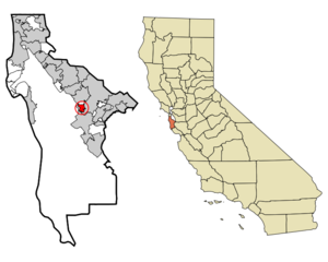
mapsize = 250x200px
map_caption = Location in San Mateo County and the state ofCalifornia
mapsize1 =
map_caption1 =
image_dot_
dot_mapsize =
dot_map_caption =
dot_x =
dot_y =
pushpin_
pushpin_label_position =
pushpin_map_caption =
pushpin_mapsize =
subdivision_type = Country
subdivision_name =United States
subdivision_type1 = State
subdivision_name1 =California
subdivision_type2 = County
subdivision_name2 = San Mateo
subdivision_type3 =
subdivision_name3 =
subdivision_type4 =
subdivision_name4 =
government_footnotes =
government_type =
leader_title =
leader_name =
leader_title1 =
leader_name1 =
leader_title2 =
leader_name2 =
leader_title3 =
leader_name3 =
leader_title4 =
leader_name4 =
established_title =
established_date =
established_title2 =
established_date2 =
established_title3 =
established_date3 =
area_magnitude =
unit_pref =
area_footnotes =
area_total_km2 = 3
area_land_km2 = 3
area_water_km2 = 0
area_total_sq_mi = 1.2
area_land_sq_mi = 1.2
area_water_sq_mi = 0
area_water_percent =
area_urban_km2 =
area_urban_sq_mi =
area_metro_km2 =
area_metro_sq_mi =
area_blank1_title =
area_blank1_km2 =
area_blank1_sq_mi =
population_as_of = 2000
population_footnotes =
population_note =
population_total = 3899
population_density_km2 = 1299.7
population_density_sq_mi = 3249.2
population_metro =
population_density_metro_km2 =
population_density_metro_sq_mi =
population_urban =
population_density_urban_km2 =
population_density_urban_sq_mi =
population_blank1_title =
population_blank1 =
population_density_blank1_km2 =
population_density_blank1_sq_mi =
timezone = PST
utc_offset = -8
timezone_DST = PDT
utc_offset_DST = -7
latd = 37 |latm = 27 |lats = 52 |latNS = N
longd = 122 |longm = 15 |longs = 59 |longEW = W
elevation_footnotes =
elevation_m = 158
elevation_ft = 518
postal_code_type =ZIP code
postal_code = 94062
area_code = 650
blank_name = FIPS code
blank_info = 06-22587
blank1_name = GNIS feature ID
blank1_info = 1867022
website =
footnotes =Emerald Lake Hills is a
census-designated place and neighborhood in unincorporated San Mateo County, in the state ofCalifornia , USA. It is located in the hills between Woodside and Redwood City, roughly bounded by Edgewood Road, Alameda de las Pulgas, Farm Hill Boulevard, and Interstate 280. The population was 3,899 at the 2000 census.Geography
Emerald Lake Hills is located at coor dms|37|27|52|N|122|15|59|W|city (37.464388, -122.266389)GR|1.
According to the
United States Census Bureau , the neighborhood has a total area of 1.2square mile s (3.1km² ), of which, 1.2 square miles (3.1 km²) of it is land and 0.85% is water.Demographics
As of the
census GR|2 of 2000, there were 3,899 people, 1,437 households, and 1,120 families residing in the neighborhood. Thepopulation density was 3,312.1 people per square mile (1,275.8/km²). There were 1,466 housing units at an average density of 1,245.3/sq mi (479.7/km²). The racial makeup of the neighborhood was 89.46% White, 0.56% African American, 0.18% Native American, 5.16% Asian, 0.21% Pacific Islander, 1.36% from other races, and 3.08% from two or more races. Hispanic or Latino of any race were 5.18% of the population.There were 1,437 households out of which 34.6% had children under the age of 18 living with them, 70.1% were married couples living together, 4.4% had a female householder with no husband present, and 22.0% were non-families. 14.8% of all households were made up of individuals and 4.0% had someone living alone who was 65 years of age or older. The average household size was 2.69 and the average family size was 2.97.
In the neighborhood the population was spread out with 22.7% under the age of 18, 4.3% from 18 to 24, 30.6% from 25 to 44, 32.2% from 45 to 64, and 10.2% who were 65 years of age or older. The median age was 42 years. For every 100 females there were 100.6 males. For every 100 females age 18 and over, there were 101.5 males.
The median income for a household in the neighborhood was $127,250, and the median income for a family was $141,255 compared to Redwood City's other census-designated place and low income neighborhood,
North Fair Oaks , which has a median family income of $54,678. Males had a median income of $95,873 versus $66,250 for females. Theper capita income for the neighborhood was $68,966. About 0.5% of families and 2.0% of the population were below thepoverty line , including 1.2% of those under age 18 and 1.6% of those age 65 or over.Education
Residents are zoned to primary schools in the
Redwood City School District and secondary schools in theSequoia Union High School District [http://www.emeraldhills.org/pages/aroundtown.html] .Elementary school children in the northern half of the CDP attend [http://clifford.ca.campusgrid.net/home Clifford School] , while elementary school children in the southern half attend [http://roycloud.ca.campusgrid.net/home Roy Cloud School] .
High school children attend either
Sequoia High School or Woodside High School [http://www.woodsidehs.org/] .Politics
In the state legislature Emerald Lake Hills is located in the 11th Senate District, represented by Democrat
Joe Simitian , and in the 21st Assembly District, represented by DemocratIra Ruskin . Federally, Emerald Lake Hills is located inCalifornia's 12th congressional district , which has a Cook PVI of D +22 [cite web | title = Will Gerrymandered Districts Stem the Wave of Voter Unrest? | publisher = Campaign Legal Center Blog | url=http://www.clcblog.org/blog_item-85.html | accessdate = 2008-02-10] and is currently vacant with the recent death of DemocratTom Lantos .References
External links
* [http://www.emeraldhills.org/ Emerald Hills Homeowners Association]
Wikimedia Foundation. 2010.