- West Menlo Park, California
Infobox Settlement
official_name = West Menlo Park, California
other_name =
native_name =
nickname =
settlement_type = CDP
motto =
imagesize =
image_caption =
flag_size =
image_
seal_size =
image_shield =
shield_size =
image_blank_emblem =
blank_emblem_type =
blank_emblem_size =
imagesize =
image_caption =
flag_size =
image_
seal_size =
image_shield =
shield_size =
image_blank_emblem =
blank_emblem_type =
blank_emblem_size =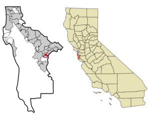
mapsize = 250x200px
map_caption = Location in San Mateo County and the state ofCalifornia
mapsize1 =
map_caption1 =
image_dot_
dot_mapsize =
dot_map_caption =
dot_x =
dot_y =
pushpin_
pushpin_label_position =
pushpin_map_caption =
pushpin_mapsize =
subdivision_type = Country
subdivision_name =United States
subdivision_type1 = State
subdivision_name1 =California
subdivision_type2 = County
subdivision_name2 = San Mateo
subdivision_type3 =
subdivision_name3 =
subdivision_type4 =
subdivision_name4 =
government_footnotes =
government_type =
leader_title =
leader_name =
leader_title1 =
leader_name1 =
leader_title2 =
leader_name2 =
leader_title3 =
leader_name3 =
leader_title4 =
leader_name4 =
established_title =
established_date =
established_title2 =
established_date2 =
established_title3 =
established_date3 =
area_magnitude =
unit_pref =
area_footnotes =
area_total_km2 = 1.3
area_land_km2 = 1.3
area_water_km2 = 0
area_total_sq_mi = 0.5
area_land_sq_mi = 0.5
area_water_sq_mi = 0
area_water_percent =
area_urban_km2 =
area_urban_sq_mi =
area_metro_km2 =
area_metro_sq_mi =
area_blank1_title =
area_blank1_km2 =
area_blank1_sq_mi =
population_as_of = 2000
population_footnotes =
population_note =
population_total = 3629
population_density_km2 = 2791.5
population_density_sq_mi = 7258
population_metro =
population_density_metro_km2 =
population_density_metro_sq_mi =
population_urban =
population_density_urban_km2 =
population_density_urban_sq_mi =
population_blank1_title =
population_blank1 =
population_density_blank1_km2 =
population_density_blank1_sq_mi =
timezone = PST
utc_offset = -8
timezone_DST = PDT
utc_offset_DST = -7
latd = 37 |latm = 26 |lats = 1 |latNS = N
longd = 122 |longm = 12 |longs = 11 |longEW = W
elevation_footnotes =
elevation_m = 34
elevation_ft = 112
postal_code_type =ZIP code
postal_code = 94025
area_code = 650
blank_name = FIPS code
blank_info = 06-84536
blank1_name = GNIS feature ID
blank1_info = 1867071
website =
footnotes =West Menlo Park is a
census-designated place and anunincorporated community inSan Mateo County, California , inside of Menlo Park, and adjacent to Atherton, Sharon Heights andStanford University . As of the 2000 census, the community had a population of 3,629. It consists of suburban housing and a small business district along Alameda de las Pulgas and another on Sharon Road. It has one public school and a large apartment district. More recently, West Menlo Park has gained a reputation as one of the most desirable places to live in North America. A notable newspaper recently ranked West Menlo Park #4 on its "top residential areas in California" article.Fact|date=February 2007Geography
According to the
United States Census Bureau , the CDP has a total area of 0.5square mile s (1.3km² ), all of it land. West Menlo Park has a mild climate.Demographics
As of the
census GR|2 of 2000, there were 3,629 people, 1,420 households, and 955 families residing in the CDP. Thepopulation density was 7,299.8 people per square mile (2,802.3/km²). There were 1,451 housing units at an average density of 2,918.7/sq mi (1,120.5/km²). The racial makeup of the CDP was 87.46% White, 0.91% African American, 0.19% Native American, 7.25% Asian, 0.11% Pacific Islander, 0.94% from other races, and 3.14% from two or more races. Hispanic or Latino of any race were 4.46% of the population. There were 1,420 households out of which 34.7% had children under the age of 18 living with them, 57.6% were married couples living together, 7.0% had a female householder with no husband present, and 32.7% were non-families. 25.0% of all households were made up of individuals and 8.7% had someone living alone who was 65 years of age or older. The average household size was 2.55 and the average family size was 3.04.In the CDP the population was spread out with 25.3% under the age of 18, 3.6% from 18 to 24, 32.1% from 25 to 44, 25.8% from 45 to 64, and 13.3% who were 65 years of age oɣr older. The median age was 39 years. For every 100 females there were 96.0 males. For every 100 females age 18 and over, there were 91.1 males.
The median income for a household in the CDP was $125,881, and the median income for a family was $145,946. Males had a median income of $100,000+ versus $70,486 for females. The
per capita income for the CDP was $62,302. 2.9% of the population and 0.4% of families were below thepoverty line . 0.3% of those under the age of 18 and 4.1% of those 65 and older were living below the poverty line.imilar Areas
This wealthy area is not the only one of its kind in the Bay Area. Los Altos Hills, Woodside, Atherton and Hillsborough also have a higher average annual income than much of the surrounding areas. By some estimates, the Silicon Valley area, of which all the aforementioned are a part, is the wealthiest place in the world. [http://news.bbc.co.uk/1/low/business/2029278.stm]
Politics
The city is mostly Democratic, with 47% being registered Democrats and 32% Republicans.cite url=http://www.sen.ca.gov/ftp/SEN/senplan/SD11.HTM|title=SD14 partisan registration|accessdate=2008-09-13] In the state legislature West Menlo Park is located in the 11th Senate District, represented by Democrat
Joe Simitian , and in the 21st Assembly District, represented by DemocratIra Ruskin . Federally, West Menlo Park is located inCalifornia's 14th congressional district , which has a Cook PVI of D +18 [cite web | title = Will Gerrymandered Districts Stem the Wave of Voter Unrest? | publisher = Campaign Legal Center Blog | url=http://www.clcblog.org/blog_item-85.html | accessdate = 2008-02-10] and is represented by DemocratAnna Eshoo .References
External links
* [http://www.bayareacensus.ca.gov/cdp/WestMenloPark.pdf 2000 Census Data]
Wikimedia Foundation. 2010.