- Chinese Camp, California
-
Not to be confused with China Camp State Park.
Chinese Camp — census-designated place — Main Street, Chinese Camp Location in Tuolumne County and the state of California
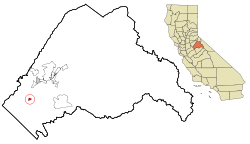
Coordinates: 37°52′13″N 120°26′1″W / 37.87028°N 120.43361°WCoordinates: 37°52′13″N 120°26′1″W / 37.87028°N 120.43361°W Country  United States
State  California
County Tuolumne Area[1] - Total 0.901 sq mi (2.332 km2) - Land 0.898 sq mi (2.326 km2) - Water 0.003 sq mi (0.007 km2) 0.28% Elevation 1,273 ft (388 m) Population (2000) - Total 126 - Density 139.8/sq mi (54/km2) Time zone Pacific (PST) (UTC-8) - Summer (DST) PDT (UTC-7) ZIP code 95309 Area code(s) 209 FIPS code 06-13182 GNIS feature ID 0233668 Reference #: 423 Chinese Camp is a census-designated place (CDP) in Tuolumne County, California, United States. The population was 126 at the 2010 census, down from 146 at the 2000 census. It lies in the grassy foothills of the Sierra Nevada near the southern end of California's Gold Country.
Contents
History
Chinese Camp is the remnant of a notable California Gold Rush mining town. The settlement was first known as "Camp Washington" or "Washingtonville" and one of the few remaining streets is Washington Street. Some of the very first Chinese laborers arriving in California in 1849 were driven from neighboring Camp Salvado and resettled here, and the area started to become known as "Chinee" or "Chinese Camp" or "Chinese Diggings". At one point the town was home to an estimated 5,000 Chinese. Consequently, there were several Joss houses.
The Chinese Camp post office was established in the general store on April 18, 1854. This building is currently vacant, and a post office is in operation on a plot of land rented from a local resident.
An 1892 Tuolumne County history indicates that, in 1856, four of the six Chinese companies (protective associations) had agents here and that the first tong war (between the Sam Yap and Yan Woo tongs) was fought near here when the population of the area totaled several thousand. The actual location is several miles away, past the 'red hills', near the junction of Red Hills Road and J-59.
An 1860 diary says Chinese Camp was the metropolis for the mining district, with many urban comforts. While placer mining had played out in much of the Gold Country by the early 1860s, it was still active here as late as 1870. An 1899 mining bulletin listed the total gold production of the area as near US$2.5 million.
Chinese Camp is the location and subject of California Historical Landmark 423 - The Saint Francis Xavier Roman Catholic Church, established in 1849, making it the oldest church in the county. The church was renovated in 1949 by John Nicolini and is still maintained out of private funds by a local resident. The church itself is owned by the Stockton archdiocese.
The current Chinese Camp School is very distinctive, having been designed by Dolores Nicolini in the style of a Chinese pagoda. This school has been in operation since 1970. Previously, the school was in a building near the church. This building was lost in a fire on May 4, 2006. The fire was caused by carelessness on the part of several local individuals.
Geography
Chinese Camp is located at 37°52′13″N 120°26′1″W / 37.87028°N 120.43361°W (37.870294, -120.433526)[2].
According to the United States Census Bureau, the CDP has a total area of 0.9 square miles (2.3 km2), 99.72% of it land and 0.28% of it water.
Demographics
2010
The 2010 United States Census[3] reported that Chinese Camp had a population of 126. The population density was 139.9 people per square mile (54.0/km²). The racial makeup of Chinese Camp was 92 (73.0%) White, 0 (0.0%) African American, 7 (5.6%) Native American, 0 (0.0%) Asian, 0 (0.0%) Pacific Islander, 16 (12.7%) from other races, and 11 (8.7%) from two or more races. Hispanic or Latino of any race were 25 persons (19.8%).
The Census reported that 126 people (100% of the population) lived in households, 0 (0%) lived in non-institutionalized group quarters, and 0 (0%) were institutionalized.
There were 50 households, out of which 15 (30.0%) had children under the age of 18 living in them, 23 (46.0%) were opposite-sex married couples living together, 2 (4.0%) had a female householder with no husband present, 6 (12.0%) had a male householder with no wife present. There were 5 (10.0%) unmarried opposite-sex partnerships, and 1 (2.0%) same-sex married couples or partnerships. 15 households (30.0%) were made up of individuals and 6 (12.0%) had someone living alone who was 65 years of age or older. The average household size was 2.52. There were 31 families (62.0% of all households); the average family size was 3.23.
The population was spread out with 30 people (23.8%) under the age of 18, 11 people (8.7%) aged 18 to 24, 24 people (19.0%) aged 25 to 44, 46 people (36.5%) aged 45 to 64, and 15 people (11.9%) who were 65 years of age or older. The median age was 43.5 years. For every 100 females there were 106.6 males. For every 100 females age 18 and over, there were 108.7 males.
There were 60 housing units at an average density of 66.6 per square mile (25.7/km²), of which 36 (72.0%) were owner-occupied, and 14 (28.0%) were occupied by renters. The homeowner vacancy rate was 2.6%; the rental vacancy rate was 0%. 99 people (78.6% of the population) lived in owner-occupied housing units and 27 people (21.4%) lived in rental housing units.
2000
As of the census[4] of 2000, there were 146 people, 57 households, and 38 families residing in the CDP. The population density was 162.5 people per square mile (62.6/km²). There were 64 housing units at an average density of 71.2 per square mile (27.5/km²). The racial makeup of the CDP was 91.78% White, 1.37% African American, 3.42% Native American, 0.68% Asian, 0.68% from other races, and 2.05% from two or more races. Hispanic or Latino of any race were 11.64% of the population.
There were 57 households out of which 31.6% had children under the age of 18 living with them, 54.4% were married couples living together, 12.3% had a female householder with no husband present, and 31.6% were non-families. 29.8% of all households were made up of individuals and 8.8% had someone living alone who was 65 years of age or older. The average household size was 2.56 and the average family size was 3.18.
In the CDP the population was spread out with 28.1% under the age of 18, 10.3% from 18 to 24, 32.2% from 25 to 44, 19.9% from 45 to 64, and 9.6% who were 65 years of age or older. The median age was 35 years. For every 100 females there were 117.9 males. For every 100 females age 18 and over, there were 110.0 males.
The median income for a household in the CDP was $31,875, and the median income for a family was $35,833. Males had a median income of $25,833 versus $18,750 for females. The per capita income for the CDP was $11,501. There were 20.6% of families and 22.7% of the population living below the poverty line, including 36.4% of under eighteens and 14.3% of those over 64.
Politics
In the state legislature Chinese Camp is located in the 14th Senate District, represented by Republican Tom Berryhill, and in the 25th Assembly District, represented by Republican Kristin Olsen. Federally, Chinese Camp is located in California's 19th congressional district, which has a Cook PVI of R +10[5] and is represented by Republican Jeff Denham.
Natural history
Wilderness near Chinese Camp is the location of the last remaining known population of the federally listed threatened plant species Brodiaea pallida, the Chinese Camp brodiaea.[6]
References
- ^ U.S. Census
- ^ "US Gazetteer files: 2010, 2000, and 1990". United States Census Bureau. 2011-02-12. http://www.census.gov/geo/www/gazetteer/gazette.html. Retrieved 2011-04-23.
- ^ All data are derived from the United States Census Bureau reports from the 2010 United States Census, and are accessible on-line here. The data on unmarried partnerships and same-sex married couples are from the Census report DEC_10_SF1_PCT15. All other housing and population data are from Census report DEC_10_DP_DPDP1. Both reports are viewable online or downloadable in a zip file containing a comma-delimited data file. The area data, from which densities are calculated, are available on-line here. Percentage totals may not add to 100% due to rounding. The Census Bureau defines families as a household containing one or more people related to the householder by birth, opposite-sex marriage, or adoption. People living in group quarters are tabulated by the Census Bureau as neither owners nor renters. For further details, see the text files accompanying the data files containing the Census reports mentioned above.
- ^ "American FactFinder". United States Census Bureau. http://factfinder.census.gov. Retrieved 2008-01-31.
- ^ "Will Gerrymandered Districts Stem the Wave of Voter Unrest?". Campaign Legal Center Blog. http://www.clcblog.org/blog_item-85.html. Retrieved 2008-02-10.
- ^ Flora of North America
- Gudde, Erwin G. (1975). California Gold Camps. University of California Press. ISBN 0-520-02572-5.
External links
- Photographic virtual tour of Chinese Camp.
- Note: Although interesting, many of the descriptions are inaccurate and several prominent landmarks are omitted.
- Western Ghost Towns
- Chinese Camp history
- Landmark 423
- myMotherLode.com Community Guide
Municipalities and communities of Tuolumne County, California County seat: Sonora City 
CDPs Cedar Ridge | Chinese Camp | Cold Springs | Columbia | East Sonora | Groveland | Jamestown | Long Barn | Mi-Wuk Village | Mono Vista | Phoenix Lake | Pine Mountain Lake | Sierra Village | Soulsbyville | Strawberry | Tuolumne City | Tuttletown | Twain Harte
Unincorporated
communitiesBlanchard | Buchanan | Bumblebee | Confidence | Dardanelle | Deadwood | Groveland-Big Oak Flat | Mather | Moccasin | Phoenix Lake-Cedar Ridge | Pinecrest | Standard
Categories:- Census-designated places in Tuolumne County, California
- Ghost towns in California


Wikimedia Foundation. 2010.