Copper Country State Forest

Copper Country State Forest
IUCN Category VI (Managed Resource Protected Area)
Map showing the location of Copper Country State Forest
Map showing State Forests in Michigan.
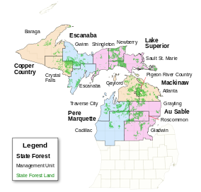
Location Upper Peninsula, Michigan
Coordinates 46°37′N 89°10′W / 46.62°N 89.16°W / 46.62; -89.16Coordinates: 46°37′N 89°10′W / 46.62°N 89.16°W / 46.62; -89.16
Governing body Michigan Department of Natural Resources

Copper Country State Forest is a state forest in the west-central Upper Peninsula of Michigan. It is operated by the Michigan Department of Natural Resources.

Like other Upper Peninsula state forests, Copper Country is made up of clear cut parcels of forest land in thinly settled portions of counties such as Baraga County and Dickinson County. The state of Michigan acquired these land parcels after they had been stripped of their old growth trees in the late 19th and early 20th centuries; today, the state manages the land for reforestation. In many cases, the second-growth trees that have sprouted throughout Copper Country land are pulpwood trees such as aspen and birch.[1]

In addition to pulpwood logging, the Copper Country land is valuable for active recreation, such as camping, fishing, and hunting. Many of the towns and cities of the Upper Peninsula have an active culture of whitetail deer hunting.

References

  1. ^ Michigan Atlas and Gazetteer (10th ed.). Yarmouth, Maine: DeLorme. 2002. 

External links


Wikimedia Foundation. 2010.

Игры ⚽ Поможем написать курсовую

Look at other dictionaries:

  • Copper Country — Map of the region. Miners …   Wikipedia

  • Copper Falls State Park — Coordinates: 46°22′35″N 90°38′36″W / 46.37639°N 90.64333°W / 46.37639; 90.64333 …   Wikipedia

  • Au Sable State Forest — IUCN Category VI (Managed Resource Protected Area) …   Wikipedia

  • State Parks in Michigan — Dies ist die Liste der State Parks im US Bundesstaat Michigan. Sie werden vom Michigan Department of Natural Resources jurisdiction betrieben, der zudem 14 State Harbors an den Große Seen unterhält. Fayette Historic State Park …   Deutsch Wikipedia

  • Northern Highland-American Legion State Forest — Coordinates: 46°2′54″N 89°39′16″W / 46.04833°N 89.65444°W / 46.04833; 89.65444 …   Wikipedia

  • List of Michigan state parks — Lake of the Clouds in Porcupine Mountains Wilderness State Park This is a list of Michigan state parks and related protected areas under Michigan Department of Natural Resources (DNR) jurisdiction. DNR also operates 16 state harbors on the Great… …   Wikipedia

  • List of Michigan state forests — The following is a list of state forests in the U.S. state of Michigan. The Michigan Department of Natural Resources manages the largest state forest system in the nation (3.9 million acres (16,000 km²)), administered by Forest, Mineral and Fire… …   Wikipedia

  • Copper mining in Michigan — While it originated thousands of years earlier, copper mining in Michigan became an important industry in the 19th and early 20th centuries. Its rise marked the start of copper mining as a major industry in the United States. Contents 1 Geology 2 …   Wikipedia

  • State House elections in Michigan, 2008 — Elections in Michigan Federal government Presidential Elections …   Wikipedia

  • Copper Hills High School — Location 5445 New Bingham Highway West Jordan, UT 84088 Information Type Public Motto A Full Spectrum of Educational Opportunities Established 1995 School district …   Wikipedia

Share the article and excerpts

Direct link
Do a right-click on the link above
and select “Copy Link”