- Dacula, Georgia
-
Dacula, Georgia — City — Location in Gwinnett County and the state of Georgia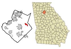
Coordinates: 33°59′15″N 83°53′31″W / 33.9875°N 83.89194°WCoordinates: 33°59′15″N 83°53′31″W / 33.9875°N 83.89194°W Country United States State Georgia County Gwinnett Area - Total 2.9 sq mi (7.5 km2) - Land 2.9 sq mi (7.5 km2) - Water 0 sq mi (0 km2) Elevation 1,050 ft (320 m) Population (2009) - Total 4,804 - Density 1,326.9/sq mi (513.1/km2) Time zone Eastern (EST) (UTC-5) - Summer (DST) EDT (UTC-4) ZIP code 30019 Area code(s) 770 FIPS code 13-21184[1] GNIS feature ID 0333990[2] Dacula is a city in Gwinnett County, Georgia, United States. The population was 4,804 at the 2009 census [3]
Contents
Geography
Dacula is located at 33°59′15″N 83°53′31″W / 33.9875°N 83.89194°W (33.987598, -83.891926)[4].
According to the United States Census Bureau, the downtown area has a total area of 2.9 square miles (7.5 km2), all of it land.
Demographics
Historical populations Census Pop. %± 1960 440 — 1970 782 77.7% 1980 1,577 101.7% 1990 2,217 40.6% 2000 3,848 73.6% 2010 4,442 15.4% As of 2010 Dacula had a population of 4,442. the median age was 35.2. There were 1,472 households with 92.0% of housing units occupied. The racial and ethnic composition of the population was 76.6% white (70.3% non-Hispanic white), 11.3% black or African American, 0.3% Native American, 0.4% Asian Indian, 2.8% other Asian, 0.1% Pacific Islander, 5.4% from some other race (0.1% non-Hispanic from some other race) and 3.1% from two or more races. 13.6% of the population was Hispanic or Latino.[5]
As of the census[1] of 2000, there were 3,848 people, 1,283 households, and 1,077 families residing in the city. The population density was 1,333.0 people per square mile (514.1/km²). There were 1,320 housing units at an average density of 456.9 per square mile (176.2/km²). The racial makeup of the city was 91.37% White, 4.24% African American, 0.34% Native American, 1.53% Asian, 0.03% Pacific Islander, 1.25% from other races, and 1.25% from two or more races. Hispanic or Latino of any race were 3.72% of the population.
There were 1,283 households out of which 44.3% had children under the age of 18 living with them, 68.9% were married couples living together, 11.1% had a female householder with no husband present, and 16.0% were non-families. 12.5% of all households were made up of individuals and 3.4% had someone living alone who was 65 years of age or older. The average household size was 3.00 and the average family size was 3.27.
In the city the population was spread out with 29.2% under the age of 18, 7.7% from 18 to 24, 36.9% from 25 to 44, 19.7% from 45 to 64, and 6.5% who were 65 years of age or older. The median age was 33 years. For every 100 females there were 96.2 males. For every 100 females age 18 and over, there were 91.0 males.
The median income for a household in the city was $57,525, and the median income for a family was $58,603. Males had a median income of $40,616 versus $27,380 for females. The per capita income for the city was $19,720. About 0.9% of families and 1.5% of the population were below the poverty line, including 1.0% of those under age 18 and 2.3% of those age 65 or over.
Dacula has experienced rapid growth recently, and with the addition of commercial businesses, commerce has exploded. A 2008 demographic study completed by the developers of the Dacula Town Center, showed the population has increased greatly. According to the study, the population is now 31,466 in a 3-mile radius around Dacula. The same survey reveals that in a 5-mile radius within the 30019 zipcode the population is 82,719.[6]
History
Dacula started its history near the town of Chinquapin Grove which was located where Dacula Elementary now stands. The town was originally named Hokeville after a Seaboard Airline Railway executive, but was changed due to the railroad's protest.. The city of Dacula has a storied and colorful history dating back to a shocking murder in the early 1920s of a father and son. Dacula is now more known for its large Memorial Day parade, professional and collegiate athletes, and Little Mulberry Park[citation needed]
Dacula's name comes from letters in Decatur and Atlanta,[7] two nearby cities that were already prospering at the time of Dacula's founding. The name "Dacula" is properly pronounced "duh-KYOO-luh".
The city was once home to a train station on a CSX line through Northeast Georgia, although the station closed back in the mid-1950s. The city has experienced immense growth from a small, one light town in the early to late 1980s, to now having nearly 10 public schools both from the Dacula and Mill Creek clusters of Gwinnett County Public Schools. It is also home to one of the largest Southern Baptist churches in the Southeast United States, Hebron Baptist Church, which recently finished construction of a 3,850 seat auditorium.
Linebacker Michael Boley of the Atlanta Falcons lives in Dacula.
Education
The county operates Gwinnett County Public Schools.
Gwinnett County Public Library operates the Dacula and Hamilton Mill Branch in a nearby unincorporated area.[8]
Media
Newspapers
References
- ^ a b "American FactFinder". United States Census Bureau. http://factfinder.census.gov. Retrieved 2008-01-31.
- ^ "US Board on Geographic Names". United States Geological Survey. 2007-10-25. http://geonames.usgs.gov. Retrieved 2008-01-31.
- ^ "Dacula city, Georgia". U.S. Census. http://factfinder.census.gov/servlet/SAFFPopulation?_event=Search&geo_id=01000US&_geoContext=01000US&_street=&_county=dacula&_cityTown=dacula&_state=04000US13&_zip=&_lang=en&_sse=on&ActiveGeoDiv=geoSelect&_useEV=&pctxt=fph&pgsl=010&_submenuId=population_0&ds_name=null&_ci_nbr=null&qr_name=null®=null:null&_keyword=&_industry=. Retrieved 2010-10-28.
- ^ "US Gazetteer files: 2010, 2000, and 1990". United States Census Bureau. 2011-02-12. http://www.census.gov/geo/www/gazetteer/gazette.html. Retrieved 2011-04-23.
- ^ 2010 profile of general population and housing characteristics of Dacula from the US Census
- ^ DemographicsNow.com
- ^ "Dacula". Gwinnett Chamber. http://www.gwinnettchamber.org/Dacula.dacula.0.html. Retrieved 2010-06-28.
- ^ "Hours & Locations." Gwinnett County Public Library. Retrieved on February 24, 2010.
External links
- City of Dacula
- Dacula Athletic Association
- Dacula High School
- DaculaWeather.com
- Harbins Elementary School
- Hebron Baptist Church
Municipalities and communities of Gwinnett County, Georgia County seat: Lawrenceville Cities Auburn‡ | Berkeley Lake | Buford‡ | Dacula | Duluth | Grayson | Lawrenceville | Lilburn | Loganville‡ | Norcross | Snellville | Sugar Hill | Suwanee

Towns Braselton‡ | Rest Haven‡
CDP Unincorporated
communitiesFootnotes ‡This populated place also has portions in an adjacent county or counties
Categories:- Cities in Georgia (U.S. state)
- Populated places in Gwinnett County, Georgia
- Atlanta metropolitan area


Wikimedia Foundation. 2010.