- Lāna'i City, Hawai'i
Infobox Settlement
official_name = Lanai City, Hawaii
other_name =
native_name =
nickname =
settlement_type = CDP
motto =
imagesize =
image_caption =
flag_size =
image_
seal_size =
image_shield =
shield_size =
image_blank_emblem =
blank_emblem_type =
blank_emblem_size =
imagesize =
image_caption =
flag_size =
image_
seal_size =
image_shield =
shield_size =
image_blank_emblem =
blank_emblem_type =
blank_emblem_size =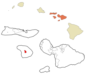
mapsize =
map_caption = Location in Maui County and the state ofHawaii
mapsize1 =
map_caption1 =
image_dot_
dot_mapsize =
dot_map_caption =
dot_x =
dot_y =
pushpin_
pushpin_label_position =
pushpin_map_caption =
pushpin_mapsize =
subdivision_type = Country
subdivision_name =United States
subdivision_type1 = State
subdivision_name1 =Hawaii
subdivision_type2 = County
subdivision_name2 = Maui
subdivision_type3 =
subdivision_name3 =
subdivision_type4 =
subdivision_name4 =
government_footnotes =
government_type =
leader_title =
leader_name =
leader_title1 =
leader_name1 =
leader_title2 =
leader_name2 =
leader_title3 =
leader_name3 =
leader_title4 =
leader_name4 =
established_title =
established_date =
established_title2 =
established_date2 =
established_title3 =
established_date3 =
area_magnitude =
unit_pref = Imperial
area_footnotes =
area_total_km2 = 9.3
area_land_km2 = 9.3
area_water_km2 = 0.0
area_total_sq_mi = 3.6
area_land_sq_mi = 3.6
area_water_sq_mi = 0.0
area_water_percent =
area_urban_km2 =
area_urban_sq_mi =
area_metro_km2 =
area_metro_sq_mi =
area_blank1_title =
area_blank1_km2 =
area_blank1_sq_mi =
population_as_of = 2000
population_footnotes =
population_note =
population_total = 3164
population_density_km2 = 341.9
population_density_sq_mi = 885.5
population_metro =
population_density_metro_km2 =
population_density_metro_sq_mi =
population_urban =
population_density_urban_km2 =
population_density_urban_sq_mi =
population_blank1_title =
population_blank1 =
population_density_blank1_km2 =
population_density_blank1_sq_mi =
timezone = Hawaii-Aleutian
utc_offset = -10
timezone_DST =
utc_offset_DST =
latd = 20
latm = 49
lats = 39
latNS = N
longd = 156
longm = 55
longs = 19
longEW = W
elevation_footnotes =
elevation_m = 501
elevation_ft = 1644
postal_code_type =ZIP code
postal_code = 96763
area_code = 808
blank_name = FIPS code
blank_info = 15-43700
blank1_name = GNIS feature ID
blank1_info = 0361713
website =
footnotes = Lānaokinai City is acensus-designated place (CDP) on the island of Lānaokinai, in Maui County, Hawaiokinai,United States . The population was 3,164 at the 2000 census. Because of the island of Lanai's small population, Lānaʻi City function as the island's main commerce and business area. Many of the island's restaurants and shops can be found in the town square that surrounds Dole Park.Geography
Lānaokinai City is located at coor dms|20|49|39|N|156|55|19|W|city (20.827574, -156.921912)GR|1.
According to the
United States Census Bureau , the CDP has a total area of 3.6square mile s (9.2km² ), all of it land.Demographics
As of the
census GR|2 of 2000, there were 3,164 people, 1,148 households, and 796 families residing in the CDP. Thepopulation density was 885.5 people per square mile (342.2/km²). There were 1,343 housing units at an average density of 375.9/sq mi (145.2/km²). The racial makeup of the CDP was 13.24% White, 0.13% African American, 0.38% Native American, 58.09% Asian, 7.02% Pacific Islander, 0.32% from other races, and 20.83% from two or more races. Hispanic or Latino of any race were 7.74% of the population.There were 1,148 households out of which 34.9% had children under the age of 18 living with them, 53.7% were married couples living together, 9.9% had a female householder with no husband present, and 30.6% were non-families. 25.7% of all households were made up of individuals and 8.8% had someone living alone who was 65 years of age or older. The average household size was 2.75 and the average family size was 3.33.
In the CDP the population was spread out with 28.0% under the age of 18, 7.9% from 18 to 24, 28.3% from 25 to 44, 21.4% from 45 to 64, and 14.4% who were 65 years of age or older. The median age was 35 years. For every 100 females there were 101.4 males. For every 100 females age 18 and over, there were 100.6 males.
The median income for a household in the CDP was $43,271, and the median income for a family was $49,209. Males had a median income of $29,800 versus $27,065 for females. The
per capita income for the CDP was $18,668. About 8.5% of families and 9.5% of the population were below thepoverty line , including 7.2% of those under age 18 and 11.9% of those age 65 or over.References
External links
Wikimedia Foundation. 2010.