- New Meadows, Idaho
-
New Meadows, Idaho — City — PIN Railroad Depot Location in Adams County and the state of Idaho
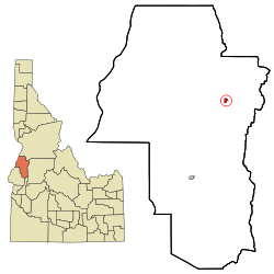
Coordinates: 44°58′13″N 116°17′7″W / 44.97028°N 116.28528°WCoordinates: 44°58′13″N 116°17′7″W / 44.97028°N 116.28528°W Country United States State Idaho County Adams Area – Total 0.5 sq mi (1.3 km2) – Land 0.5 sq mi (1.3 km2) – Water 0.0 sq mi (0.0 km2) Elevation 3,868 ft (1,179 m) Population (2010) – Total 496 – Density 1,089.1/sq mi (420.5/km2) Time zone Mountain (MST) (UTC-7) – Summer (DST) MDT (UTC-6) ZIP code 83654 Area code(s) 208 FIPS code 16-56890 GNIS feature ID 0387535 Website newmeadowsidaho.org New Meadows is a rural city in Adams County, Idaho, United States, at the southern and upper end of the Meadows Valley, on the Little Salmon River. Located in the west central part of the state, just south of the 45th parallel north, the population was 496 at the 2010 census. New Meadows is located at the junction of the primary north-south highway in the state, U.S. Route 95, and State Highway 55, which connects it with McCall and Boise.
Contents
History
The city of New Meadows hosts the last surviving Pacific and Idaho Northern (PIN) Railroad Depot. Without the Pacific and Idaho Northern Railroad, New Meadows would arguably not have existed. The PIN Railroad ran from Weiser to an area about two miles from Meadows, thus creating the site of modern day New Meadows, founded in 1911.
The railroad depot was built in 1910 and served as the northern end of the PIN Railroad. It is a significant cultural and historical resource, located in the Payette River Scenic Byway corridor in the city of New Meadows, at the junction of US-95 and state highway 55. It is listed on the National Register of Historic places.[1] The depot is an asset for the community of New Meadows and currently functions as a community center for the local area. It hosted the Barn Again! Smithsonian Institution traveling exhibition in 2005,[2] and represents early twentieth century efforts to create a north-south railroad for Idaho. Though the efforts ultimately failed, the PIN Railroad served an important function as a “farm-to-market” railroad until 1940, and then as a timber railroad for local timber outfits.
The Union Pacific acquired the line in 1936 and in 1979 abandoned the northern end of the line, from the Tamarack sawmill site north of Council to New Meadows, along US-95. The depot was a functioning facility until 1972. In 1978, ACHS acquired the title to the PIN Depot to preserve it as a repository for the history of Adams County.[3] Since 2000, the building has been preserved from immediate deterioration. The foundation has been restored and the building now has a new roof.
Education
The only school in New Meadows is the Meadows Valley School, which houses all thirteen grades, K-12. The school mascot is the mountaineer, and the school colors are orange and black.[4]
Recreation
Two established alpine ski areas, Brundage Mountain and the Little Ski Hill are less than ten miles (16 km) to the east, both on the west side of the Valley/Adams county line. The challenging Meadows Creek golf course (originally "Kimberland Meadows") is a few miles northwest of town. Payette Lake and the surrounding areas in McCall offer numerous recreational opportunities, and further north along US-95 is Riggins, the gateway to the Salmon River and the Seven Devils Mountains.
Highways
 - U.S. Route 95
 SH-55 - Payette River Scenic Byway
New Meadows is approximately 115 miles (185 km) north of Boise, accessed via State Highway 55, the Payette River Scenic Byway, a designated national scenic byway. It heads north from Eagle in Ada County to Horseshoe Bend in Boise County, and climbs the whitewater of the Payette River to Cascade and McCall in Valley County. The route turns west at Payette Lake in McCall and ends at New Meadows at the junction with U.S. Route 95.[5]
Geography
New Meadows is located at 44°58′13″N 116°17′7″W / 44.97028°N 116.28528°W (44.970405, -116.285283),[6] at an altitude of 3,868 feet (1,179 m).[7]
According to the United States Census Bureau, the city has a total area of 0.5 square miles (1.3 km2), all of it land.
Demographics
As of the census[8] of 2000, there were 533 people, 208 households, and 143 families residing in the city. The population density was 1,089.1 people per square mile (420.0/km²). There were 262 housing units at an average density of 535.4 per square mile (206.4/km²). The racial makeup of the city was 97.19% White, 0.19% African American, 1.31% Native American, 0.38% from other races, and 0.94% from two or more races. Hispanic or Latino of any race were 0.75% of the population.
Historical populations Census Pop. %± 1920 141 — 1930 220 56.0% 1940 264 20.0% 1950 621 135.2% 1960 647 4.2% 1970 605 −6.5% 1980 576 −4.8% 1990 534 −7.3% 2000 533 −0.2% 2010 496 −6.9% source:[9][10] There were 208 households out of which 34.6% had children under the age of 18 living with them, 57.7% were married couples living together, 7.7% had a female householder with no husband present, and 30.8% were non-families. 24.5% of all households were made up of individuals and 7.2% had someone living alone who was 65 years of age or older. The average household size was 2.56 and the average family size was 3.08.
In the city the population was spread out with 29.1% under the age of 18, 6.2% from 18 to 24, 30.8% from 25 to 44, 24.0% from 45 to 64, and 9.9% who were 65 years of age or older. The median age was 36 years. For every 100 females there were 159.5 males. For every 100 females age 18 and over, there were 140.1 males.
The median income for a household in the city was $28,500, and the median income for a family was $31,042. Males had a median income of $30,000 versus $14,500 for females. The per capita income for the city was $11,884. About 16.2% of families and 16.4% of the population were below the poverty line, including 14.8% of those under age 18 and 5.0% of those age 65 or over.
References
- ^ "National Register Information System". National Register of Historic Places. National Park Service. 2009-03-13. http://nrhp.focus.nps.gov/natreg/docs/All_Data.html.
- ^ http://www.museumonmainstreet.org/past_partners/Idaho_partners.htm
- ^ "Idaho for the Curious", by Cort Conley, ©1982, ISBN 0-9603566-3-0, p.580-584
- ^ Meadows Valley School - accessed 2009-05-18
- ^ Idaho Byways - Payette River Scenic Byway - accessed 2009-05-18
- ^ "US Gazetteer files: 2010, 2000, and 1990". United States Census Bureau. 2011-02-12. http://www.census.gov/geo/www/gazetteer/gazette.html. Retrieved 2011-04-23.
- ^ U.S. Geological Survey Geographic Names Information System: New Meadows, Idaho
- ^ "American FactFinder". United States Census Bureau. http://factfinder.census.gov. Retrieved 2008-01-31.
- ^ Moffatt, Riley. Population History of Western U.S. Cities & Towns, 1850-1990. Lanham: Scarecrow, 1996, 96.
- ^ "Subcounty population estimates: Idaho 2000-2007" (CSV). United States Census Bureau, Population Division. 2009-03-18. http://www.census.gov/popest/cities/files/SUB-EST2007-16.csv. Retrieved 2009-04-28.
External links
- City of New Meadows website
- Meadows Valley Chamber of Commerce
- Southwest Idaho Travel Association - New Meadows
Municipalities and communities of Adams County, Idaho Cities Council | New Meadows

Unincorporated
communitiesIndian Valley | Mesa
Categories:- Populated places in Adams County, Idaho
- Cities in Idaho


Wikimedia Foundation. 2010.