- Ririe, Idaho
Infobox Settlement
official_name = Ririe, Idaho
other_name =
native_name =
nickname =
settlement_type =City
motto =
imagesize =
image_caption =
flag_size =
image_
seal_size =
image_shield =
shield_size =
image_blank_emblem =
blank_emblem_type =
blank_emblem_size =
imagesize =
image_caption =
flag_size =
image_
seal_size =
image_shield =
shield_size =
image_blank_emblem =
blank_emblem_type =
blank_emblem_size =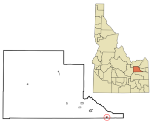
mapsize =
map_caption = Location in Jefferson County and the state ofIdaho
mapsize1 =
map_caption1 =
image_dot_
dot_mapsize =
dot_map_caption =
dot_x =
dot_y =
pushpin_
pushpin_label_position =
pushpin_map_caption =
pushpin_mapsize =
subdivision_type = Country
subdivision_name =United States
subdivision_type1 = State
subdivision_name1 =Idaho
subdivision_type2 = Counties
subdivision_name2 = Jefferson, Bonneville
subdivision_type3 =
subdivision_name3 =
subdivision_type4 =
subdivision_name4 =
government_footnotes =
government_type =
leader_title =
leader_name =
leader_title1 =
leader_name1 =
leader_title2 =
leader_name2 =
leader_title3 =
leader_name3 =
leader_title4 =
leader_name4 =
established_title =
established_date =
established_title2 =
established_date2 =
established_title3 =
established_date3 =
area_magnitude =
unit_pref = Imperial
area_footnotes =
area_total_km2 = 0.8
area_land_km2 = 0.8
area_water_km2 = 0.0
area_total_sq_mi = 0.3
area_land_sq_mi = 0.3
area_water_sq_mi = 0.0
area_water_percent =
area_urban_km2 =
area_urban_sq_mi =
area_metro_km2 =
area_metro_sq_mi =
area_blank1_title =
area_blank1_km2 =
area_blank1_sq_mi =
population_as_of = 2000
population_footnotes =
population_note =
population_total = 545
population_density_km2 = 721.8
population_density_sq_mi = 1869.5
population_metro =
population_density_metro_km2 =
population_density_metro_sq_mi =
population_urban =
population_density_urban_km2 =
population_density_urban_sq_mi =
population_blank1_title =
population_blank1 =
population_density_blank1_km2 =
population_density_blank1_sq_mi =
timezone = Mountain (MST)
utc_offset = -7
timezone_DST = MDT
utc_offset_DST = -6
latd = 43
latm = 37
lats = 48
latNS = N
longd = 111
longm = 46
longs = 23
longEW = W
elevation_footnotes =
elevation_m = 1513
elevation_ft = 4964
postal_code_type =ZIP code
postal_code = 83443
area_code = 208
blank_name = FIPS code
blank_info = 16-67960
blank1_name = GNIS feature ID
blank1_info = 0398047
website =
footnotes = Ririe is a city in Jefferson and Bonneville Counties (mostly Jefferson) in the eastern part of theU.S. state ofIdaho . It is part of theIdaho Falls, Idaho Metropolitan Statistical Area. The population was 545 at the 2000 census.History
The city of Ririe was named for its first homesteader,
David Ririe . A Utah resident, Ririe settled in the area in 1888, and began cultivating a small claim of land. In 1891, Joseph Lovell and his family settled on an adjoining area and began farming. That winter, however, Joseph died of illness, leaving his family alone and isolated. David Ririe helped the widowed family to establish their farm, and eventually married one of the Lovell daughters, Leah Ann. The families flourished in the area, and David eventually built a large stone home to house his large family, which stands today. As more residents settled in the area, the common need for schools and churches help foster a community. However, Ririe was truly established in 1914, when therailroad was routed through the city as a way to transport crops. The small community of Shelton was absorbed by Ririe, but several prominent buildings and sites continue to bear the previous name, such as the Shelton Cemetery.Geography
Ririe is located at coor dms|43|37|48|N|111|46|23|W|city (43.629998, -111.773012)GR|1.
According to the
United States Census Bureau , the city has a total area of 0.3square mile s (0.8km² ), all of it land.Culture
The economy of Ririe and the surrounding area is largely dependent on
farming . The major crops are wheat, barley, alfalfa, andpotatoes . In fact, up until recently, during the annual potato harvest season in September, school was let out for 2 weeks for "Spud vacation," allowing teenagers to help out in the labor-intensive work. The large majority of the city either farms their own land or works in some aspect of farm support, such as supplying farm equipment or coordinating crop buyers. In addition to farming, a large number of residents work at theIdaho National Laboratory (a.k.a. the Site), a regional division of the Department of Energy that focuses onnuclear energy and security technology.Ririe is equidistant from two relatively larger cities--Idaho Falls and Rexburg, and the Jefferson
county seat in Rigby, all about a half-hour away. These communities provide Ririe easy access to shopping, restaurants, entertainment, and other city amenities. Because of its unique location and small size, Ririe has been turned into a functional suburb, with little retail commerce of its own. There have been several business startup attempts in the city, most failing within the first year. The several small-town businesses that have succeeded are loyally supported, including 3 gas stations, 2 convenience stores, a bank, 1 auto parts store, and 2 bars. Ririe also has its own community fire station, associated with Central Fire District, which provides volunteer EMS and fire-fighting to the area.The community does have an independent school system, consisting of a Ririe Elementary School, Ririe Middle School, and
Ririe High School . The city also includes a post office, senior citizen community center, community library, city park, and city cemetery.The predominant religion,
The Church of Jesus Christ of Latter-day Saints , is ubiquitous in city culture. The overwhelming majority of the city count themselves as membersFact|date=July 2008, and two large church buildings serve as centers for many community activities. There is also a smallLutheran parish in the community with a handful of loyal members.Based in the heart of the
Rocky Mountains and on the edge of theSnake River , a large number of outdoor activities are available, including snowmobiling, hiking, skiing, snowboarding, hunting, and fishing.Heise Hot Springs , a local pool, provides year-round swimming.Kelly Canyon , a small ski resort with 4 chairlifts, offers day and night skiing in the winter.Demographics
As of the
census GR|2 of 2000, there were 545 people, 191 households, and 131 families residing in the city. Thepopulation density was 1,869.5 people per square mile (725.6/km²). There were 211 housing units at an average density of 723.8/sq mi (280.9/km²). The racial makeup of the city was 93.76% White, 0.73% Native American, 4.59% from other races, and 0.92% from two or more races. Hispanic or Latino of any race were 8.62% of the population.There were 191 households out of which 42.4% had children under the age of 18 living with them, 53.4% were married couples living together, 9.4% had a female householder with no husband present, and 31.4% were non-families. 27.7% of all households were made up of individuals and 16.2% had someone living alone who was 65 years of age or older. The average household size was 2.85 and the average family size was 3.60.
In the city the population was spread out with 36.3% under the age of 18, 10.3% from 18 to 24, 26.1% from 25 to 44, 16.0% from 45 to 64, and 11.4% who were 65 years of age or older. The median age was 28 years. For every 100 females there were 94.0 males. For every 100 females age 18 and over, there were 90.7 males.
The median income for a household in the city was $27,019, and the median income for a family was $30,000. Males had a median income of $26,250 versus $17,727 for females. The
per capita income for the city was $10,578. About 12.7% of families and 16.0% of the population were below thepoverty line , including 14.9% of those under age 18 and 16.0% of those age 65 or over.References
External links
* [http://www.ririe.org/ Ririe genealogical site]
* [http://www.bonnevilleheritage.org/resources/power_points/WelcometoRirie_files/frame.htm Ririe history and trivia]
* [http://www.archive.org/download/usgs_drg_id_43111_f7/o43111f7.tif Map of Ririe from the Libre Map Project (3.82 MB)]
Wikimedia Foundation. 2010.