- Clent
-
Coordinates: 52°24′55″N 2°06′50″W / 52.415178°N 2.113967°W
Clent 
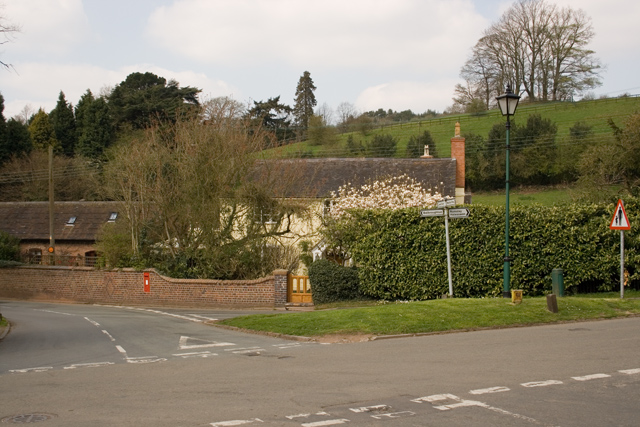
The village green next to the parish church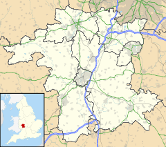
 Clent
Clent
Clent shown within WorcestershirePopulation 2,600 - London 105 miles (170 kilometres) Parish Clent District Bromsgrove Shire county Worcestershire Region West Midlands Country England Sovereign state United Kingdom Post town Stourbridge Postcode district DY9 Dialling code 01562 Police West Mercia Fire Hereford and Worcester Ambulance West Midlands EU Parliament West Midlands UK Parliament Bromsgrove List of places: UK • England • Worcestershire Clent is a village and civil parish in the Bromsgrove District of Worcestershire, England, southwest of Birmingham and close to the edge of the West Midlands conurbation. At the 2001 census it had a population of 2,600. [1]
The parishes of Clent and Broome were once an exclave of Staffordshire, completely surrounded by Worcestershire, having been seized by the Sheriff of Staffordshire before the Norman Conquest. This anomaly was addressed in 1844 when it was belatedly returned to Worcestershire. Clent had however always remained part of the Worcester Diocese.
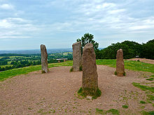 The four stones or "Ossian's Tomb" on the top of the Clent Hills were follies erected by George Lyttelton, 1st Baron Lyttelton
Because of the hilly topography of the parish the village consists of several distinct hamlets. These are Upper Clent (around the parish church of St. Leonard and Clatterbach), Lower Clent, Holy Cross, Adams Hill and Walton Pool.[2]
The Civil Parish of Clent also includes part of the village of West Hagley, the population of which is about half that of the whole parish. Though in the ancient ecclesiastical parish of Clent, that area is now part of the Anglican parish of Broome.
Part of the parish is an area of agricultural lowland, but to the northwest the ground rises forming the Clent Hills (now owned by the National Trust), which is a popular destination for walkers.
Sunfield Children's Home is located in Clent, a charitable school for children with autism and complex learning needs.[3] There is also a small primary school located in Holy Cross, called Clent Parochial Primary School, with just over 100 pupils ranging from Reception (age 4) to Year 6 (age 11), after which the pupils feed into Haybridge High School, the local secondary school, in the neighbouring village of Hagley.[4]
Notable residents of Clent include barrister Alan Todd and cricketers Richard Fowler and James Higgs-Walker.
References
Further reading
External links
Towns Villages Alvechurch • Aston Fields • Barnt Green • Belbroughton • Bell End • Beoley • Blackwell • Bordesley • Bournheath • Burcot • Catshill • Clent • Charford • Cofton Hackett • Dodford • Fairfield • Finstall • Frankley • Hagley • Hollywood • Holt End • Holy Cross • Hopwood • Hunnington • Lickey • Lickey End • Marlbrook • Romsley • Rowney Green • Rubery • Sidemoor • Stoke Heath • Stoke Prior • Tardebigge • Tutnall • Upper Bentley • WythallCivil Parishes Categories:- Villages in Worcestershire
- Worcestershire geography stubs


Wikimedia Foundation. 2010.