- Midhirst
-
Not to be confused with Midhurst, the town in West Sussex, England.
Midhirst 
 Midhirst
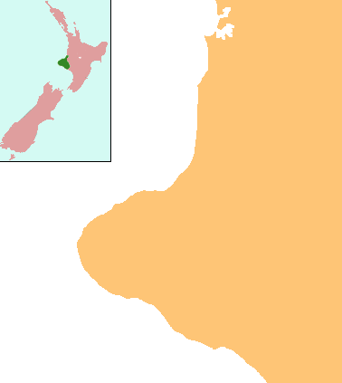
Coordinates: 39°17′36″S 174°15′59″E / 39.29333°S 174.26639°E Country New Zealand Region Taranaki District Stratford District Population (2006) – Total 225 Midhirst is a small village in Taranaki, New Zealand, approximately 4 km north of Stratford, on State Highway 3. Inglewood is 17 km (11 mi) north of Midhirst, and New Plymouth is 35 km (22 mi) to the northwest.[1][2]
According to the 2006 census, the total population of Midhirst is 225, down 21 on the 2001 census.[3] Midhirst is home to Midhirst School, the Midhirst Tavern, and a number of other local businesses.
Contents
Education
Midhirst School is a coeducational full primary (years 1-8) school with a decile rating of 6 and a roll of 84.[4] The school was founded in 1880.[5]
Notes
- ^ Peter Dowling (editor) (2004), Reed New Zealand Atlas, Reed Books, pp. map 34, ISBN 0-7900-0952-8
- ^ Roger Smith, GeographX (2005), The Geographic Atlas of New Zealand, Robbie Burton, pp. map 85, ISBN 1-877333-20-4
- ^ Quickstats about Midhirst
- ^ Te Kete Ipurangi - Midhirst School, Ministry of Education, http://www.tki.org.nz/e/schools/display_school_info.php?school_id=2198
- ^ "Midhirst School 125th Jubilee" ([dead link] – Scholar search), Education Gazette New Zealand 83 (17), 13 September 2004, http://www.edgazette.govt.nz/notices.php/notices.php?action=view&id=60365
External links
Further reading
General historical works
-
- Alsop, Nancy et al. (1981), Midhirst School and districts centennial, 1880-1980, Midhirst, [N.Z.] ; Stratford, [N.Z.]: Jubilee Committee ; Stratford Press
- Youngman, Reeve (1965), Perhaps-ies: early days Canterbury and Taranaki, Mt. Maunganui, [N.Z.] ; Hastings, [N.Z.]: R. Youngman ; Hart Printing
Business history
-
- Midhirst Dairy Company, 1895-1945, : Midhirst, [N.Z.]: Midhirst Co-operative Dairy Factory Company, 1945
- Midhirst Dairy Company, 1895-1970, : Midhirst, [N.Z.]: n.p., 1970
Maps
-
- New Zealand Minimaps Ltd. (2000), Kiwi minimap New Plymouth, 20 Taranaki towns & district map: includes: Eltham, Hawera, Inglewood, Kaponga, Lepperton, Manaia, Midhirst, Mokau, Normanby, Oakura, Ohawe Beach, Okato, Onaero, Opunake, Patea, Rahotu, Stratford, Urenui, Waitara, Waitotara & Waverley. (4th ed.), Christchurch, [N.Z.]: Minimaps Ltd.
NOTE: Scale = 1:35,000 and 1:275,000
-
- New Zealand Minimaps Ltd. (2001), Kiwi minimap New Plymouth, 20 Taranaki towns & district map: includes: Eltham, Hawera, Inglewood, Kaponga, Lepperton, Manaia, Midhirst, Mokau, Normanby, Oakura, Ohawe Beach, Okato, Onaero, Opunake, Patea, Rahotu, Stratford, Urenui, Waitara, Waitotara & Waverley. (5th ed.), Christchurch, [N.Z.]: Minimaps Ltd.
NOTE: Scale = 1:35,000 and 1:275,000
Schools
-
- Midhirst School: 75th anniversary 1880-1955; jubilee celebrations, October 22nd, 23rd and 24th, 1955, n.p.: n.p., n.d.
- Alsop, Nancy et al. (1981), Midhirst School and districts centennial, 1880-1980, Midhirst, [N.Z.] ; Stratford, [N.Z.]: Jubilee Committee ; Stratford Press
Coordinates: 39°18′S 174°16′E / 39.3°S 174.267°E
Categories:- Populated places in New Zealand
- Stratford District
- Taranaki Region geography stubs
Wikimedia Foundation. 2010.