- Mount Aetna, Maryland
-
For the Mount Aetna summit in the Maryland Savage River State Forest, see Savage Mountain.
Mount Aetna, Maryland — CDP — Location of Mount Aetna, Maryland
Coordinates: 39°36′10″N 77°36′49″W / 39.60278°N 77.61361°WCoordinates: 39°36′10″N 77°36′49″W / 39.60278°N 77.61361°W Country United States State Maryland County Washington Area – Total 3.9 sq mi (10.1 km2) – Land 3.9 sq mi (10.1 km2) – Water 0.0 sq mi (0.0 km2) Elevation 535 ft (163 m) Population (2000) – Total 838 – Density 215.5/sq mi (83.2/km2) Time zone Eastern (EST) (UTC-5) – Summer (DST) EDT (UTC-4) FIPS code 24-53750 GNIS feature ID 0590831 Mount Aetna is a census-designated place (CDP) in Washington County, Maryland, United States. The population was 838 at the 2000 census.
Contents
Geography
Mount Aetna is located at 39°36′10″N 77°36′49″W / 39.60278°N 77.61361°W (39.602673, -77.613496)[1].
According to the United States Census Bureau, the CDP has a total area of 3.9 square miles (10 km2), all of it land.
The community is situated at the eastern base of South Mountain at elevations between 500-700'; the landscape here is principally underlain by the Tomstown Dolomite, and the neighboring area is home to at least four known solutional caves, one of which—Mount Aetna Cave—was open briefly for commercial tours in the 1930s.[2] This region is drained by Mount Aetna Creek, which has at least three headwaters in the neighboring mountain, and is a tributary of Beaver Creek.[3]
Demographics
Historical populations Census Pop. %± 1990 3,608 — 2000 838 −76.8% source: [4][5] As of the census[6] of 2000, there were 838 people, 286 households, and 233 families residing in the CDP. The population density was 215.5 people per square mile (83.2/km²). There were 292 housing units at an average density of 75.1/sq mi (29.0/km²). The racial makeup of the CDP was 95.94% White, 1.07% African American, 0.36% Native American, 1.55% Asian, 0.84% from other races, and 0.24% from two or more races. Hispanic or Latino of any race were 2.39% of the population.
There were 286 households out of which 35.3% had children under the age of 18 living with them, 73.4% were married couples living together, 4.5% had a female householder with no husband present, and 18.5% were non-families. 12.2% of all households were made up of individuals and 4.5% had someone living alone who was 65 years of age or older. The average household size was 2.88 and the average family size was 3.13.
In the CDP the population was spread out with 27.7% under the age of 18, 6.4% from 18 to 24, 30.0% from 25 to 44, 27.7% from 45 to 64, and 8.2% who were 65 years of age or older. The median age was 38 years. For every 100 females there were 102.4 males. For every 100 females age 18 and over, there were 95.5 males.
The median income for a household in the CDP was $48,523, and the median income for a family was $52,344. Males had a median income of $40,750 versus $31,250 for females. The per capita income for the CDP was $21,435. About 3.0% of families and 4.0% of the population were below the poverty line, including none of those under the age of eighteen or sixty-five or over.
Community
The area is traditionally defined as lying along the road of the same name, between MD Route 66 and Crystal Falls Road. Mount Aetna is home to a Seventh-day Adventist community and a private school of the same denomination, Highland View Academy, founded in 1949. There is also a volunteer fire company and a scout camp. There was once a small convenience market featuring vegetarian goods, but now the only food store in the community is located on the academy grounds.[7]
References
- ^ "US Gazetteer files: 2010, 2000, and 1990". United States Census Bureau. 2011-02-12. http://www.census.gov/geo/www/gazetteer/gazette.html. Retrieved 2011-04-23.
- ^ Caves of Maryland; Franz/Slifer, 1971
- ^ USGS Myserville Topographic Quadrangle, 1994
- ^ "CENSUS OF POPULATION AND HOUSING (1790-2000)". U.S. Census Bureau. http://www.census.gov/prod/www/abs/decennial/index.html. Retrieved 2010-07-17.
- ^ Most of the census area in 1990 is now in Robinwood.
- ^ "American FactFinder". United States Census Bureau. http://factfinder.census.gov. Retrieved 2008-01-31.
- ^ Highland View Academy website
Municipalities and communities of Washington County, Maryland City 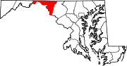
Towns Boonsboro | Clear Spring | Funkstown | Hancock | Keedysville | Sharpsburg | Smithsburg | Williamsport
CDPs Cavetown | Chewsville | Fort Ritchie | Fountainhead-Orchard Hills | Halfway | Highfield-Cascade | Leitersburg | Maugansville | Mount Aetna | Mount Lena | Paramount-Long Meadow | Robinwood | Rohrersville | St. James | San Mar | Wilson-Conococheague
Other
communitiesAntietam | Beaver Creek | Benevola | Big Pool | Broadfording | Brownsville | Burtner | Cearfoss | Cedar Grove | Dargan | Downsville | Eakles Mills | Fairplay | Fairview | Gapland | Huyett | Indian Springs | Jugtown | Mapleville | Mercersville | Park Hall | Pecktonville | Pen Mar | Pinesburg | Ringgold | Samples Manor | Sandy Hook | Spielman | Trego | Van Lear | Weverton | Woodmont
Categories:- Populated places in Washington County, Maryland
- Census-designated places in Maryland


Wikimedia Foundation. 2010.