- Mannings Heath
-
Coordinates: 51°02′42″N 0°16′59″W / 51.04504°N 0.28317°W
Mannings Heath 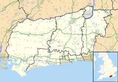
 Mannings Heath
Mannings Heath shown within West SussexOS grid reference TQ204287 Parish Nuthurst District Horsham Shire county West Sussex Region South East Country England Sovereign state United Kingdom Post town HORSHAM Postcode district RH13 Dialling code 01403 Police Sussex Fire West Sussex Ambulance South East Coast EU Parliament South East England UK Parliament Horsham List of places: UK • England • West Sussex Mannings Heath is a village in the Horsham District of West Sussex, England, on the A281 a few miles south-east of the town of Horsham[1]. It lies in the civil parish of Nuthurst.
Mannings Heath has an Anglican church dedicated to The Good Shepherd, built in 1845, a pub, the Dun Horse Inn and golf course (Mannings Heath Golf Club).
The village experienced a period of expansion after 1945, but development of the local area has been sympathetic to the original character of the village[1]. Several 17th-century buildings and a few 18th-century buildings survive.
Notable inhabitants
Other notable inhabitants include Norman Tebbit, Baron Tebbit of Chingford (a Cabinet minister in the Thatcher government), and famous television and film actor Peter Vaughan with his actress wife, Lilias Walker.
References
- ^ a b "Nuthurst". british-history.ac.uk. http://www.british-history.ac.uk/report.aspx?compid=18426. Retrieved 2010-01-20.
External links
 Media related to Mannings Heath at Wikimedia CommonsCategories:
- Horsham
- Villages in West Sussex
- West Sussex geography stubs

Wikimedia Foundation. 2010.