- Gulf Park Estates, Mississippi
Infobox Settlement
official_name = Gulf Park Estates, Mississippi
settlement_type = CDP
nickname =
motto =
imagesize =
image_caption =
image_
imagesize =
image_caption =
image_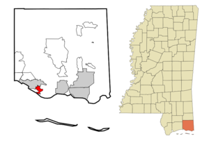
mapsize = 250px
map_caption = Location of Gulf Park Estates, Mississippi
mapsize1 =
map_caption1 =subdivision_type = Country
subdivision_name =United States
subdivision_type1 = State
subdivision_name1 =Mississippi
subdivision_type2 = County
subdivision_name2 = Jackson
government_footnotes =
government_type =
leader_title =
leader_name =
leader_title1 =
leader_name1 =
established_title =
established_date =unit_pref = Imperial
area_footnotes =area_magnitude =
area_total_km2 = 7.2
area_land_km2 = 6.9
area_water_km2 = 0.3
area_total_sq_mi = 2.8
area_land_sq_mi = 2.7
area_water_sq_mi = 0.1population_as_of = 2000
population_footnotes =
population_total = 4272
population_density_km2 = 621.7
population_density_sq_mi = 1610.1timezone = Central (CST)
utc_offset = -6
timezone_DST = CDT
utc_offset_DST = -5
elevation_footnotes =
elevation_m = 5
elevation_ft = 16
latd = 30 |latm = 22 |lats = 37 |latNS = N
longd = 88 |longm = 45 |longs = 38 |longEW = Wpostal_code_type =
ZIP code
postal_code = 39564
area_code = 228
blank_name = FIPS code
blank_info = 28-29660
blank1_name = GNIS feature ID
blank1_info = 0689021
website =
footnotes =Gulf Park Estates is a
census-designated place (CDP) in Jackson County,Mississippi ,United States . It is part of thePascagoula, Mississippi Metropolitan Statistical Area. The population was 4,272 at the 2000 census.Geography
Gulf Park Estates is located at coor dms|30|22|37|N|88|45|38|W|city (30.376932, -88.760579)GR|1.
According to the
United States Census Bureau , the CDP has a total area of 2.8square mile s (7.2km² ), of which, 2.7 square miles (6.9 km²) of it is land and 0.1 square miles (0.3 km²) of it (4.66%) is water.Demographics
As of the
census GR|2 of 2000, there were 4,272 people, 1,537 households, and 1,188 families residing in the CDP. Thepopulation density was 1,610.1 people per square mile (622.4/km²). There were 1,624 housing units at an average density of 612.1/sq mi (236.6/km²). The racial makeup of the CDP was 91.90% White, 3.60% African American, 0.37% Native American, 1.54% Asian, 0.02% Pacific Islander, 0.75% from other races, and 1.80% from two or more races. Hispanic or Latino of any race were 2.29% of the population.There were 1,537 households out of which 44.4% had children under the age of 18 living with them, 62.6% were married couples living together, 10.5% had a female householder with no husband present, and 22.7% were non-families. 17.0% of all households were made up of individuals and 2.7% had someone living alone who was 65 years of age or older. The average household size was 2.78 and the average family size was 3.14.
In the CDP the population was spread out with 30.2% under the age of 18, 8.0% from 18 to 24, 36.4% from 25 to 44, 19.7% from 45 to 64, and 5.8% who were 65 years of age or older. The median age was 34 years. For every 100 females there were 98.6 males. For every 100 females age 18 and over, there were 97.1 males.
The median income for a household in the CDP was $47,647, and the median income for a family was $49,211. Males had a median income of $32,138 versus $26,503 for females. The
per capita income for the CDP was $17,978. About 6.0% of families and 6.7% of the population were below thepoverty line , including 10.0% of those under age 18 and 3.2% of those age 65 or over.Education
Gulf Park Estates is served by the
Ocean Springs School District .References
External links
Wikimedia Foundation. 2010.