- Mantee, Mississippi
-
Mantee, Mississippi — Village — Location of Mantee, Mississippi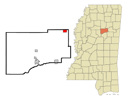
Coordinates: 33°43′50″N 89°3′36″W / 33.73056°N 89.06°WCoordinates: 33°43′50″N 89°3′36″W / 33.73056°N 89.06°W Country United States State Mississippi County Webster Area - Total 1.7 sq mi (4.4 km2) - Land 1.7 sq mi (4.3 km2) - Water 0.1 sq mi (0.1 km2) Elevation 335 ft (102 m) Population (2000) - Total 169 - Density 102.3/sq mi (39.5/km2) Time zone Central (CST) (UTC-6) - Summer (DST) CDT (UTC-5) FIPS code 28-44960 GNIS feature ID 0673117 Mantee is a village in Webster County, Mississippi, United States. The population was 169 at the 2000 census.
Contents
Geography
Mantee is located at 33°43′50″N 89°3′36″W / 33.73056°N 89.06°W (33.730615, -89.060074)[1].
According to the United States Census Bureau, the village has a total area of 1.7 square miles (4.4 km2), of which, 1.6 square miles (4.1 km2) of it is land and 0.1 square miles (0.26 km2) of it (3.51%) is water.
Demographics
As of the census[2] of 2000, there were 169 people, 74 households, and 52 families residing in the village. The population density was 102.3 people per square mile (39.5/km²). There were 77 housing units at an average density of 46.6 per square mile (18.0/km²). The racial makeup of the village was 99.41% White and 0.59% African American. Hispanic or Latino of any race were 1.78% of the population.
There were 74 households out of which 24.3% had children under the age of 18 living with them, 67.6% were married couples living together, 1.4% had a female householder with no husband present, and 28.4% were non-families. 28.4% of all households were made up of individuals and 12.2% had someone living alone who was 65 years of age or older. The average household size was 2.28 and the average family size was 2.77.
In the village the population was spread out with 17.8% under the age of 18, 11.2% from 18 to 24, 26.6% from 25 to 44, 25.4% from 45 to 64, and 18.9% who were 65 years of age or older. The median age was 38 years. For every 100 females there were 119.5 males. For every 100 females age 18 and over, there were 101.4 males.
The median income for a household in the village was $40,750, and the median income for a family was $41,750. Males had a median income of $32,500 versus $23,750 for females. The per capita income for the village was $18,871. About 3.5% of families and 6.3% of the population were below the poverty line, including 9.7% of those under the age of eighteen and 8.2% of those sixty five or over.
Education
The Village of Mantee is served by the Webster County School District.
References
- ^ "US Gazetteer files: 2010, 2000, and 1990". United States Census Bureau. 2011-02-12. http://www.census.gov/geo/www/gazetteer/gazette.html. Retrieved 2011-04-23.
- ^ "American FactFinder". United States Census Bureau. http://factfinder.census.gov. Retrieved 2008-01-31.
External links
Municipalities and communities of Webster County, Mississippi County seat: Walthall City 
Towns Villages Mantee | Walthall
Communities Bellefontaine | Hohenlinden | Tomnolen
Footnotes ‡This populated place also has portions in an adjacent county or counties
Categories:- Villages in Mississippi
- Populated places in Webster County, Mississippi


Wikimedia Foundation. 2010.