- Dingestow
-
Coordinates: 51°47′N 2°47′W / 51.79°N 2.79°W
Dingestow Welsh: Llanddingad 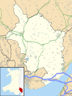
 Dingestow
Dingestow shown within MonmouthshireOS grid reference SO457102 Principal area Monmouthshire Country Wales Sovereign state United Kingdom Police Gwent Fire South Wales Ambulance Welsh EU Parliament Wales List of places: UK • Wales • Monmouthshire Dingestow (pronounced dinj-stoh, Welsh: Llanddingad) is a village in Monmouthshire, Wales.
Contents
Location
Dingestow is located three miles south of Monmouth and approximately the same distance north east from Raglan in rural Monmouthshire.
History and amenities
The village was once the site of a Norman motte and bailey [1] and later stone castle sited to control this part of the Welsh Marches by the incoming Marcher Lords and was attacked by the Welsh Lord of Caerleon in the 13th century.
The village has a church [2], St. Dingat [3] and the River Trothy passes through the Village.
The community is served by a Village Hall [4] and a general store with a sub Post Office. The Somerset Arms is the local public house.
It was served from 1857 to 1955 by the Coleford, Monmouth, Usk and Pontypool Railway which had a railway station at Dingestow.[1]
The area is popular with campers and caravanners in season and is close to the River Wye, the Wye Valley and the River Monnow.
References
- ^ Stanley C Jenkins, The Ross, Monmouth and Pontypool Road Line, revised second edition 2009, ISBN 978-0-85361-692-4
External links
- Dingestow Castle
- www.geograph.co.uk : photos of Dingestow and surrounding area
- Dingestow Church
- Dingestow Village Hall
Categories:- Villages in Monmouthshire
- Gwent geography stubs

Wikimedia Foundation. 2010.