- Cwmcarvan
-
Coordinates: 51°45′49″N 2°45′33″W / 51.76373°N 2.75923°W
Cwmcarvan Welsh: Cwmcarfan 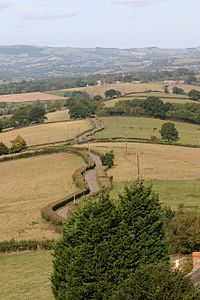
Countryside at Cwmcarvan, pictured from the top of the church tower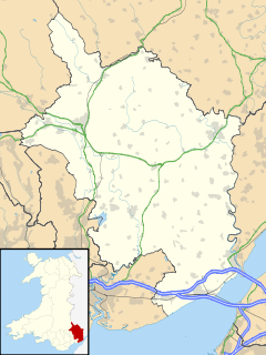
 Cwmcarvan
Cwmcarvan shown within MonmouthshireOS grid reference SO476075 Principal area Monmouthshire Ceremonial county Gwent Country Wales Sovereign state United Kingdom Post town MONMOUTH Postcode district NP25 Dialling code 01600 Police Gwent Fire South Wales Ambulance Welsh EU Parliament Wales UK Parliament Monmouth List of places: UK • Wales • Monmouthshire Cwmcarvan (Welsh: Cwmcarfan) is a small rural village in Monmouthshire, south east Wales. It is located 4 miles south west of Monmouth and about 4 miles east of Raglan, off the old A40 road not far from Trellech.
Contents
History and amenities
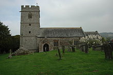 The church of St. Catwg
Church of St. Catwg
The church dates from the 13th or 14th century, in the Early English and Perpendicular styles, with some 16th century features. It was heavily restored in the 1870s.[1] The dedication is to St. Catwg or Cadoc, a Welsh saint of the 6th century. There are porches on both the south and north sides, supposedly so that the squires of Cwmbychan and Trevildu within the parish did not have to enter through the same door as each other.[2]
Craig-y-Dorth
The hill of Craig-y-Dorth, 1 mile north east of the church, was the site of a battle in 1404 between Owain Glyndŵr's rebels and English forces. According to the Annals of Owain Glyn Dwr, "Here the more part of the English were slain and they were chased up to the town gate [of Monmouth]".[3]
High Glanau
The house at High Glanau was built in 1923 for the writer and garden designer Henry Avray Tipping.[1]
References
- ^ a b John Newman, The Buildings of Wales: Gwent/Monmouthshire, 2000, ISBN 0-14-071053-1
- ^ Sir Joseph Bradney, A History of Monmouthshire, vol.2 part 2, 1913
- ^ Annals of Owain Glyn Dwr
External links
Categories:- Villages in Monmouthshire
- Gwent geography stubs


Wikimedia Foundation. 2010.